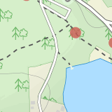
Details
Distance
1.14 miles
Elevation Gain
121 ft
Route Type
Out-and-Back
Description
This is a new adventure! Be the first to share your experience.
Join a supporting community of travelers and adventurers sharing their photos and local insights.
Added by The Outbound Collective
Morgan Falls is an out-and-back trail that takes you by a waterfall located near Mason, Wisconsin.
Download the Outbound mobile app
Find adventures and camping on the go, share photos, use GPX tracks, and download maps for offline use.
Get the appFeatures
Snowshoeing
Hiking
Dog Friendly
Family Friendly
Forest
River
Scenic
Waterfall
Morgan Falls Reviews
Have you done this adventure? Be the first to leave a review!
Leave No Trace
Always practice Leave No Trace ethics on your adventures and follow local regulations. Please explore responsibly!
Nearby
Hike to Morgan Falls
It's a easy hike to the waterfall being only 1.2 mile round trip, but traveling to the waterfall might take time as it's fairly remote. There is a $5 daily park fee.Directions can be complicated depending on which direction you are coming from, so I highly recommend entering it into your google maps and taking a screen shot of the directions as you will most likely lose cell phone service.If yo...
Hike to Red Granite Falls
Starting at the parking lot for Loon Lake, follow the signs for Red Granite Falls across a grassed yard and into the woods. The trail is a wide, well-maintained gravel trail that creates a figure-eight loop as it crosses itself twice.
Halfway along the trail (regardless of which loop direction you take) you end up along the Bad River, and can hear the roar of Red Granite Falls. Several small tr...
Hike to Copper Falls
Coming into the park on Hwy 169, you will turn west/northwest into the park entrance. After passing the Ranger's Station you will follow the road (passing camp areas and showers along the way) all the way to the main parking lot near a concessions building. *The handicap parking lot is a little further past the main parking lot.
The trailhead starts at a bridge just past the concessions buildin...
Cross Country Ski the Ashland Trails
These trails are located right in the town of Ashland, WI. They are off from Maple Lane right in the parking lot for the hospital.
They are the perfect option for people new to skiing and people who would like to get outside or train by taking a quick lap!
All together the trails are a total of 6.3 kilometers. The trail is also quite flat (just another reason it is great for beginners). There...
Lower Potato Falls
Coming into the park off Hwy 169 in Gurney, WI, you will turn West onto Falls Rd. It is a gravel road that ends at a circular parking lot, complete with a pit toilet, picnic area, viewing areas, and trailheads.
Starting at the trailhead labeled "Lower Potato Falls", you will descend a couple hundred stairs. Once at the bottom, you will still be above the river and there will be several small p...
Upper Potato Falls
You will turn off of Hwy 169 onto a gravel road, follow the road all the way to the end for the trail head. Please drive respectfully as people live on this road. Once you park, you will see multiple trails down to the river. Find the sign for Upper Falls and head that way. After .3 miles you will reach a stair case. Climb down the stairs (about 130) to the river and observation deck. You can v...
Community
© 2024 The Outbound Collective - Terms of Use - Privacy Policy


