
Danielle Tourigny Explorer
Maine resident and Emergency Medicine PA-C with a love of all things nature. Traveling around to find the most beautiful spots and most delicious eats.

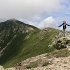
Hike Bald Mountain in Rangeley
Bald Mountain Road, Maine
2.3 mi
/ 931 ft gain
The trail itself has a gradual incline over the course of the 1.15 miles to get to the top. There are a few steeper sections near the top, but completely manageable even for a beginner. There is another trailhead off of route 4, which would lead to a longer hike, around 4 miles. When coming from Bald Mountain Rd, the intersection with the trail on route 4 is the only intersection you will come ...

Hike up to Maiden's Cliff
Camden, Maine
2 mi
/ 1000 ft gain
With a total elevation gain of 1000 feet in one mile to the top, the entire hike is uphill. The whole hike is within tree line until the very top, but there is a beautiful stream to hike next to for at least half. At the top, the view opens up to the Maiden's Cliff, and the view is spectacular. The one mile back is not difficult, but if you hike it in winter, it can get pretty icy, so be carefu...

Sargent Mountain via South Ridge Trail
Mount Desert, Maine
5.0
6.76 mi
/ 1293 ft gain
This has been one of my favorite winter adventures that I have had in a long time. There were gorgeous views of Somes Sound, we saw three snowy owls and there is a gorgeous frozen waterfall on the way up to the summit!
Because much of the Park Loop Road is closed in winter, we started our hike from a Parking area off of Route 3 (It's the one just north of Upper Hadlock Pond and you have to cr...

Fairy Head Loop
Cutler, Maine
5.0
9.31 mi
/ 1282.81 ft gain
Cutler Coast Loop: Maine's Bold Coast Backpacking Adventure
The Cutler Coast Loop delivers a 9.6-mile backpacking adventure along Maine's legendary Bold Coast—dramatic 100-foot cliffs plunging to rocky beaches, endless Atlantic views, and five primitive campsites perched on the ocean where you'll fall asleep to crashing waves and wake for sunrise over the Bay of Fundy. This beginner-friendly o...

Snowshoe to Carter Notch Hut
Gorham, New Hampshire
7.8 mi
/ 2200 ft gain
The nineteen mile brook trail is a winding path up approximately 2200 feet of elevation over the course of 3.9 miles. That distance feels a lot farther when you are breaking trail in 18-24 inches of snow and you are carrying 35 lb packs on your backs. Luckily we started out early and we able to get up to the hut in the very early afternoon. Much of the trail follows along a river and after a f...

Old Orchard Beach Pier
Old Orchard Beach, Maine
4.5
Few things create a more dramatic scene for a sunrise than a pier spanning out into the water, and the one in Old Orchard Beach is pretty iconic. Normally the area is pretty packed, and it can be tough to find a parking spot (especially in the summer). But at sunrise, there is just you, the beach, and that one old guy walking his dog around.
I spend the night before looking at the weather. Th...

Hike to Chutes Third Vault
Alma, New Brunswick
5.0
4.6 mi
/ 500 ft gain
The hike begins as a flat path through dense forest. About 1.5 miles in, the trail steepens to go almost straight down. There are several manmade steps to make it a bit easier. Near the bottom you walk through the river a bit until turning a corner to see the gorgeous, cascading falls on your left. We happened to have the entire place to ourselves which made an already magical place even better...

Winter Hike up Mount Lafayette
Franconia, New Hampshire
9 mi
/ 3900 ft gain
To start this hike, you can park right at the trailhead in a parking lot off of 93. This is a hike up a mountain so the entire hike is pretty challenging. There is a total elevation gain of 3900 feet in about 4.5 miles. A couple miles in you break through the treeline and then from there the views are incredible. There is a ridgeline to walk along and you have a great view of the summit of Lafa...

Summit Bald Peak and Mt. Pleasant
Denmark, Maine
6 mi
/ 1450 ft gain
After turning on Mountain Rd, look for East Pinnacle Condominiums. The trailhead is about 0.1miles after that on the right between the telephone poles marked 49 and 50. There is a dirt parking lot to pull into.
Now on to the hike! This hike begins by heading straight uphill immediately, and you gain about 1,300ft of elevation in about 1.5miles. The signs say that it is a mile up, but my GPS tr...

Snowshoe the Northern Loop Trail at Bradbury Mountain
Pownal, Maine
2 mi
/ 407 ft gain
Bradbury mountain has ample parking and multiple trails that lead around the mountain and up to the summit. We took the Northern Loop, which is the longest trail up the small mountain. It is a gradual incline of 407 ft over 1.0 mile. It is a perfect out and back trail just to get outside for a bit and give the snowshoes some use. The trails at Bradbury State Park are well groomed and perfect f...

Backpack to Katahdin Lake
Baxter Park Road, Maine
3.0
6.6 mi
/ 0 ft gain
This hike is located in Baxter. Maine residents gain free admission into the park; non-residents must purchase a day pass ($14 per vehicle) or season pass ($39 per vehicle).
After entering the park at Togue Pond Gate of Baxter State Park, bear right and continue onto the Roaring Brook Road for 6.3 miles to the Avalanche Parking Area on the left. The trailhead for Katahdin Lake Trail is across t...

Backpack to Enchanted Valley Chateau
Quinault, Washington
5.0
31.59 mi
/ 5052 ft gain
This backpacking trip can easily be done in 2 days, but some people prefer to stretch it out to 3. Luckily there are several different spots to stop and camp, so you can split up the distance however you are the most comfortable. The elevation over the course of the trail is minimal, which means that you can spend most of your time just enjoying the views! The signs show that Enchanted Valley i...

Avery Peak and West Bigelow
New Portland, Maine
8.96 mi
/ 3291 ft gain
Begin on East Flagstaff Rd and follow the Safford Brook Trail until you reach the junction with the Appalachian Trail. Turning left or north bound will bring you, shortly to the side trail for the Safford Brook Campsite; turning right (or southbound) on the A.T. will begin the climb to Avery Peak. The trail becomes very steep as it climbs up through boulders, and about halfway to the peak, ther...

Kinsman Pond via Basin Cascade
Lincoln, New Hampshire
7.25 mi
/ 2215 ft gain
Our hike began at the Basin, which is a clearly marked exit directly off 93. If you are coming from the Northbound side, walk under the bridge beneath 93 to get to the beginning of the trail. We enjoyed the Basin for a while before hiking 1.0 mile to the Cascade Brook Trail where we took a right. We took that trail for a 0.5 mile, and then took a left to meet up with the Kinsman Pond Trail for ...

Mount Battie
Camden, Maine
5.0
1.07 mi
/ 512 ft gain
The summit of Mount Battie is accessible from either the front trail that is located just outside of the state park, or there is an auto road that leads up to the summit within the park (the location drop pin reflects the route within the park).
To access the front trail, the trailhead is on mountain street where there is a small parking lot available. The auto road is usually closed in winte...

Cathedral Ledge
Bartlett, New Hampshire
4.0
0.31 mi
/ 95 ft gain
During spring, summer and fall there is a road that allows you to drive to the top of Cathedral Ledge. In winter the road is closed off to vehicles so reaching the top requires a 1.7 mile hike. Once at the top, there is a fenced in lookout with a 180 degree view of North Conway and the surrounding mountains. There is also a gorgeous aerial view of Echo Lake.
Cathedral Ledge also has a plethor...

Skyline Trail Loop at Blue Hills
Quincy, Massachusetts
4.0
9.63 mi
/ 1358 ft gain
Park in the lot across from Batterymarch Rd off of Willard St. Access the Skyline trail from here, it is marked blue. Follow the signs. The trails in Blue Hills are perfect for training for backpacking because they are so steep and rocky. I would fill up a big pack and take the skyline trail up to the gorgeous views at the top. It is forested and leads past a couple of bodies of water. A perfec...

Mt. Carrigain via Signal Ridge
Bartlett, New Hampshire
4.5
10.13 mi
/ 3337 ft gain
Park on Sawyer River Road at the Signal Ridge Trailhead. Trail starts out as a mild climb and meanders with the Whiteface Brook. When you arrive at the Carrigain Notch Trail junction, turn left. Enjoy three miles of steep uphill along the mountain's edge. When you reach the the apex of Mt. Carrigain, take your time to enjoy the moment of rest and take in the surrounding wilderness. When you've ...

Mount Pierce via Crawford Connector Trail
Carroll, New Hampshire
5.83 mi
/ 2392 ft gain
The hike begins right across from the AMC Highland Center, which is great because you can utilize their spacious parking lot! Once you locate the trailhead, the elevation begins almost immediately. Begin on the Crawford Connector Trail for 0.4 miles.You will come to a foot bridge over Gibbs Brook, where there are beautiful cascades to look at. Just after you cross the bridge, follow the signs v...

Southern Middlesex Fells Loop
Medford, Massachusetts
4.5
3.06 mi
/ 299 ft gain
Park in the parking area near Bellevue Pond. There are multiple entrances to the reservation (some closer to the reservoir itself than others). I have spent days in there hiking around and never seeing the water and there are days when I just hiked right in to the water and sat and enjoyed it. The trails are perfect for mountain biking as well. I spent so much time here when I lived in Boston b...
Discover
Community
Mobile Apps

© 2026 The Outbound Collective - Terms of Use - Privacy Policy