Buford, Wyoming
Top Spots in and near Buford
-
Centennial, Wyoming
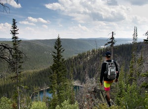
Hike Sheep Lake Trail
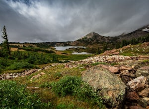
6 mi / 1000 ft gainThere are a few ways to get you to Sheep Lake Trail, this particular one will take you to the trailhead via the Lewis Lake Trailhead near the picnic area. It makes it a longer hike, but trust, it's a beautiful one, and definitely not a hike you'll want to miss. The hike starts at an approximate e...Read more -
Loveland, Colorado
Climb Green Ridge in the Roosevelt National Forest
9.8 mi / 2400 ft gainGreen Ridge is a fantastic series of summits in the Front Range that make for excellence training hikes, but is often forgotten as it lies outside of the nearby Bobcat Ridge Natural Area and just inside of Roosevelt National Forest. The summit itself at 7,402' is fantastic, featuring a nearly 900...Read more -
Loveland, Colorado
Hike the Valley Loop Trail in the Bobcat Ridge Natural Area
4.4 mi / 500 ft gainThe Valley Loop Trail in the Bobcat Ridge Natural Area begins at the main entrance of the Natural Area, just off W County Road 32 C near Masonville, west of Fort Collins and the Horsetooth Reservoir.To get there take West County Road 38 E west from Fort Collins over and around the Horsetooth Rese...Read more -
Loveland, Colorado
Hike the D.R. Trail in the Bobcat Ridge Natural Area
3.76.2 mi / 1050 ft gainD.R. Trail, named for David Rice Pulliam who donated the land to create the Bobcat Ridge Natural Area, is a 3.1 mile spur off the Valley Loop Trail that climbs roughly 1,000' into Mahoney Park before it intersects with the Powerline and Ginny Trails. To get to the start of the trail, take the Val...Read more -
Loveland, Colorado
Hike the Powerline Trail in the Bobcat Ridge Natural Area
3.8 mi / 1100 ft gainPowerline Trail is a 1.9 mile spur off the Valley Loop Trail in the Bobcat Ridge Natural Area that climbs 1,100 feet from the valley floor to Mahoney Park.To get to the start of the trail, take the Valley Loop Trail .9 miles in the Bobcat Ridge Natural Area from the main entrance of the Natural A...Read more -
Carbon County, Wyoming
Backpack the Medicine Bow Peak Trail in the Snowy Range Mountains
7 mi / 1679 ft gainTake the Snowy Range Scenic Byway to Lake Marie trail head. Lake Marie trail head is the farthest west trailhead and parking area in the immediate Snowy Range Area. Parking in the lot there. I went on a Friday evening and there was one vehicle there. Double check you gear and tighten your hikin...Read more -
Carbon County, Wyoming
Hike to the Summit of Medicine Bow Peak
4.41.6 miMedicine Bow Peak (12,014ft) is the highest summit in the Snowy Range of Wyoming. There is a network of quality alpine trails leading around the mountain and up to the summit. Stop in at the Visitor Center in Centennial for a free map of the area and pick your route. Options exist from a direct 1...Read more -
Carbon County, Wyoming
Photograph the Snowy Range
5.0Starting at the Medicine Bow Peak TH you have easy access to Lake Marie, Mirror Lake, and Lookout Lake for sunrise. When the water is calm these crystal clear lakes provide incredible reflections of Medicine Bow Peak. Nearby Snowy Range Pass provides dramatic views of the range, and on a clear d...Read more -
Bellvue, Colorado
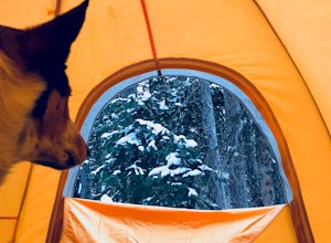
Winter camp at Zimmerman Lake
2.7 mi / 518 ft gainThis is a fairly popular snowshoeing and cross country skiing trail in the winter and offers a variety of additional trail options from the lake. Starting at the parking lot, the trailhead is easily accessed and begins the very gradual assent to Lake Zimmerman. Once at the lake, there are beautif...Read more -
Rock River, Wyoming
Hike to Crater Lake, Medicine Bow National Forest
3 mi / 751 ft gainTo get here use exit 272 (Arlington) on I-80 and then proceed south on WY-13 for a quarter mile. Turn right on Elk Mountain Arlington Rd, from here on out the roads are unpaved. After a mile turn left on Forest Rd 111, following signs for Medicine Bow National Forest. Continue on Forest Rd 111 ...Read more -
Fort Collins, Colorado
Hike the Coyote Ridge Trail
1.03 mi / 550 ft gainThe Coyote Ridge Natural Area is one of several Larimer County "gateway" preserves and Open Lands that lead into the Front Range of the Rocky Mountains, connecting the shrublands of the Great Plains to the Rocky Mountain themselves through a network of trails, parks, and preserves. The Coyote Rid...Read more
Top Activities
Let Adventure be your Destination in Wyoming
Wyoming’s wide-open spaces make it easy to get off the grid and on a trail, through a park, into a forest, up a mountain or down a river. During your journey through Wyoming’s Black to Yellow Region, discover geologic marvels, dense evergreen forests and sprawling prairielands.
Learn More

