Wardensville, West Virginia
Looking for the best hiking in Wardensville? We've got you covered with the top trails, trips, hiking, backpacking, camping and more around Wardensville. The detailed guides, photos, and reviews are all submitted by the Outbound community.
Top Hiking Spots in and near Wardensville
-
Davis, West Virginia
Bear Rocks Loop
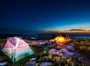
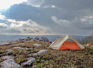
4.710.54 mi / 1293 ft gainThis particular hike is great as there are multiple camping sites, both established and backcountry, and views for miles around almost every bend. Still not convinced? This high-altitude plateau has characteristics typically found in Canadian landscapes. so you can travel north without leaving y...Read more -
Maysville, West Virginia
Dolly Sods North Loop via Bear Rocks
5.011.69 mi / 1171 ft gainArguably one of the most beautiful hiking areas on the United States' east coast, the Dolly Sods Wilderness inarguably has the most unique trailhead warning sign: Watch out for unexploded ordinance in the area. (The U.S. Army used the area for artillery and mortar training during WWII.) Don't fre...Read more -
Davis, West Virginia
Snowshoe or Cross-Country Ski Dolly Sods
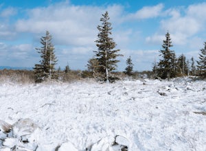
8 mi / 1400 ft gainFrom January to April, the forest roads that provide vehicle access to the Dolly Sods Wilderness in West Virginia are closed. If you're up for a cold weather adventure, park your car (in accordance with the signage and without blocking the road) and hike up the Forest Road 75 near Davis, WV, to B...Read more -
Syria, Virginia
White Oak Canyon Cedar Run Loop
4.07.67 mi / 2257 ft gainThis route combines Cedar Run Falls and White Oak Canyon Trail (one of the more popular hikes in SNP, with separate adventures detailing those hikes). Parking is easy, but gets very crowded due to the popularity of White Oak Canyon (WOC). When starting from the parking area/Shenandoah ranger stat...Read more -
Syria, Virginia
Hike Cedar Run Falls Trail
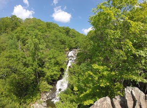
4.72.6 mi / 1000 ft gainCedar Run Falls is located in the central district of Shenandoah National Park. This is a pretty waterfall that flows into a deep swimming hole. There are two ways to get to the Cedar Run Waterfall: from the top of the mountain off of Skyline Drive and from the bottom of the mountain off of Wea...Read more -
Syria, Virginia
Fly Fish on the Robinson River
5.06 mi / 2000 ft gainThere are two sections that you can fish on the Robinson River. The first section is about 15 minutes away from the trailhead of White Oak Canyon. The river is on the right side of the road and you can see where it has bee stocked from the white diamonds on the trees on the side of the road. This...Read more -
Bluemont, Virginia
Hike to Raven Rock
4.35 mi / 1000 ft gainStarting at a small parking lot right off of Route 7 (wuick right onto Pine Grove Road) this hike takes you North on the Appalachian Trail in a very hilly/rocky part of the trail. Expect to gain and lose 300 feet+ multiple times! It's about 2.5 miles each way so budget at least a few hours to go ...Read more -
Stanley, Virginia
Dark Hollow Falls
4.61.32 mi / 440 ft gainCatch the trailhead to these falls at mile 50.7 on Skyline Drive, just north of Big Meadows Lodge and Campground and the trailhead is just to the left of the parking lot. This is an easy 1.4 mile roundtrip hike, straight down to get to the falls, and straight up to arrive back at your car. Many...Read more -
Stanley, Virginia
Lewis Falls via Lewis Spring
3.01.71 mi / 607 ft gainLewis Spring is the source of Hawksbill Creek which forms Lewis Falls (also known as Lewis Spring Falls) and eventually flows through the town of Luray and joins the Shenandoah River. The waterfall starts with 2 streams before hitting rock halfway down and fanning out. During dry seasons and summ...Read more -
Davis, West Virginia
Camp at Red Creek Campground
5.0Beginning your hikes from the Red Creek Campground gives you plenty of good options. For day hikers there is parking at the signed trailheads and for those who want to call the Campground home for a few days the campsites are nice and spaced out so you don't feel like you're sharing your tent spa...Read more -
Stanley, Virginia
Big Meadows Loop
4.71 mi / 30 ft gainBig Meadows is home to many types of wildlife and is a great location to photograph many different types of animals. The best time to see the wildlife in the meadow is near dawn and dusk. White-tailed deer and a variety of local birds are the most common animals seen in the meadow, and because o...Read more -
Bluemont, Virginia
Hike to Bears Den Overlook
4.41.31 mi / 164 ft gainBears Den is a collection of rocks and boulders that overlooks the Shenandoah Valley in northern Virginia, just off the Appalachian Trail. You have two options to access this overlook: park at the bottom of the mountain and hike up to the overlook via the trail, or drive to the top and access the...Read more -
Rapidan, Virginia
Hike to Historical Rapidan Camp in Shenandoah National Park
5.04.5 mi / 890 ft gainFor this hike park at the Milam Gap parking lot located at mile 52.8 on Skyline Drive. Once parked you will cross Skyline Drive to reach the trail. Hikers will follow the blue blazes along the trail and creek. After you have crossed the creek twice you will come to a larger waterfall. At this po...Read more -
Stanley, Virginia
Hike to Naked Creek Falls
3.01 mi / 1000 ft gainPlease note that there is no trail leading to these falls. This hike is for advanced hikers.Park your car at Naked Creek Overlook in Shenandoah National Park and walk through the field staying to the left. As you start to enter the woods you will hear the creek running on your left. Make your wa...Read more -
Swanton, Maryland
Hike the Big Savage Mountain Trail (Southern Terminus to High Rock)
11 mi / 1500 ft gainThis is not a casual hike; it is one which should be taken taken seriously. However, it will be an enjoyable experience for anyone with the resolve to face the early 1,500 ft. climb in elevation, as well the ascent of a slightly dodgy (but still structurally sound) mid-20th century fire tower. ...Read more -
Davis, West Virginia
Hike to Rohrbaugh Cliffs in Dolly Sods
5 miRohrbaugh Cliffs is the social name given to the expansive views found along the Rohrbaugh Plains Trail. This easy hike in the Dolly Sods Wilderness will take you to one of the best overlooks in the area. For a longer or more challenging hike, connect this trail with one of the many others in t...Read more

