Cabins, West Virginia
Looking for the best hiking in Cabins? We've got you covered with the top trails, trips, hiking, backpacking, camping and more around Cabins. The detailed guides, photos, and reviews are all submitted by the Outbound community.
Top Hiking Spots in and near Cabins
-
Davis, West Virginia
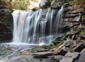
Explore Elakala Falls
3.00.4 mi / 130 ft gainStarting at the Blackwater Falls Lodge, head to the left side of the parking lot, where a trailhead becomes visible. Follow the clearly marked trail down until you reach a bridge which goes over the top of the falls. After the bridge, look for paths to allow you to get to the river level and the ...Read more -
Thomas, West Virginia
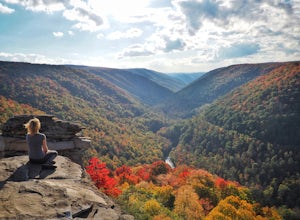
Hike to Lindy Point in Blackwater Falls State Park
4.80.83 mi / 59 ft gainIf you go to Blackwater Falls State Park for the falls, stay for the overlooks. This one, the most popular in the park, overlooks Blackwater Canyon from 3,000 feet above. Although the parking area at the trailhead is small with room for only 4-5 cars, you can also park along the road or at the ...Read more -
Parsons, West Virginia
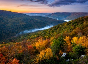
Hike Table Rock
4.71.2 mi / 200 ft gainThis hidden gem is located near Lindy Point and Blackwater Falls State Park. Unlike Lindy Point, which is very popular, hikers are usually able to enjoy the views from Table Rock all by themselves. The Table Rock trail head is located off of Canaan Loop Rd. I highly recommend driving to the tr...Read more -
Basye, Virginia
Orkney Springs Trail
4.94 mi / 1440 ft gainEasy to get to from Bryce resort, Orkney Springs Trail is a moderate to challenging trail. It starts with an easy trail through the woods but does get very steep in mile 2 in what seems like a very rocky dried-out river bed. There is a spectacular view around mile 2. If that's what you’re after y...Read more -
Orkney Springs, Virginia
Hike Laurel Run
6.6 mi / 2100 ft gainThere are two parking spots for this trail. Park at the lower lot if the gate is closed, if the gate is open, continue up the road for another mile until you reach another closed gate. Park here. If the gate is closed you will need to hike a mile up the road to get to the trail head.From the seco...Read more -
Riverton, West Virginia
Spruce Knob Observation Tower
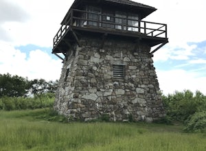
4.50.34 mi / 33 ft gainDriving to the top of Spruce Mountain is perhaps the most difficult part of the journey. Once at the top of Spruce Mountain, park and head south along a short, 0.2 mile long trail that leads to the official state highpoint of Spruce Knob. Be sure to find the USGS marker near the base of the obser...Read more -
Wardensville, West Virginia
Big Schloss via Wolf Gap Trail
5.04.27 mi / 997 ft gainBig Schloss via Wolf Gap Trail is an out-and-back trail that takes you by a river located near Lost City, West Virginia.Read more -
Wardensville, West Virginia
Hike Big Schloss
5.04.2 mi / 1000 ft gainBig Schloss (the German word for “palace”) is a popular hike in the George Washington National Forest. The trailhead is conveniently located at the Wolf Gap Campground. To begin, follow the path behind the restrooms at the parking lot. Cross the paved road where you will find a trail map with ...Read more -
Wardensville, West Virginia
Tibbet Knob via Wolf Gap
5.03.17 mi / 702 ft gainPark for free at Wolf Gap Campground and cross the road where you will pass some picnic tables and campsites. Follow the signs to the yellow-blazed Tibbet Knob trail. In half a mile, there is a little path to a summit on your left where you can catch a glimpse of Mill Mountain and Big Schloss. ...Read more -
Wardensville, West Virginia
Camp at Wolf Gap
5.0Wolf Gap is a FREE year round campground located just outside of Woodstock, VA. It is a great base camp for several scenic hikes like the Tibbet Knob trail (trailhead is just across the road) and the popular Big Schloss trail (trailhead begins at campsite number 9) -- super convenient if you hav...Read more -
25164 George Washington Highway, West Virginia
Hike the Cathedral Trail in Cathedral SP
5.01.1 mi / 0 ft gainCathedral Trail is a part of Cathedral State Park located east of Aurora, WV. Cathedral State Park was originally the site of Brookside Resort which attracted visitors from Washington D.C. and Baltimore, MD due to it’s cool clean air and natural beauty. The land was purchased in 1922 by Mr. Brans...Read more -
Whitmer, West Virginia
Spruce Knob Lake Loop
4.00.96 mi / 13 ft gainSpruce Knob Lake is located just below the peak of Spruce Knob at 3,840’, making it the highest lake in West Virginia. If you are not camping in the campground, there is a parking lot/boat launch located near the dam. If you are camped in the campground, there is a trail that leads from the campg...Read more -
Brandywine, West Virginia
High Knob Tower Trail
4.52.46 mi / 630 ft gainHigh Knob Tower Trail is an out-and-back trail that takes you through a nice forest located near Brandywine, West Virginia.Read more -
Hinton, Virginia
Camp at Switzer Lake
3.92 miDirectly off of Interstate 81, headed toward West Virginia on Rt 33 is a beautiful lake only known by the locals. Switzer Lake, named because Switzer Dam was placed on the Dry River years ago to aid Harrisonburg and the surrounding area with its increased need for drinking water. The lake is seld...Read more -
Wardensville, West Virginia
White Rocks Loop, George Washington NF
4.59.26 mi / 1690 ft gainThe trail begins near the upper parking area next to a closed gate. If you park in the lower parking area, you'll have to walk about .3 miles up the road to get to this gate. Start out on the forest service (FS) orange-blazed trail, following it for about a quarter mile. From there head onto Old...Read more -
Elkins, West Virginia
Hike to High Falls in Monongahela National Forest
5.08.2 mi / 1440 ft gainThough this beautiful hike is a serious workout, it's actually quite easy to follow. It's also listed on Google Maps - I'd highly recommend downloading the map offline just in case something happens. Starting at the trailhead (park at a pull-off along the gravel road just a few hundred feet befor...Read more

