Sultan, Washington
Looking for the best photography in Sultan? We've got you covered with the top trails, trips, hiking, backpacking, camping and more around Sultan. The detailed guides, photos, and reviews are all submitted by the Outbound community.
Top Photography Spots in and near Sultan
-
Granite Falls, Washington
Mt. Dickerman Summit
7.93 mi / 3675 ft gainIn general, this is a strenuous hike or snowshoe at approximately 8 miles round trip with nearly 4000 elevation gain. Be aware of current snow conditions and avalanche risk if heading up in the winter. Do not attempt a winter trip without proper knowledge, skill, and gear. Some previous winter tr...Read more -
Granite Falls, Washington
Hike to Perry Creek Falls & Mount Forgotten Meadows
11.5 mi / 3700 ft gainMost visitors park at this trailhead to hike Dickerman Mountain. Until this spring, so did I. However, don't overlook this stunning valley hike to Perry Creek, Mount Forgotten Meadows, and the scramble up Mount Forgotten!Begin this hike on the Perry Creek trail, which begins on the far left sid...Read more -
Snohomish County, Washington
Hike to Glacier Basin
13 mi / 2600 ft gainStart off by traveling down the Mountain Loop Highway, arriving at the Barlow Pass Trailhead. You will walk about 200ft to reach an old gated road. This road will lead you towards Monte Cristo. About 1.5 miles down the road, the road will start to turn into a trail that runs along the river. You ...Read more -
Granite Falls, Washington
Gothic Basin
4.48.74 mi / 2785 ft gainLooking for a hike that will make you feel like you're in a foreign landscape, but don't have to deal with that far of a drive? Then consider hiking Gothic Basin. This hike is located only 30 miles down the Mountain Loop Highway, which is nearly a hour shorter for people that live in the greater ...Read more -
Granite Falls, Washington
Foggy Lake via Gothic Basin
4.59.78 mi / 3179 ft gainDrive the Mountain Loop Highway to Barlow Pass and park at the pass using your Northwest Forest Pass. (In early or late season, be aware of snow conditions at the pass and, more importantly, along the trail up to Gothic Basin.) From Barlow Pass, start hiking south past the trail gate and in the ...Read more -
Granite Falls, Washington
Climb Del Campo Peak, WA
5.0Begin by parking at Barlow Pass and following the Gothic Basin Trail to Foggy Lake. Most of the trip's mileage is consumed by just getting to Foggy Lake, from here, the summit sits about 3/4 of a mile distant and over a thousand above you.Face the mountain and identify the obvious leftward trendi...Read more -
Issaquah, Washington
Grand Ridge Trail
4.07.51 mi / 1125 ft gainThe trail system in the 1,300 acre Grand Ridge Park can currently can be accessed from two lots: High Point and Central Park, with a new lot at Duthie Hill still under construction. To get to the High Point lot take exit 20 off of I-90 (coming from Seattle), take a left and pass under the freewa...Read more -
Fall City, Washington
Ride to the Snoqualmie Railroad Trestle
2.3The best way to get the old railroad trestle is by using the Preston-Snoqualmie trail. There is a parking lot for the trail located just across from SE 56th Place, Fall City, Washington, 98024. After parking, hop on your bike and pedal east on the Preston-Snoqualmie trail for about 2 miles.The tr...Read more -
Snoqualmie, Washington
Snoqualmie Falls
4.21.4 mi / 509 ft gainSnoqualmie Falls is one of the most popular waterfalls in Washington. The waterfall is almost 270 feet tall and ranges in width all the way up to 150 feet when the water is really running. On sunny, warm days, it can be a little overrun with tourists. Figure out where you want to get your photo ...Read more -
Granite Falls, Washington
North Lake via Independence Lake
5.56 mi / 2431 ft gainNorth Lake is everything you could want in a subalpine lake: emerald green hues, cold, clear water, lots of brook trout and far from cell-phone reception. This backpack is perfect when the weather gets hot and sunny, though it does reside in what is known as “the wettest section of the Cascades,...Read more -
Issaquah, Washington
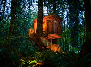
Spend a Night at TreeHouse Point
4.8This is one of the most magical and romantic places on the planet to get a good night's rest. You'll find that words will escape you when it comes to describing how this place makes you feel. With the Raging River as a backdrop, the powerful white noise will put you into one of the deepest sleeps...Read more -
Arlington, Washington
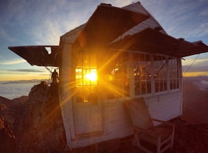
Three Fingers Lookout
4.514.31 mi / 4357 ft gainApproximately 11 miles east of Granite Falls, WA, on the Mt. Loop Highway, turn onto Forest Service road 41 and follow this road for 18.0 miles to the trailhead. The road is quite rough and it is recommended you have a four-wheel drive vehicle. There is a washout about halfway along the road, an...Read more -
Darrington, Washington
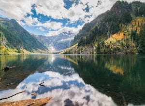
Camp at Goat Lake
4.310.4 mi / 1400 ft gainIf you just loved your day hike to Goat Lake so much that you want to return and spend some more time, you're in luck - the lake offers a camping area that holds at least 15 campsites and even comes with a pit latrine. This is a great overnight option if you aren't looking for a difficult hike in...Read more -
Darrington, Washington
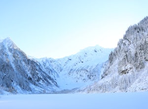
Winter Hike to Goat Lake
4.010.4 mi / 1400 ft gainThis trail is a perfect winter hike for the average outdoorsmen. Be warned that the most difficult part of this hike is getting to the trailhead in winter. The Mountain-loop highway can be a dangerous drive with black ice, snow, and serious potholes along the way. Take proper precautions like cha...Read more -
Darrington, Washington
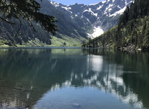
Hike to Goat Lake
4.510.4 mi / 1400 ft gainThe trail starts by lazily winding through beautiful forest. Fairly quickly, you'll reach a fork for the Upper and Lower Elliot Creek Trails. Both will take you to Goat Lake in about the same distance (~3 miles), but each offers a different take on the area. The lower trail winds along as it foll...Read more -
Edmonds, Washington
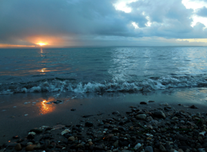
Hike to Meadowdale Beach
5.0If you plan to hike to this beach on the weekend, arrive early because the parking lot fills up fast. From the trailhead, hike down through an old forest along a stream to reach Meadowdale Beach Park. Take in the sounds of birds, wildlife, and the stream adjacent to the trail. At one mile you wil...Read more

