Snoqualmie Pass, Washington
Looking for the best hiking in Snoqualmie Pass? We've got you covered with the top trails, trips, hiking, backpacking, camping and more around Snoqualmie Pass. The detailed guides, photos, and reviews are all submitted by the Outbound community.
Top Hiking Spots in and near Snoqualmie Pass
-
Ronald, Washington
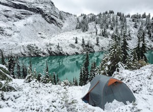
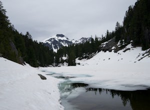
Winter Backpack to Jade Lake
4.022 mi / 4000 ft gainStarting at the Hyas Lake trailhead north of Cle Elum, it's a meandering easy hike through the woods for about 5.0 miles up to Deception Pass. You gain 1100 feet through this first five miles to the junction with the PCT. From here take a left to continue on the Lake Clarice Trail towards Marmot...Read more -
Ronald, Washington
Sprite Lake via Paddy-Go-Easy Pass Trail
6.5 mi / 2923 ft gainThe Trail Begin backpacking the Paddy-Go-Easy Pass Trail (#1595) through dense spruce forests with riparian undergrowth. The trail will switchback and climb steadily across dry meadows filled with wildflowers, and you'll have increasing views westward of Mount Daniel, Mount Hinman, and Cathedral...Read more -
North Bend, Washington
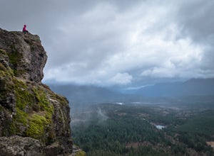
Rattlesnake Ledge
3.95.46 mi / 2096 ft gainRATTLESNAKE LEDGE TRAIL:The hike to Rattlesnake Ledge begins at the trailhead next to the parking lot at Rattlesnake Lake. From here, you can look up and see the Ledge and rock face that you'll be hiking up toward. The trail begins covered under the forest, which can protect from the elements (su...Read more -
North Bend, Washington
Snowy Hike to Rattlesnake Ledge
4.54 mi / 1160 ft gainThe trail to Rattlesnake Ledge is one of the busiest in Washington. Usually, a Saturday or Sunday is a no go for a lot of avid hikers due to the crowds. Adding a little snow and cold diminishes the crowds nicely. While it is no secret, this hike is popular for a reason. The 2 miles it takes t...Read more -
North Bend, Washington
Little Si
3.64.01 mi / 1250 ft gainLittle Si, neighbor to the bigger Mount Si is a decent hike for beginners and families with younger children. It is 4.7 miles round trip (including Boulder Garden Loop - 1.5 miles) gaining 1300ft in elevation - Discover Pass required. This trail is very popular, so if you want seclusion avoid thi...Read more -
Skykomish, Washington
Tank Lakes via Necklace Valley
18.94 mi / 4721 ft gainTucked high in the heart of the Alpine Lakes Wilderness, Tank Lakes has everything you could ask for out of a Washington hike. You start low at the Necklace Valley trailhead just south of Skykomish along Highway 2 and meander five miles to a giant log crossing of the East Fork Foss River. From h...Read more -
Skykomish, Washington
Jade Lake via the Necklace Valley Trail
15.26 mi / 3323 ft gainThis hike is definitely one of our all-time favorites. The first time we did it was in August 2015 and due to the exceptionally mild winter that year, fall was already beginning to show its colors. We wanted to see it again in the springtime when everything was in bloom, so we decided to go again...Read more -
Enumclaw, Washington
Backpack Noble Knob via Greenwater Trail
16.9 mi / 3920 ft gainFrom Greenwater heading south: Pass the fire station to FR 70 on the left. Follow FR 70 for about nine miles to FR 7033. Take a right and follow the road to the trailhead. Northwest Forest Pass required. The trail is in good shape and mostly flat to Greenwater Lakes which is great for families a...Read more -
Enumclaw, Washington
Hike to Greenwater Lakes
4.5 mi / 900 ft gainFollowing along the Greenwater River, family friendly Greenwater lakes Trail #1176 which has minimal elevation gain, winds through a lush green mossy old growth forest. Along the trail you will cross over several log bridges and pass a couple of beautiful waterfalls. At just under two miles int...Read more -
Skykomish, Washington
Hike Mount Sawyer
8 mi / 1200 ft gainThis trail starts off going through the forest of fir and hemlock for the first mile. Once you reach the top of the first hill, you will get a glimpse of all the views you will have the opportunity to enjoy later on. As you descend, the trees will start to thin out. The trail follows the ridge l...Read more -
Leavenworth, Washington
Day Hike to Lake Ingalls
4.39 mi / 2500 ft gainFrom the parking lot you start out on an old miners road that leads to the trail. Keep right at the first fork (left lead to Esmeralda Basin), then in about 2 miles, go left at the next fork (right leads to Ingalls Pass). The trail will climb steadily as you continue. In about another mile you wi...Read more -
Leavenworth, Washington
Mountain Run to Lake Ann and Ingalls
9 mi / 2500 ft gainBoth trails start at the Esmeralda Trailhead, Trail Number 1394. Lake Ann has a handful of folks that you will run into, whereas Lake Ingalls is a well-traveled trail. Both offer camping spots along the trail, and Lake Ann has spots where you can camp by the lake. NO CAMPING ALLOWED at Lake Ingal...Read more -
Leavenworth, Washington
Climb Mount Stuart
5.0Global climbing legend Fred Beckey once said, "[Mount Stuart is] without a rival as the crown peak in the central Cascades of Washington, Mount Stuart has been pronounced the single greatest mass of exposed granite in the United States".To ascend the mountain by is easiest route, the Cascading Co...Read more -
Snoqualmie, Washington
Rattlesnake Mountain Trail
4.010.54 mi / 2664 ft gainThe Rattlesnake Mountain Trail is often associated with Rattlesnake Ledge, one of the busiest hiking destinations around. But most people don't know that you can continue on from Rattlesnake Ledge another 10 miles to Snoqualmie Point Park. Using the Snoqualmie Point Trailhead, this hike is a wo...Read more -
Snoqualmie, Washington
Snoqualmie Falls
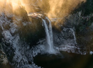
4.21.4 mi / 509 ft gainSnoqualmie Falls is one of the most popular waterfalls in Washington. The waterfall is almost 270 feet tall and ranges in width all the way up to 150 feet when the water is really running. On sunny, warm days, it can be a little overrun with tourists. Figure out where you want to get your photo ...Read more -
Skykomish, Washington
Beckler Peak
7.55 mi / 2139 ft gainLooking for a gradual forest hike up to a peak with 360° views of the Cascades? Beckler Peak trail winds through old growth, past rushing waterfalls, and up to a granite summit. From the top, you can see mountains in the Cascades such as Glacier Peak, Mount Baring, Mount Index, Evergreen Mounta...Read more

