Skykomish, Washington
Looking for the best hiking in Skykomish? We've got you covered with the top trails, trips, hiking, backpacking, camping and more around Skykomish. The detailed guides, photos, and reviews are all submitted by the Outbound community.
Top Hiking Spots in and near Skykomish
-
Easton, Washington
Snowshoe to Amabilis Mountain
9.5 mi / 2100 ft gainTo reach Amabilis Mountain, park at the Cabin Creek Sno Park at Exit 63 off I-90. Take the overpass across the highway to the trailhead and strap on your snowshoes. There's a maze of cross-country ski trails, but you'll want to keep to the right and follow the Berg trail for a quarter mile until ...Read more -
Granite Falls, Washington
North Lake via Independence Lake
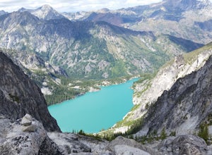
5.56 mi / 2431 ft gainNorth Lake is everything you could want in a subalpine lake: emerald green hues, cold, clear water, lots of brook trout and far from cell-phone reception. This backpack is perfect when the weather gets hot and sunny, though it does reside in what is known as “the wettest section of the Cascades,...Read more -
Darrington, Washington
Scramble Mount Pugh
5.011 mi / 5300 ft gainNot for the faint of heart - or those with a fear of heights - Mount Pugh offers some of the most rewarding summit views in the Cascades.Located off the northern end of the Mountain Loop Highway, this is an easy day trip from anywhere in the Puget Sound area. Though finding the trailhead can be t...Read more -
Issaquah, Washington
Grand Ridge Trail
4.07.51 mi / 1125 ft gainThe trail system in the 1,300 acre Grand Ridge Park can currently can be accessed from two lots: High Point and Central Park, with a new lot at Duthie Hill still under construction. To get to the High Point lot take exit 20 off of I-90 (coming from Seattle), take a left and pass under the freewa...Read more -
Granite Falls, Washington
Lake 22
4.65.98 mi / 1434 ft gainIf you're looking for a taste of the Mountain Loop Highway area, but don't have it in you for a longer, steeper journey, look no further than Lake 22. The trail starts out as flat and well-maintained, from the parking lot, before becoming a true mountain rainforest trail. Water and dampness are f...Read more -
Ronald, Washington
Hex Mountain Trail
7.36 mi / 2710 ft gainHex Mountain is a steep but rewarding out and back hike/snowshoe with 360 views from the peak. On a clear day you can see Mount Rainier, the Teanaways, the Stuart range, and many other surrounding peaks. Low avalanche risk makes this an enjoyable winter destination for snowshoers and backcountry ...Read more -
Leavenworth, Washington
Winter Camping in Leavenworth
It's an easy day hike to the Ridge of only 2.5 miles. On the ridge you can relax and enjoy the view of the surrounding mountains and a view of Leavenworth. I went into the Rangers office to ask for a good spot to take night time photos and this is one of the areas they suggested. Make sure you ge...Read more -
Issaquah, Washington
West Tiger #3 (Cable Line Trail)
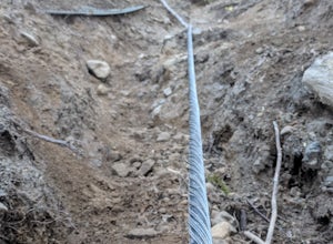
4.76 mi / 2051 ft gainIf you're looking for something with low-grade steepness, you're not going to find it here. Gaining over 2,000' in under 2 miles to the summit, this isn't for the faint of heart. The trail exists because of a buried cable, which has since been exposed and which you can see near the top of the t...Read more -
Granite Falls, Washington
Heather Lake Trail
4.34.33 mi / 1165 ft gainThe trail takes you on a gradual climb up to Heather Lake with beautiful second growth to admire along the way. The trail can be very wet and muddy with many tree roots to catch your toes, so make sure to wear a sturdy pair of tennis shoes or hiking shoes. Dogs are permitted on this trail on-leas...Read more -
Leavenworth, Washington
The Enchantments Mountain Run
5.018 mi / 6000 ft gainAt the Snow Lake Trail, you start at a elevation of 1400 feet and run up to Nada Lake 5000 feet at 5.6 miles. From here, you make your way to Lower and Upper Snow Lake, 2.2 miles. There are a lot of campsites in this area, but you have to apply to stay the night at these lakes. You will need to...Read more -
Leavenworth, Washington
The Enchantments: Leprechaun Lake via Snow Lake Trailhead
4.719.57 mi / 5948 ft gainThe Alpine Lakes Wilderness named “The Enchantments” draws explorers from all over the world. On a four day backpacking trip you can take day trips from camp to explore over a dozen crystal clear lakes, summit surrounding peaks, and camp at an alpine lake of your choice! Before you set out to c...Read more -
Leavenworth, Washington
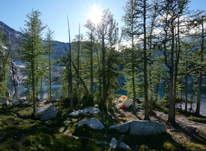
Winter Camp at Nada Lake
10.6 mi / 3800 ft gainBeing one of the lucky recipients of an Enchantments overnight permit can't happen for everybody. So, for the rest of us, taking to the mountains in the winter is an awesome way to bypass this system and experience the central Cascades in a completely different, colder way. The suffering is almos...Read more -
Leavenworth, Washington
Climb Prusik Peak's West Ridge
18 mi / 5000 ft gainThe Enchantments are an amazing experience in themselves. Yet one of the most striking features of any hike into the core zone of the Enchantments is that of Prusik Peak. This pyramid like spire rises dramatically from the many puddle lakes and boulder fields you pass along your way. With it's...Read more -
Granite Falls, Washington
Mount Pilchuck Lookout
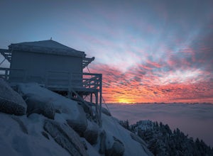
4.85.22 mi / 2113 ft gainHike the well-maintained Mount Pilchuck Lookout trail through a variety of terrain: old-growth forest and granite boulder fields. At the top, you'll reach a lookout tower perched on Mount Pilchuck. Pilchuck sits on the western edge of the Cascades, which offers up amazing panoramic views once you...Read more -
Issaquah, Washington
Poo Poo Point
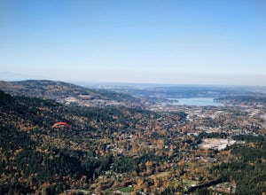
4.46.57 mi / 1880 ft gainThe Poo Poo Point trail is a great option for beautiful forest and great views only about 20 minutes outside of Seattle. The longer and less steep of the two routes to Poo Poo Point, this trail leaves from the Issaquah High School (the shorter and steeper Chirico Trail leaves from the paragliding...Read more -
Woodinville, Washington
Woodland Plateau and Lloyd Trail Loop
5.02.63 mi / 276 ft gainWoodland Plateau and Lloyd Trail Loop is a loop trail where you may see local wildlife located near Woodinville, Washington.Read more

