Skamania County, Washington
Top Spots in and near Skamania County
-
Skamania County, Washington
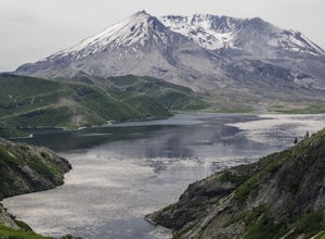
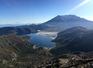
Just 96 miles south of Seattle, and 50 miles northeast of Portland, Mt. St. Helens and its wild, rugged beauty awaits you.Starting at the Norway Pass Trailhead parking lot, walk a dusty and sometimes ashy trail through recovering forest, low brush, wildflowers and blown down, sun bleached logs. T...
Read more
-
Hood River, Oregon
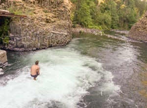
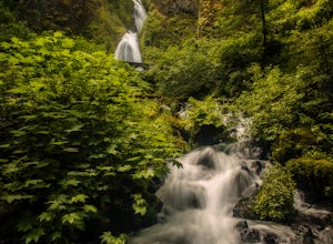
Getting to Punchbowl Falls is a super quick hike to a fun cliff-jumping swimming hole and waterfall. Be careful hiking the steep trail to the falls. Make use of the rope.
Be VERY careful approaching the edge of the cliff higher up and know your limits when it comes to jumping. Always walk down a...
Read more
-
Skamania County, Washington
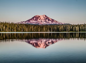
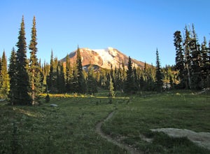
Takhlakh Lake is located 7 miles NW of Mt Adams with a 53 site campground on the west side of the lake as well as a day use picnic area.The campground features a boat ramp and a wheelchair-accessible 1.1 mile flat trail, which encircles the lake, and accesses the Meadows Trail that climbs up to t...
Read more
-
Multnomah County, Oregon
4.2
2.61 mi
/ 1214 ft gain
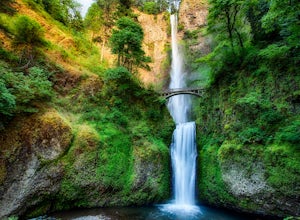
Multnomah Falls is worth a quick stop anytime you're visiting the Columbia River Gorge National Scenic Area in Oregon. This waterfall is the tallest in Oregon at 620 feet and the third largest in the Pacific Northwest behind Bridal Veil Falls (1,289 feet) and Green Lake Falls (979 feet) and has a...
Read more
-
Cascade Locks, Oregon
You can get on the trail in about 45 minutes from Portland and 35 minutes from Hood River via I-84.
Once you get out of your car in the Multnomah Falls parking lot, head over to the historic Multnomah Falls Lodge. This is a neat place to check out after your hike. Then, follow the crowds to the ...
Read more
-
Cascade Locks, Oregon
4.3
5.11 mi
/ 2162 ft gain
The Multnomah-Wahkeena loop is a classic hike in the Columbia Gorge. Few hikes take you by as many waterfalls, and the tree cover makes it a great hike in the rain.
Starting at the Multnomah Falls Parking Area, head to the main viewing area of Multnomah Falls. If you get there early in the morn...
Read more
-
Cascade Locks, Oregon
4.0
13.28 mi
/ 4629 ft gain
Done as a loop or one way shuttle (in summer/fall), the full Larch Mountain experience starts at the large (but still always full) Multnomah Falls parking lot. There you'll have the chance to grab a final snack, use the restroom, and fill water bottles before joining all the "tourist" hikers on t...
Read more
-
Toutle, Washington
While thousands of visitors come to witness the raw power and devastation left behind from Mount St Helens' famous 1980 eruption, few wander past the groomed paths surrounding the Johnston Ridge Observatory. It is beyond these paths where you come across the more commonly designed backcountry tra...
Read more
-
Toutle, Washington
5.0
14.8 mi
/ 2700 ft gain
The Boundary trail is amazing. It's 54 miles long and runs for the most part along a ridge in Gifford Pinchot National Forest. You can climb various peaks and viewpoints right off the trail, but this trip report is for climbing Coldwater Peak and hiking up to Harry's Ridge Viewpoint on the way. H...
Read more
-
Corbett, Oregon
4.0
0.48 mi
/ 427 ft gain
This Waterfall is located along the Colombia River Gorge and is surrounded by many other, much more trafficked waterfalls so it gets a lot fewer visitors. This is a beautiful spot to relax at, take photos, and get away from some of the crowds. The bottom of the falls end right at the parking lot ...
Read more
-
Corbett, Oregon
4.8
2.02 mi
/ 1293 ft gain
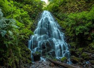
Fairy Falls sits in the heart of the Columbia River Gorge, not much more than a mile from the Wahkeena Trailhead. The parking lot is right off the Old Columbia River Highway and will be packed with cars in the summer.
Head up the trail towards Wahkeena Falls, which is not far up the hill. This f...
Read more
-
Washougal, Washington
4.3
6.76 mi
/ 1795 ft gain
The Cape Horn Trail is great for those who are short on time, but still want to get outside for something close by with great views.
Located just 35 min east of Portland, the Cape Horn Trail offers a few different possibilities for you to hike. The whole loop (lower section is closed from Feb 1s...
Read more
-
Toutle, Washington
From roughly May to September, both star gazers and photographers alike travel to the darkest locations in order to capture something truly magnificent- the galactic core of the milky way. The Loowit Viewpoint is unlike any around due to the perfect combination of it's remote location, higher ele...
Read more
-
Skamania County, Washington
Mt Adams is the second tallest volcano in the Cascades and is one of the easiest to climb. There are two main nontechnical routes up Mt Adams, the well-known and crowded route on the south face, and the lesser traveled north cleaver route. The north cleaver offers solitude, views of Rainier, high...
Read more
-
Skamania County, Washington
For the most of the hike, the mountain is hidden behind the firs that surround the hiker as they gain elevation. Because of the dense forest the trail is remains in for most of the hike, it is nicely shaded and pleasant to wander through. At about 2 miles in, the trail leads the hiker into variou...
Read more
-
White Salmon, Washington
3.5
6.29 mi
/ 1962 ft gain
Coyote Wall is a relatively uncrowded trail system in the Columbia River Gorge that provides outstanding views of the Columbia River. The trail system is made up primarily of user-created mountain biking trails, allowing hikers a choose-your-own-adventure approach to exploring the area.
Start o...
Read more

