Redmond, Washington
Top Spots in and near Redmond
-
Port Townsend, Washington
Hike to Point Wilson
5.02.5 mi / 0 ft gainThis trail offers amazing views of Mt. Baker, Vancouver Island, the San Juan Islands, and the Cascade Mountains. The Point Wilson trail is located in Fort Worden State Park on the Olympic Peninsula, along the Strait of Juan De Fuca. The trail is 2.5 miles round trip, and is accessible regardless ...Read more -
Quilcene, Washington
Marmot Pass via Big Quilcene Trail
5.010.5 mi / 3481 ft gainThis trail has a nice, steady climb that's perfect for beginner or intermediate backpackers. The first 2.5 miles follow a forest trail along the Big Quilcene River. For the next 3 miles, the trail flows in and out of shaded trees, over a small talus field, and through a meadow before the final ac...Read more -
Quilcene, Washington
Buckhorn Mountain
12.26 mi / 4429 ft gainThe climb to Buckhorn Mountain above Marmot Pass is a must see for every PNW adventurer with the endurance to tackle nearly 14 miles and 4,400 feet of gain. Listen to the rushing waters of the Big Quilcene River as the trail gently traverses up 5.5 miles to Marmot Pass. Be sure to filter water ...Read more -
Quilcene, Washington
Backpack to Marmot and Constance Passes
24 mi / 5200 ft gainThe secret to this trip: Marmot Pass and Boulder Shelter, where you can camp on National Forest Service land. Multiple excellent, large backpacking sites sit just on the edge of the National Park, giving you great access to Mt. Constance and Mt. Deception, two of the tallest peaks in the Olympics...Read more -
Quilcene, Washington
Mount Townsend
8.59 mi / 2949 ft gainThere are four trailheads that guide you to the top of Mount Townsend, but the most popular choice is to begin at the Upper Trailhead Trail #839 (snow permitting). The trail gradually climbs while traversing through forested area. While walking through the fir and hemlock trees, you pass three ...Read more -
Snoqualmie Pass, Washington
Chikamin Peak via Mineral Creek Trailhead
15.34 mi / 5771 ft gainThis is a S5 T4 scramble that involves some routefinding past the alpine lakes. We did this as a day trip and we were out and back in about 12 hours. There are multiple routes to get to Chikamin, one from the PCT, which is 24 miles RT and the other is from the Mineral Creek Trailhead (47.4176, -...Read more -
Coupeville, Washington
Hike Ebey's Landing
4.5Just walk straight past the restroom to find the start of the trail route. The Bluff trail heads up a set of stairs to the top of the hillside on the right. After climbing the stairs, you come right up on farmland (Ebey's Prairie), with a grassy two-track trail leading up toward the top of the bl...Read more -
Leavenworth, Washington
Scenic Hot Springs
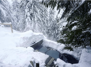
3.21 mi / 1135 ft gainScenic Hot Springs is a privately owned hot spring located near Stevens Pass outside of Leavenworth, Washington. To access the three steaming pools, please visit ScenicHotSprings.com to make a reservation. Reservations are required. The three tubs have varying temperatures and only 10 people ar...Read more -
Darrington, Washington
Scramble Mount Pugh
5.011 mi / 5300 ft gainNot for the faint of heart - or those with a fear of heights - Mount Pugh offers some of the most rewarding summit views in the Cascades.Located off the northern end of the Mountain Loop Highway, this is an easy day trip from anywhere in the Puget Sound area. Though finding the trailhead can be t...Read more -
Enumclaw, Washington
Hike to Kelly Butte
3.4 mi / 1100 ft gainAfter a rough drive to the trailhead you’ll have little time to catch your breath as the trail laces up the mountain side, but with Rainier to distract you, it won’t be long until you’re at the top with a view that is more than enough reward for your efforts. Pay very close attention to the drivi...Read more -
Carbonado, Washington
Summit Lake
4.56.13 mi / 1499 ft gainSummit Lake, nestled in a small basin just north of Mt. Rainier National Park in the Clearwater Wilderness, has everything a hiker could want in a day-hike or easy overnight backpack. The views, the well-maintained trail, and a perfect distance make this hike a must-do for anybody in the Pacific ...Read more -
Carbonado, Washington
Hike Bearhead Mountain
5.06 mi / 1800 ft gainFormerly the site of an old fire lookout, Bearhead Mountain located in the Clearwater Wilderness, provides great unobstructed views of the north side of Mount Rainier, Little Tahoma, and many other surrounding Cascade mountain peaks. In the summer months you are likely to encounter great wildflow...Read more -
Carbonado, Washington
Hike the Upper Foothills Trail along the Carbon River
10 mi / 30 ft gainThe upper Foothills Trail from the Fairfax Bridge to Manley Moore can be hiked starting from either end as an "out and back" hike or a "point to point" by shuttling with two vehicles. Starting from the upper end of the trail you begin by walking under the Kolisch Rd. Bridge, which has the Manley...Read more -
Snoqualmie Pass, Washington
Spectacle Lake via Pete Lake Trail
5.018.91 mi / 3058 ft gainDepending on when you arrive at the Pete Lake Trailhead, expect to be traveling with company as it is one of the more popular locations on the eastside of Snoqualmie Pass. At an elevation of 2600 feet, the beginning route is a moderate 400 feet of elevation gain. Start on your way through the va...Read more -
Easton, Washington
Snowshoe to Amabilis Mountain
9.5 mi / 2100 ft gainTo reach Amabilis Mountain, park at the Cabin Creek Sno Park at Exit 63 off I-90. Take the overpass across the highway to the trailhead and strap on your snowshoes. There's a maze of cross-country ski trails, but you'll want to keep to the right and follow the Berg trail for a quarter mile until ...Read more -
Darrington, Washington
Backpack to Glacier Peak Meadows and White Chuck Glacier
34 mi / 9000 ft gainStarting at the North Fork Sauk Trailhead (NFD 49) off the Mountain Loop Highway, you will travel 5.3 miles and gain a leisurely 1,100 feet of elevation until you reach Mackinaw Shelter. This is where the real work begins. The trail gains a calf-burning 3,000 feet in the next 2.9 miles until you ...Read more

