Rattlesnake Ledge, Washington
Looking for the best camping in Rattlesnake Ledge? We've got you covered with the top trails, trips, hiking, backpacking, camping and more around Rattlesnake Ledge. The detailed guides, photos, and reviews are all submitted by the Outbound community.
Top Camping Spots in and near Rattlesnake Ledge
-
Gold Bar, Washington
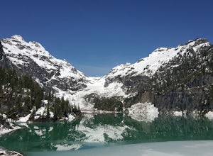
Winter Backpack to Blanca Lake
7.5 mi / 3300 ft gainSince Blanca Lake is a very popular place for folks to explore and with the nice and sunny weekend. I drove out Friday night and slept in my Jeep. Got up at 7:30am when folks first started arriving to the trail head.A couple of things to keep in mind before you start this hike. The 7.5 miles ro...Read more -
Granite Falls, Washington
Cutthroat Lakes via Walt Bailey Trail
4.06.21 mi / 1978 ft gainAlong the Mountain Loop Highway, past the crowds crawling over Mt. Pilchuck, lies the muddy, unkempt Walt Bailey Trail into a verdant subalpine basin speckled with tiny tarns. The Cutthroat Lakes are a delightful location to spend the night with optional day hikes up to exposed ridgelines and cra...Read more -
Leavenworth, Washington
Hike to the Summit of Mt. McCausland
8 mi / 1800 ft gainBegin by driving a fairly smooth Forest Road 6700 for 2.5 miles to the Smith Brook Trailhead and park in the space on the left. Much of the signage has been taken down along the trail, so it may be helpful to bring some written directions with you. The hike begins by keeping close to the road, me...Read more -
Granite Falls, Washington
Vesper Peak Trail
4.06.59 mi / 3927 ft gainThis hike is very strenuous, but nothing unconquerable! The views at sunset were once in a lifetime and something I will remember for the rest of my life. The first half mile or so of the trail begins in a wooded area then opens up to views of the lower valley. After hiking for about another ½ t...Read more -
Granite Falls, Washington
Mt. Dickerman Summit
7.93 mi / 3675 ft gainIn general, this is a strenuous hike or snowshoe at approximately 8 miles round trip with nearly 4000 elevation gain. Be aware of current snow conditions and avalanche risk if heading up in the winter. Do not attempt a winter trip without proper knowledge, skill, and gear. Some previous winter tr...Read more -
Ashford, Washington
Backpack the Wonderland Trail
4.890 mi / 22000 ft gainPossibly one of the greatest loop hikes in the Lower 48, this trail sees a lot of use. You won't be alone out there, but opportunities for solitude are abundant with a little effort. The crowds show up for good reason - it's incredibly beautiful, relatively wild, and about as close to feeling l...Read more -
Ashford, Washington
Mt. Rainier via Disappointment Cleaver
4.314.9 mi / 8993 ft gainMt. Rainier is a technical climb on all routes and is covered with glaciers all four seasons. It is not a mountain to learn mountaineering unless you hire a guide service who will help guide you up the mountain. With good weather and previous mountaineering experience, Mt. Rainier's Disappointmen...Read more -
Ashford, Washington
Winter Camp at Glacier Vista
5.03 mi / 1000 ft gainIt's always a good idea to check the weather, but when it comes to getting a peak at Mt. Rainier you might be better off just showing up and hoping for a miracle. To do this from Seattle, you'll have a 2 hour 20 minute drive down I-5 and WA-167. After a couple turns here and there (you can follow...Read more -
Ashford, Washington
Skyline Loop in Mt. Rainier NP
4.55.65 mi / 1722 ft gainThe trailhead to Skyline Trail is located at the north side of the upper parking lot near the Visitor Center and Paradise Inn. You'll see that it breaks off into many other small trails if you want, as well. However, this 5.5 mile hike alongside Nisqually Glacier is classified by the rangers at...Read more -
Leavenworth, Washington
The Enchantments: Stuart Lake Trailhead to Snow Lake Trailhead
5.018.02 mi / 4626 ft gainThere are a couple different ways to tackle this hike through the stunning Central Cascade region. I recommend checking out this handy resource for more detailed info. Bottom line: this is an absolutely amazing hike for people willing to take a little bit of an ass kicking. Aasgard Pass rises 1,...Read more -
Leavenworth, Washington
Snowshoe to Colchuck Lake
3.316 mi / 3000 ft gainFrom Leavenworth, head south on Icicle Creek rd for 8.2 miles until you reach USFS rd 7601. This road isn't plowed and is blocked by a locked gate about one quarter mile from where it intersects with Icicle Creek Road (usually from November to May), so parking at the intersection is probably your...Read more -
Leavenworth, Washington
Ski Tour the Enchantments
5.0The Enchantments is one of the most beautiful spots in Washington, but rarely visited outside the summer months, when access is merely difficult. But for those brave souls with the knowledge and determination to ski these hallowed slopes, the experience is surreal.The approach up Aasgard Pass is ...Read more -
Leavenworth, Washington
Backpack to Lake Caroline in the Enchantments
5.75 mi / 3100 ft gainFrom Leavenworth, WA head down Icicle Creek road and head to the Eightmile Lake Trailhead.The backpack starts at roughly 3270 feet of elevation and the highest point of the hike is 6300 feet. To start you will hike through a very beautiful and forested area for a while before getting into a burn ...Read more -
Eatonville, Washington
Hike to Gobbler's Knob
4.05 mi / 1500 ft gainEntering the Park from the Southwest Entrance, bear left when you approach the forking Westside Rd. This road has been closed a few miles in due to massive rockfall. When you reach the road closure, just park along the side of the road. In Spring and Summer, you should be able to see plenty of ot...Read more -
Cle Elum, Washington
Backpack to Navaho Pass
12 mi / 4220 ft gainThis is a beautiful trail in the Teanaway area, located in Washington State. The trailhead starts along the Stafford Creek Trail and follows the creek for the first couple miles of the trail. There are a number of different types of wildflowers out here that make the first few miles a nice warmup...Read more -
Darrington, Washington
Camp at Goat Lake
4.310.4 mi / 1400 ft gainIf you just loved your day hike to Goat Lake so much that you want to return and spend some more time, you're in luck - the lake offers a camping area that holds at least 15 campsites and even comes with a pit latrine. This is a great overnight option if you aren't looking for a difficult hike in...Read more

