Port Angeles, Washington
Looking for the best hiking in Port Angeles? We've got you covered with the top trails, trips, hiking, backpacking, camping and more around Port Angeles. The detailed guides, photos, and reviews are all submitted by the Outbound community.
Top Hiking Spots in and near Port Angeles
-
Brinnon, Washington
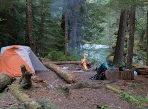
Camp at the Dose Forks
15 mi / 1200 ft gainThe Dose Forks Campground is an overlooked campsite deep within the Olympic National Park, making it a perfect weekend camping destination. A mild, 7.5 mile (one-way) trail delivers you to this enchanting area and is a must for those who love photographing forests. There are no reservation requir...Read more -
Brinnon, Washington
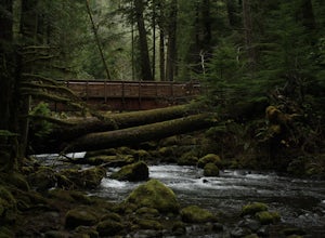
Hike Lower Big Quilcene River
13 mi / 1800 ft gainWhile this hike does not provide any sort of fantastic views, its does provide an easy ~13 mile roundtrip hike from the trailhead to a parking lot for the Upper Big Quilcene Trail which leads to Marmot Pass. Along the way you will cross several bridges, some large and wide, other simple log bridg...Read more -
27662-27664 Olympic Highway, Washington
Hike Falls View Canyon
1.5 mi / 300 ft gainThis hike is located immediately off of Highway 101 in the Falls View Campground. If the campground is closed you can park right outside of the gate (but don't block it) and hike in. Inside the gate you will see 3 paths in front of you, take a left and after about a quarter mile you will reach th...Read more -
Friday Harbor, Washington
Hike Mount Grant on San Juan Island
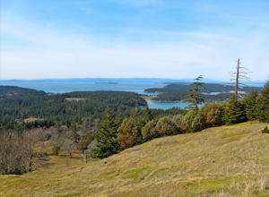
2 mi / 500 ft gainMount Grant Preserve is still in the midst of becoming an official park, but is open to the public for hiking, so you will get to see this amazing spot before it's too crowded. With a trial system currently being made, most people hike up the established road, but there are well marked signs to h...Read more -
Brinnon, Washington
Hike to Mt. Walker North & South Viewpoints
3.04 mi / 2000 ft gainDirections: From the Quilcene Ranger Station drive 4.6 miles south on US 101. Watch for the signs for Mount Walker View Point. Turn left onto Mount Walker Road. The trail head is about a quarter mile up the road with pull over parking on the left side of the road. In the winter and early spring, ...Read more -
Coupeville, Washington
Hike Ebey's Landing
4.5Just walk straight past the restroom to find the start of the trail route. The Bluff trail heads up a set of stairs to the top of the hillside on the right. After climbing the stairs, you come right up on farmland (Ebey's Prairie), with a grassy two-track trail leading up toward the top of the bl...Read more -
Shirley, British Columbia
Beach Day at Sandcut Beach
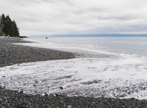
The adventure begins during the rugged wooded hike from the gravel parking lot to the stunning beach (10 minutes). Once you reach the stone and pebble beach, plant yourself down to enjoy the 180 degree view of the Juan de Fuca Strait (and a picnic lunch if you’ve come prepared!).Head east to find...Read more -
Friday Harbor, Washington
Hike to Young Hill
4.01.2 mi / 650 ft gainFrom the main parking lot at English camp, follow the wide path east and cross West Valley road to the trailhead of Young Hill. The trail switchbacks several times and leads you past the English Camp cemetery. Continue left on the main trail through the forest of Pacific Madrone trees until you r...Read more -
Lopez Island, Washington
Watmough Bay Trail
4.01.59 mi / 453 ft gainThe Watmough Bay Trail on Lopez Island, Washington, is a moderate-level hiking trail that stretches for approximately 1.59 miles. The trail is known for its unique natural features, including a prominent cliff face, a pebble beach, and a protected bay. The trail is relatively flat, making it acce...Read more -
National Forest Development Road 2530, Washington
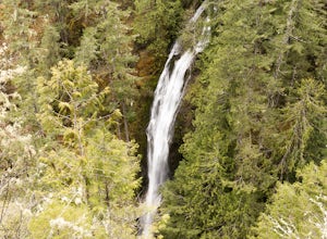
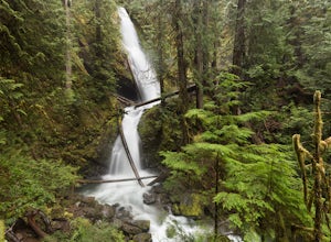
Hike to Murhut Falls
1.37 mi / 371 ft gainThe trailhead to Murhut Falls is located about 7.5 miles off US-101 S but the last couple of miles are on NF-2530 which can be potholed and rutted. I made it up the road in my 2WD sedan but it took quite some time to dodge all of the potholes. This hike is nice and quick! It starts with a small ...Read more -
Brinnon, Washington
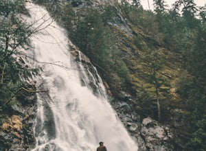
Rocky Brook Falls
4.80.25 mi / 141 ft gainTo find the falls, head north up Hwy. 101 past Brinnon, Washington and hang a left at Dosewallips Rd. Keep an eye on the mile markers. Right after mile three and crossing a small bridge, there's a parking area on the left side enough for about 6 cars. The hike to Rocky Brook Falls is a short on...Read more -
Port Renfrew, British Columbia
Hike to Mystic Beach
5.0Head west from Victoria along Highway 14 past Sooke and Jordan River until you see the Juan De Fuca Marine Trail - China Creek trailhead about 5km past Jordan River on the West Coast Road. Ample signage, parking, and outhouses are available here.The trail taking you to Mystic Beach is just one s...Read more -
Mason County, Washington
Hike to Lake of the Angels
5.06.75 mi / 3599 ft gainThe trail up to Lake of the Angels, known as the Putvin Trail, starts out pretty mellow with a gradual uphill climb. Your first marker will be an old roadbed at around 1.4 miles, but you'll need to cross two ravines before making it there. It's thick forest with gorgeous views in the clearings, s...Read more -
Mason County, Washington
Upper Lena Lake
5.012.61 mi / 4239 ft gainThe hike to Upper Lena Lake is a beautiful one. It first takes you past Lena Lake, which is a very popular weekend destination for families. Luckily you're pushing on to Upper Lena Lake that sits in a peaceful alpine meadow with Mt. Lena and Mt. Bretherton towering above. The first part of the t...Read more -
Mason County, Washington
Lena Lake
4.56.24 mi / 1644 ft gainThe trail climbs gently up and is accessible almost every season, weather permitting. Snowshoes may be needed December-February, so make sure and check with the Hoodsport Ranger Station. Just 45 minutes north of Hoodsport (a darling small town on the shores of Puget Sound), this trailhead has sp...Read more -
Mason County, Washington
Climb the Brothers (South Climb)
4.517 mi / 6062 ft gainThe Brothers is a notable peak on the border of Olympic National Park. The dual summits are a distinguishing feature of the Olympic Range, viewed from Seattle. This is a challenging route, testing a climber's route finding skills, physical fitness, and mental fortitude. From the parking lot, you ...Read more

