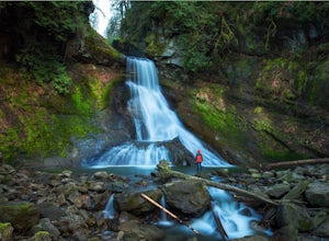
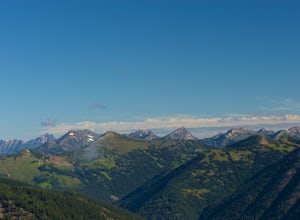
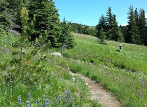
North Cascades, Washington
Looking for the best hiking in North Cascades? We've got you covered with the top trails, trips, hiking, backpacking, camping and more around North Cascades. The detailed guides, photos, and reviews are all submitted by the Outbound community.
Top Hiking Spots in and near North Cascades
-
Deming, Washington
Hike the Horseshoe Bend Trail
4.06 mi / 210 ft gainLocated just outside the town of Glacier, WA and 40 minutes prior to Mount Baker Ski area, sits the Horseshoe Bend Trail. A simple and straightforward 6 mile out and back route. To get here, take Hwy 542 towards the direction of Mount Baker. About 4 miles after you pass through the town of Glacie...Read more -
Marblemount, Washington
Climb Eldorado Peak via the East Ridge
8 mi / 6800 ft gainStanding on the knife edge summit, the terrain around you plummets steeply into glacier-filled basins that trickle into turquoise alpine lakes. Serrated snowy peaks give way to forest covered valleys below that craft a rugged landscape. Eldorado Peak delivers you atop this wild and mountainous wo...Read more -
Marblemount, Washington
Sahale Glacier Camp via Cascade Trailhead
5.011.09 mi / 4183 ft gainAs an initial note, to spend an overnight at Sahale Glacier Camp, you need to obtain a permit at the North Cascades Ranger Station in Marblemount, Washington. Permits are limited, so get there early or call in advance. To start, go to Marblemount, WA and then drive ~23 miles east on Cascade Rive...Read more -
Skagit County, Washington
Sahale Arm via Cascade Pass
4.312.34 mi / 5230 ft gainTo get to this hike, go to Marblemount, WA. Then, drive ~23 miles east on Cascade River Road until the end, the Cascade Pass Trailhead. Even before you hit the trail, you'll get an amazing view of Johannesburg Mountain. Once you're ready to get going, the initial 3.7 miles of this hike to Cascad...Read more -
Skagit County, Washington
Pelton Basin Camp
8.82 mi / 2543 ft gainStarting at 3,640 feet elevation, the Cascade Pass Trailhead begins adjacent to the Johannesburg Camp and proceeds east along a relentless series of switchbacks. Though the trail is consumed by a thick Washington evergreen forest, the switchbacks frequently open to sweeping vistas of the far-reac...Read more -
Skagit County, Washington
Climb Sahale Peak via the South Slope Route
5.012 mi / 4000 ft gainTo get to Sahale Peak, drive to Marblemount, WA and continue on the Cascade River Road (Forest Road 15) for 23.5 miles. The road ends at the Cascade Pass trailhead, where the climb begins.The first part of the climb follows the Cascade Pass trail for 3.5 miles and 1,800 feet. Cascade Pass makes a...Read more -
Chilliwack, British Columbia
Hike to Elk Mountain
4.74.3 mi / 2624.7 ft gainElk Mountain is one of the not so hidden-hidden gems in Chilliwack, BC. Clocking in at around 4 hours return it is an easy day hike offering beautiful views of the Fraser Valley and surrounding mountains. Reaching around 1500m in only 3.5 km, this trail is steep, but beautiful forest and mountain...Read more -
Fraser Valley E, British Columbia
Hike Mount Cheam
5.0Even at the parking lot, there is a stunning view of Lady Peak and Mount Cheam. Walk towards the big pile of logs and towards the old logging road. You will also see an outhouse – this will be your one and only time to use a toilet, so go now. The road continues for about 15 min. before reaching ...Read more -
Hope, British Columbia
Hike to Eaton Lake
5.0From Exit 68, follow Silver Skagit Road 16km until you reach a sign for Eaton Lake Trail and Eaton Lake Forestry Campsite on the left. There is parking for a few cars a short distance past the campsites where you will find the start of the trailhead on your left. From here, the trail climbs steep...Read more -
Fraser Valley D, British Columbia
Explore Bridal Veil Falls in Chilliwack
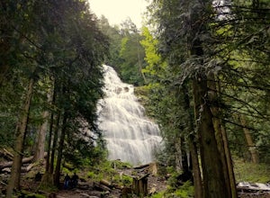
4.00.5 mi / 164 ft gainLocated only a short distance from the Trans-Canada highway is the Bridal Veil Falls Provincial Park. The park is a great area for a picnic lunch, but the highlight of the park is the almost 200 ft. (60 meter) waterfall. The location of the park and the duration of the hike to the waterfall make ...Read more -
Fraser Valley D, British Columbia
Camp at Jones Lake
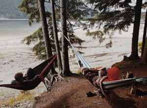
3.0Southwest of Hope and just east of Chilliwack, Jones Lake is a recreation site at a reservoir lake in the coastal mountain range, managed by BC Hydro. Set below granite mountain peaks and surrounded by a dense forest (that is unfortunately being logged), this lake isn't pristine, but it sure is p...Read more -
Winthrop, Washington
Hike to Easy Pass
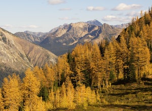
5.07.81 mi / 2844 ft gainIf you're looking for a beautiful fall hike with breathtaking views and acres of golden larches, this is it. This trail provides a good workout along with miles of photogenic scenery, including glacier views at the top, making the climb well worth the effort. Easy Pass is also (arguably) one of t...Read more -
Manning Park, British Columbia
Hike to Mt. Frosty, EC Manning Provincial Park
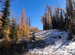
14.2 mi / 5433.1 ft gainThe larch meadows on the approach to Mt. Frosty are known for 2 things: 1. Wild flowers during the summer and 2. Larches during the autumn.The trail climbs up the south end of Lightning Lake; it is well groomed and graded all the way up. The steepest section is the climb out of Lightning Lakes – ...Read more -
Deming, Washington
Hike to Racehorse Falls
3.7Racehorse Creek is broken up into four distinct waterfalls that drop a total of 140ft through a relatively shallow gorge. The first two waterfalls are punchbowl-type falls that have deep holes at their bases. Immediately below the second waterfall, the creek descends rapidly before it arrives at...Read more -
Okanogan County, Washington
Hike Tatie Peak and Grasshopper Pass
11 mi / 1800 ft gainDirection are from Mazama, WA. From Mazama drive west on the Lost River Road for approximately 19 miles to Hart's Pass. Note that the pavement ends around 7 miles from Mazama and the road becomes FS RD 54. The drive up to Hart's Pass is fairly exposed in one spot and has unnerved several of my ...Read more -
Manning Park, British Columbia
Backpack the Heather Trail, BC
24.9 mi / 1138.5 ft gainThis hike begins in the middle of Manning Park, with a drive up to the trail-head. This means you get all the benefits of alpine views and fields of wildflowers in the summer months, without hiking the elevation gain. Manning Park is on the Crowsnest Highway (BC-3). Across the highway from the ...Read more

