North Cascades, Washington
Looking for the best camping in North Cascades? We've got you covered with the top trails, trips, hiking, backpacking, camping and more around North Cascades. The detailed guides, photos, and reviews are all submitted by the Outbound community.
Top Camping Spots in and near North Cascades
-
Rockport, Washington
Backpack to Fourth of July Pass from Thunder Creek
11.2 mi / 2400 ft gainStarting at the Colonial Creek Campgrounds, the trail starts out fairly flat taking you along Thunder Creek for about two miles to the Fourth of July Pass trail head. Once you reach here, the trail begins to climb.Beginning with switch backs, the path straightens out for a while before coming to ...Read more -
Rockport, Washington
Backpack Thunder Creek
10.48 mi / 1027 ft gainThis hike along Thunder Creek in North Cascades National Park is perfect for families and beginner backpackers. The trail is at a lower elevation in the park so it is a great early-season hike, but be sure to check with the ranger station for trail and weather conditions before you go. Starting ...Read more -
Marblemount, Washington
Lookout Mountain Trail
5.09.06 mi / 4610 ft gainBeginning about 7 miles down the Cascade River Road from Marblemount, the Lookout Mountain Lookout trailhead is on the north side of the road with parking for about 4-5 cars. With about 4500' elevation gain in 4.7 miles, this hike is definitely a thigh burner. The trail begins with a steep climb...Read more -
Concrete, Washington
Climb Mt. Baker via Squak Glacier
10 mi / 7500 ft gainNOTE: THIS ROUTE REQUIRES GLACIER TRAVEL SKILLSMt Baker, or Kulshan, is a remarkable mountain in northwest Washington. Whether you're in Anacortes, Bellingham, Vancouver or on the San Juan Islands you can see Mt Baker standing as a citadel over the Northwest. Unlike the more popular routes like t...Read more -
Concrete, Washington
Park Butte Lookout
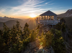
4.57.64 mi / 2100 ft gainThis place is really the stuff of fairy tales. Where else can you find a tiny cabin with 360-degree views of stunning mountain scenery? To the west, you can see all the way to Bellingham and the Puget Sound. To the south and east lie the jagged North Cascades. And the entire northern horizon is ...Read more -
Concrete, Washington
Backpack the Easton Glacier Railroad Grade
10 mi / 3000 ft gainBegin at the Park Butte trailhead, trail 603. Hike past the first Scott Paul trail sign a few hundred feet from the trailhead. Continue on and cross appropriately name Rocky Creek heading up on the Park Butte Trail. Continue up the Park Butte trail passing the Scott Paul trail again at about 4,50...Read more -
Fraser Valley E, British Columbia
Hike to Lindeman & Greendrop Lakes
4.46.89 mi / 1240 ft gainYou start the trail in a newly created parking lot (outhouses as well). Follow along the trail, and within a short distance from the parking lot you will come to a fork. Take the left trail (right goes to Flora Lake). This part of the trail is fairly flat with some nice scenery. You will follow t...Read more -
Concrete, Washington
Dock Butte
4.53.92 mi / 1388 ft gainDock Butte is an easy hike offering truly spectacular 360 degree views of the Mt. Baker region. In summer this summit can be done as an easy walk up. It is especially good during the late summer for hikers and introducing someone into hiking. From the parking lot the trail goes through forest wi...Read more -
Deming, Washington
Hike Skyline Divide
5.09 mi / 2500 ft gainIf driving 13 miles on a forest road, and hiking miles of switchbacks doesn't bother you, your in for one of the most exquisite views that you can get from hiking in Washington state.Just a mile outside of the town of Glacier, turn onto Forest Road 37 and follow it up switchbacks for the majority...Read more -
Marblemount, Washington
Hidden Lake Lookout
4.97.39 mi / 3415 ft gainBe careful when heading up this 4.5 mile trail since there can be snow coverage into the summer. When you start the trail, you'll get a little tree coverage as you start climbing up. Unfortunately, the shade starts to dissipate after about a mile, where you'll cross over Sibley Creek and enter th...Read more -
Marblemount, Washington
Climb Eldorado Peak via the East Ridge
8 mi / 6800 ft gainStanding on the knife edge summit, the terrain around you plummets steeply into glacier-filled basins that trickle into turquoise alpine lakes. Serrated snowy peaks give way to forest covered valleys below that craft a rugged landscape. Eldorado Peak delivers you atop this wild and mountainous wo...Read more -
Marblemount, Washington
Sahale Glacier Camp via Cascade Trailhead
5.011.09 mi / 4183 ft gainAs an initial note, to spend an overnight at Sahale Glacier Camp, you need to obtain a permit at the North Cascades Ranger Station in Marblemount, Washington. Permits are limited, so get there early or call in advance. To start, go to Marblemount, WA and then drive ~23 miles east on Cascade Rive...Read more -
Skagit County, Washington
Pelton Basin Camp
8.82 mi / 2543 ft gainStarting at 3,640 feet elevation, the Cascade Pass Trailhead begins adjacent to the Johannesburg Camp and proceeds east along a relentless series of switchbacks. Though the trail is consumed by a thick Washington evergreen forest, the switchbacks frequently open to sweeping vistas of the far-reac...Read more -
Skagit County, Washington
Climb Sahale Peak via the South Slope Route
5.012 mi / 4000 ft gainTo get to Sahale Peak, drive to Marblemount, WA and continue on the Cascade River Road (Forest Road 15) for 23.5 miles. The road ends at the Cascade Pass trailhead, where the climb begins.The first part of the climb follows the Cascade Pass trail for 3.5 miles and 1,800 feet. Cascade Pass makes a...Read more -
Fraser Valley D, British Columbia
Camp at Jones Lake
3.0Southwest of Hope and just east of Chilliwack, Jones Lake is a recreation site at a reservoir lake in the coastal mountain range, managed by BC Hydro. Set below granite mountain peaks and surrounded by a dense forest (that is unfortunately being logged), this lake isn't pristine, but it sure is p...Read more -
Fraser Valley D, British Columbia
Paddle on Jones Lake, BC
5.0Jones Lake Reservoir is approximately 25 km southwest of the town of Hope, British Columbia. Directly off of BC Highway #1 at the community of Laidlaw. To reach the lake, you will have to drive 9 km (5.6 mi.) on a steep and pretty beat up gravel road. The Jones Lake Forest Service Road is car ac...Read more

