Mount Ellinor, Washington
Looking for the best hiking in Mount Ellinor? We've got you covered with the top trails, trips, hiking, backpacking, camping and more around Mount Ellinor. The detailed guides, photos, and reviews are all submitted by the Outbound community.
Top Hiking Spots in and near Mount Ellinor
-
Port Angeles, Washington
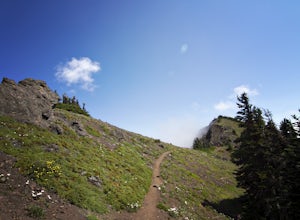
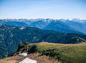
Klahhane Ridge (Switchback Route)
4.05 mi / 1700 ft gainHiking to Klahhane Ridge is a rewarding experience that provides you with sweeping views of the Olympic Mountains. Further access to overnight opportunities is possible if you venture beyond the summit trail. Here’s the scoop: Get an early start. There is a decent amount of parking available at ...Read more -
Port Angeles, Washington
Hurricane Hill
4.83.13 mi / 689 ft gainTo get to this hike you drive up to Hurricane Ridge in Olympic National Park. The drive up to Hurricane Ridge is on a winding road with amazing views of the mountains. Once you reach the visitors center at Hurricane Ridge you can fill up water bottles or use the restroom. The trailhead for Hurric...Read more -
Port Angeles, Washington
Humes Ranch and Goblin Gates
6.4 mi / 994 ft gainThe Elwha River Trail cuts south into the heart of Olympic National Park along a densely forested valley, following the same route taken by some of the earliest explorers of the Olympic Peninsula at the end of the 19th century. Past Port Angeles, at a hard curve in US-101, take Olympic Hot Sprin...Read more -
Port Angeles, Washington
Wolf Creek Trail
8.12 mi / 3970 ft gainTo tackle the Wolf Creek Trail, you start by winding up Whiskey Bend Road just outside of Port Angeles, falling the curves and hills of Elwha River. The peaks of the Olympic Mountains stand in the distance.Once you approach a clearing and small parking area, you grab the gear and hit the trail. T...Read more -
Port Angeles, Washington
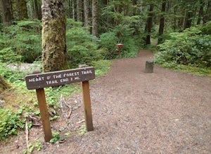
Hike the Heart O' the Forest Trail
5.04.52 mi / 840 ft gainThis hike is a short, 4.0 mile round trip, half-day or less hike, located just past the Hurricane Ridge entrance into Olympic National Park. Being relatively level and the trail head just off loop E of the Heart O' the Hills Campground, the Heart O' the Forest hike offers those looking for a tast...Read more -
Port Angeles, Washington
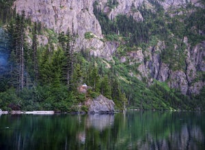
Backpack to Lake Angeles
5.07.12 mi / 2503 ft gainLake Angeles is, rightfully, a popular day hike and overnight backpacking option, as its one of the larger, more accessible lakes in Olympic National Park. It can be done either as a moderate day hike with a refreshing swim and picnic lunch or a relaxing overnight with gorgeous views and reliable...Read more -
Gig Harbor, Washington
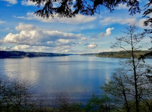
Run through Point Defiance Park
5.04.3 miPoint Defiance Park is the largest urban park in Pierce County and it provides a variety of amenities. Located at the very northwest tip of Tacoma, the park provides residents with a much needed retreat from the bustle of everyday life. Point Defiance Park is the place to go if you need a quick d...Read more -
Port Angeles, Washington
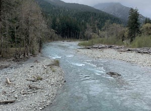
West Elwha River Trail
5.06.11 mi / 1198 ft gainWest Elwha River Trail is an out-and-back trail that takes you by a river located near Port Angeles, Washington.Read more -
Port Angeles, Washington
Olympic National Park Foothills Trail
6.23 mi / 1772 ft gainOlympic National Park Foothills Trail is an out-and-back trail where you may see beautiful wildflowers located near Port Angeles, Washington.Read more -
Port Angeles, Washington
Olympic Hot Springs
3.721.52 mi / 3556 ft gainA local favorite, this moderate day hike winds its way uphill from the Appleton Pass trailhead through old growth stands of fir, hemlock and cedar for 2.2 miles to a cluster of hot springs interspersed among the trees. Note: This route is now closed due to a washed out road. The current route is ...Read more -
18113 Upper Hoh Road, Washington
Spruce Nature Trail and Hall of Mosses Loop
5.02.08 mi / 272 ft gainSpruce Nature Trail and Hall of Mosses Loop Trail is a loop trail that takes you by a river located near Joyce, Washington.Read more -
18113 Upper Hoh Road, Washington
Hoh Rainforest and Hall Of Mosses
4.51.04 mi / 203 ft gainStarting at the Hoh Rainforest Visitor Center, take the only trail out into the forest itself. After a few hundred yards there will be a sign pointing you in the direction of the Hall Of Mosses. Follow signs and a very well-maintained trail over crystal clear creeks and fallen trees until you r...Read more -
Forks, Washington
Backpack the Hoh River Trail
5.035.69 mi / 5948 ft gainGrab a permit on your way in at the Wilderness Information Center (WIC) in Port Angeles or at the Quinault USFS/NFS Recreation Information center before parking at the Hoh Rain Forest Visitor Center and use the wash station and rest room before you head out on the trail. The first five miles of...Read more -
Forks, Washington
Hike the Hoh River Trail to Five Mile Island
10.6 mi / 300 ft gainOlympic National Park was established to preserve “the finest example of primeval forest” and so the Hoh Valley remains much like it has for thousands of years. This is the best trail to experience the magic of Hoh Valley, the grandeur of its old growth trees, lush understory and iridescent glaci...Read more -
Forks, Washington
Climb Mount Olympus, Olympic NP
45 mi / 8000 ft gainGetting to the summit is no easy task. The approach is long, you must cross a glacier, and once you are to the summit block the easiest way up is on loose 4th class rock, however a short pitch of 5.4 rock is recommended instead. Getting there On your way to the trail-head you will need to stop a...Read more -
Forks, Washington
Backpack the Hoh River Trail to Blue Glacier
5.035.68 mi / 5948 ft gainThe well trodden and well marked trail begins in the rainforest, and is flat and follows the river for the first few miles. There are many marked camp sites along the way, as well as dispersed camping on the sand bars in the river bed. Follow the trail until the first major intersection, at the O...Read more

