Marblemount, Washington
Looking for the best photography in Marblemount? We've got you covered with the top trails, trips, hiking, backpacking, camping and more around Marblemount. The detailed guides, photos, and reviews are all submitted by the Outbound community.
Top Photography Spots in and near Marblemount
-
Concrete, Washington
Dock Butte
4.53.92 mi / 1388 ft gainDock Butte is an easy hike offering truly spectacular 360 degree views of the Mt. Baker region. In summer this summit can be done as an easy walk up. It is especially good during the late summer for hikers and introducing someone into hiking. From the parking lot the trail goes through forest wi...Read more -
Rockport, Washington
Backpack to High Camp on Ruby Mountain
17 mi / 6300 ft gainRuby Mountain is one of the North Cascades more prominent peaks, sitting high above Diablo and Ross Lakes. This trip is one for more experienced hikers with a very aggressive incline from start to finish. If that does not scare you then definitely add this amazing hike to your list. While it can ...Read more -
Rockport, Washington
Canoe Diablo Lake
Pack up your canoe with supplies for the day and launch from Colonial Creek Campground Area to begin your journey. As you approach the bridge to cross the lake, pull off to the parking area, there is signage for the boat launch area where you can easily carry your equipment down to the water's ed...Read more -
Concrete, Washington
Rainbow Ridge
4.51 mi / 1552 ft gainThe Trail From the parking area proceed back towards the road and hang a right up an abandoned road bed. The trail follows this road bed for a about 0.2 miles before the real trail becomes evident. The first 0.5 - 1.0 miles of this trail can be difficult. Deadfall, wet, steep, and root covere...Read more -
Concrete, Washington
Winter Hike to Rainbow RIdge
4.5 mi / 1200 ft gainTurn left off of the Grandy-Baker Lake Road onto FS RD 1130 just past the Boulder Creek Campground. Stay right at the first fork in the road. At 3.9 miles go right towards Rainbow Falls. The falls are located at a large bend in the road at approximately 4.5 miles. I have never found a good safe...Read more -
Darrington, Washington
Hike to Green Mountain
8.5 mi / 3200 ft gainAfter the long drive down FR 26, turn onto FR 2680. 6 miles down the road, you'll see what slightly resembles a trail to your left. Park and prepare for your gorgeous hike!The trail starts with a 1.5 mile windy trek through the woods. You'll pop out onto the lush meadows of the mountain sides. He...Read more -
Rockport, Washington
Explore Diablo Lake
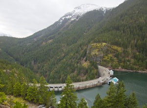
5.0Diablo Lake is a reservoir in the North Cascades created by Diablo Dam. The hue of the lake is created by ground up rocks from local glaciers, which end up drifting down streams into the lake.If you’ve decided to take in the viewpoints driving Hwy 20 through the park, be sure to check out Liberty...Read more -
Concrete, Washington
Park Butte Lookout
4.57.64 mi / 2100 ft gainThis place is really the stuff of fairy tales. Where else can you find a tiny cabin with 360-degree views of stunning mountain scenery? To the west, you can see all the way to Bellingham and the Puget Sound. To the south and east lie the jagged North Cascades. And the entire northern horizon is ...Read more -
Concrete, Washington
Backpack the Easton Glacier Railroad Grade
10 mi / 3000 ft gainBegin at the Park Butte trailhead, trail 603. Hike past the first Scott Paul trail sign a few hundred feet from the trailhead. Continue on and cross appropriately name Rocky Creek heading up on the Park Butte Trail. Continue up the Park Butte trail passing the Scott Paul trail again at about 4,50...Read more -
Rockport, Washington
Hike to Ross Dam
5.02 miThis is a short hike at just under 2 miles round-trip, with little elevation change. The trail begins at a parking area, alongside Washington Route 20. The hike takes you through the forest to an overlook of both Ross Dam and Ross Lake, before making the final descent down to the dam. The trail i...Read more -
Rockport, Washington
Kayak Ross Lake to Cougar Island and Rainbow Point
5.0Start from the Ross Lake Trailhead off Highway 20. Hike down with your vessel 1.5 miles to the hull road. From there you can launch your vessel. Ross Lake is very large with many destinations to paddle to. I went to Cougar Island and Rainbow Point then paddled up to multiple spectacular wate...Read more -
Deming, Washington
Hiking the Kulshan Ridge
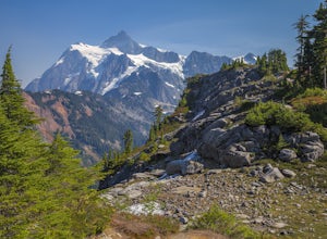
This hike starts out at Artist Point, where already you can see jaw-dropping scenery of Mt. Shuksan, Baker, Coleman, and many other peaks of the North Cascades. No matter what time of year you visit, you are bound to get unbelievable views and photos.Artist Point is the furthest destination along...Read more -
Deming, Washington
Hike to Table Mountain via Artist Point
5.03 mi / 560 ft gainThe hike takes off from the Artist Point parking lot at an elevation of 5,220 feett.The trail slowly meanders up for a while until reaching the final steep switchbacks where you'll have a sheer cliff to your side—don't let it distract you, and keep focused on the trail in front of you!Once you've...Read more -
Deming, Washington
Hike Ptarmigan Ridge in the North Cascades
5.09 mi / 1350 ft gainDirections are from Bellingham. Drive Sr 542(Mt Baker Highway) approximately 60 miles to the parking area at Artist Point, elev. 5140 ft. Try to park towards the southwest corner of the lot as this is where our trail begins. Toilets are available.The trail starts from the southwest corner of t...Read more -
Deming, Washington
Explore Artist Point
5.0Note that Artist Point is only accessible by car during the summer - it is closed off from cars as of First Snowfall (end of September) through June.The parking lot of Artist Point is only about an hour and fifteen minute drive from the city of Bellingham, WA. The beautiful and peaceful road that...Read more -
Deming, Washington
Snowshoe to Artist Point
5.05.5 mi / 1200 ft gainFrom the south end of the ski area, snowshoe past an old ski lodge along an old access road parallel to the ski hill. Then, ascend Austin Pass (2 miles) following the broad switchbacks. Once at the top of the ridge, follow the road to the left 1/4 mile and take in the views of Artist Point, Mou...Read more

