Marblemount, Washington
Looking for the best camping in Marblemount? We've got you covered with the top trails, trips, hiking, backpacking, camping and more around Marblemount. The detailed guides, photos, and reviews are all submitted by the Outbound community.
Top Camping Spots in and near Marblemount
-
Darrington, Washington
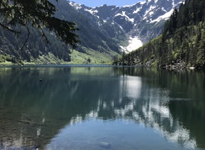
Camp at Goat Lake
4.310.4 mi / 1400 ft gainIf you just loved your day hike to Goat Lake so much that you want to return and spend some more time, you're in luck - the lake offers a camping area that holds at least 15 campsites and even comes with a pit latrine. This is a great overnight option if you aren't looking for a difficult hike in...Read more -
Winthrop, Washington
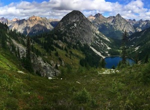
Heather-Maple Pass Loop
5.07.5 mi / 2185 ft gainNote to any hikers taking on this trail, this is a non-repeating trail meaning it goes in a big loop. The trailhead has 2 trail points of entrance. To the right (the pathway that is not paved) is the counter-clockwise route, a little less steep and more scenic at the start. To the left, the trail...Read more -
Pacific Crest Trail, Washington
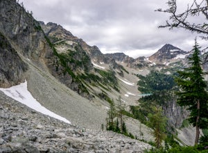
Summit Black Peak
5.010 mi / 4400 ft gainStarting at the Heather-Maple Pass Loop Trailhead, jump onto the trail that will take you counter-clockwise along the loop. After about 1.25 miles, you will come to a split in the trail, take the right path and continue for just under a mile until you reach Heather Pass. Off to the right there ar...Read more -
Chelan County, Washington
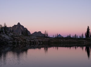
Camp at Snowy Lakes
22 mi / 3550 ft gainTake Hwy 20 to Rainy Pass, and park at the trailhead on the east side of the highway. Begin on the Pacific Crest Trail (PCT), heading towards Cutthroat Pass.The trail winds it's way towards the pass at a gentle grade over 5 miles. As the trail ascends, you'll leave the forest behind as you enter ...Read more -
Granite Falls, Washington
Mt. Dickerman Summit
7.93 mi / 3675 ft gainIn general, this is a strenuous hike or snowshoe at approximately 8 miles round trip with nearly 4000 elevation gain. Be aware of current snow conditions and avalanche risk if heading up in the winter. Do not attempt a winter trip without proper knowledge, skill, and gear. Some previous winter tr...Read more -
Darrington, Washington
Backpack to Glacier Peak Meadows and White Chuck Glacier
34 mi / 9000 ft gainStarting at the North Fork Sauk Trailhead (NFD 49) off the Mountain Loop Highway, you will travel 5.3 miles and gain a leisurely 1,100 feet of elevation until you reach Mackinaw Shelter. This is where the real work begins. The trail gains a calf-burning 3,000 feet in the next 2.9 miles until you ...Read more -
Granite Falls, Washington
Vesper Peak Trail
4.06.59 mi / 3927 ft gainThis hike is very strenuous, but nothing unconquerable! The views at sunset were once in a lifetime and something I will remember for the rest of my life. The first half mile or so of the trail begins in a wooded area then opens up to views of the lower valley. After hiking for about another ½ t...Read more -
Granite Falls, Washington
Cutthroat Lakes via Walt Bailey Trail
4.06.21 mi / 1978 ft gainAlong the Mountain Loop Highway, past the crowds crawling over Mt. Pilchuck, lies the muddy, unkempt Walt Bailey Trail into a verdant subalpine basin speckled with tiny tarns. The Cutthroat Lakes are a delightful location to spend the night with optional day hikes up to exposed ridgelines and cra...Read more -
Winthrop, Washington
Ski Washington Pass
Because the North Cascades highway usually closes from November to May due to heavy snow and huge slides that bury the road, few people expend the energy to get there, meaning it's one of the only places where fresh tracks are almost guaranteed through the winter and early spring.To start, you'll...Read more -
Winthrop, Washington
Hike to Cutthroat Pass
11 mi / 2300 ft gainLooking for a distinctive high-country hike just east of the pass? Cutthroat Pass is a hearty day hike perfect for gaining elevation and views with every step. It's even more dynamic as a point-to-point, exiting via the Pacific Crest Trail if you have two vehicles. Also great for a one-night back...Read more -
Fraser Valley E, British Columbia
Hike to Lindeman & Greendrop Lakes
4.46.89 mi / 1240 ft gainYou start the trail in a newly created parking lot (outhouses as well). Follow along the trail, and within a short distance from the parking lot you will come to a fork. Take the left trail (right goes to Flora Lake). This part of the trail is fairly flat with some nice scenery. You will follow t...Read more -
Leavenworth, Washington
Spider Gap to Buck Creek Pass
5.034.4 mi / 8317 ft gainBackpacking the Spider Gap to Buck Creek Pass Loop in the Glacier Peak Wilderness is no easy task, but yields some of the most spectacular views found in Washington. Plan for at least four days in order to stay fresh and to allow for extra time to soak in the Cascadian beauty that assaults your ...Read more -
Leavenworth, Washington
Scramble Fortress Mountain
5.022 mi / 6000 ft gainThe Approach Starting at the Trinity trailhead you'll hike the Buck Creek Trail towards Buck Creek Pass. The trail is fairly obvious once the snows have melted but if you are going early season (June-early July) you will definitely want to bring a GPS. The trail works it's way up the valley alon...Read more -
Gold Bar, Washington
Winter Backpack to Blanca Lake
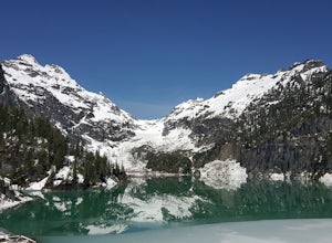
7.5 mi / 3300 ft gainSince Blanca Lake is a very popular place for folks to explore and with the nice and sunny weekend. I drove out Friday night and slept in my Jeep. Got up at 7:30am when folks first started arriving to the trail head.A couple of things to keep in mind before you start this hike. The 7.5 miles ro...Read more -
Winthrop, Washington
Hike Abernathy Peak
9 mi / 5100 ft gainAbernathy Peak is one of the shortest and easiest peak on the Bulger List, as it's just a walk-up covering around 9 miles and 5100 feet in gain. The trail to starts at the Twisp River Trail, but a few paces after the trailhead, the trail splits and you head left for Scatter Lake. The next 3.5 mi...Read more -
Bow, Washington
North Butte via Chuckanut Trail
1.07.71 mi / 2047 ft gainThe HikeThe hike there isn't short, has several steep sections, and ends at the top of the mountain. There are cliff warnings at the top, so be careful as you explore the view! The steepest portions are at the beginning and right at the end. The trail is very well maintained (because it is so pop...Read more

