Maple Falls, Washington
Top Spots in and near Maple Falls
-
Olga, Washington
Hike the Highlands Trail
1.5 mi / 200 ft gainObstruction Pass State Park is something of a hidden gem on Orcas Island given that its nearby neighbor, Moran State Park, gets most of the tourist attention. What this means is that you can find solitude and quiet, *and* make a visit to the only publicly owned beach on the island. There are seve...Read more -
Anacortes, Washington
Hike to the Summit of Mt. Erie
4.05 mi / 900 ft gainTo start this hike, jump on trail 215 for a short distance of about a 1/4 mile. From here, continue until you cross trail 320 and head left onto it. Stay on 320 until you come across trail 230.Take 230 uphill (resembles an old fire road) toward the ravine just above a creek. From here, head onto ...Read more -
Olga, Washington
Camp at Obstruction Pass State Park
5.0The nine primitive campsites and one Cascadia Marine Trail campsite of Obstruction Pass State Park are the only first come, first serve campsites available on Orcas Island. The campsites themselves overlook a fantastic (and accessible beach) and Obstruction Pass itself. There are four composting ...Read more -
Eastsound, Washington
Go Whale Watching from Rosario Harbor
No visit to the San Juan Islands is complete without taking a whale watching tour and Rosario Harbor on Orcas Island is uniquely situation to allow for trips east into the Rosario Straight, south into Lopez Sound, or west into the Haro Straight. Such flexibility is useful when on the looking for ...Read more -
Blakely Island, Washington
Boat Camp at Blakely Island
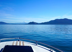
From Washington Park in Anacortes, Washington we launched our 19' Beachcraft with a deep hull into Puget Sound on a beautiful blue sky morning. The weather and water was favorable for an overnight adventure to Blakely Island! We made our way across Rosario Straight and toward James Island (20 mi...Read more -
Rockport, Washington
Sourdough Mountain Trail
5.09.34 mi / 5046 ft gainGoing east from Newhalem on highway 20, turn off towards the small town of Diablo. There are signs from there on where to park. This hike is very difficult. It is very steep and gains elevation very quickly and right from the start. Once you get above tree line though you are greeted with great ...Read more -
Eastsound, Washington
Kayaking at Point Doughty State Park
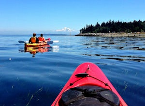
The easiest way to explore this area is through Outer Island Excursions, which offers a 3-hour kayaking tour from Smuggler’s Villa Resort on Orcas Island (they also offer various tours of the surrounding islands).The tour begins with a paddle down the North Shore of Orcas Island to Point Doughty ...Read more -
Anmore, British Columbia
Backpack the Dilly Dally Loop
15.5 mi / 3800 ft gainThis hike begins near the parking lot of Buntzen Lake. The trailhead will read "Halvor Lunden Trail,” named after the man who made it. This part of the trail is well marked, however as you continue along the loop it gets less and less worn, making things more difficult, but also more natural.The ...Read more -
Rockport, Washington
Hike to Pyramid Lake
2.1 mi / 1500 ft gainDay hike with moderate elevation gain, 2.1 miles one way. You will be going up, up, up until you get to the top where you will find the lake. Take your time going up - take breaks and stop to check out the forest around you. There were a few times where we found it difficult to follow the trail (...Read more -
Anmore, British Columbia
Hike Lake Buntzen
4.5Buntzen Lake is located in a beautiful recreation area just north of Port Moody. Although the lake is man-made and maintained by BC Hydro, the surrounding area is full of forests, nice beach areas, and many trails for hiking including the Buntzen Lake Trail, which loops around the lake.Beginning ...Read more -
Marblemount, Washington
Hike to Monogram Lake
9.8 mi / 4500 ft gainOn a drizzly day, we set out to patrol Monogram Lake. Sore legs and thousands of feet later, we had the pristine lake all to ourselves with gorgeous fall weather and peek-a-boo views of the North Cascades.From Highway 20 in Marblemount, take Cascade River Road for 7 miles and look for a small par...Read more -
Marblemount, Washington
Lookout Mountain Trail
5.09.06 mi / 4610 ft gainBeginning about 7 miles down the Cascade River Road from Marblemount, the Lookout Mountain Lookout trailhead is on the north side of the road with parking for about 4-5 cars. With about 4500' elevation gain in 4.7 miles, this hike is definitely a thigh burner. The trail begins with a steep climb...Read more -
Belcarra, British Columbia
Hike the Springboard Trail and Explore Woodhaven Swamp
5.9 mi / 1312.3 ft gainFrom the parking lot at Woodhaven Swamp, head down the wooden steps to the lower path and then follow the path clockwise, passing over a small boardwalk bridge at the east end of the wetland. At the west side of the swamp, look out for a smaller trail that veers off on the left and follow that as...Read more -
Blakely Island, Washington
Hike and Camp at James Island
If you're looking for a weekend camping getaway to a small San Juan Island and you have a boat of substantial size or experience sea kayaking, this is the adventure for you!Launch your boat from Washington Park in Anacortes and cruise or sea kayak across Rosario Straight to James Island. There i...Read more -
Belcarra, British Columbia
Hike the Jug Island Trail
4.7From the parking lot at Belcarra Regional Park, follow the Jug Island Trail. It is well marked and well walked so it's near impossible to wander off in the wrong direction! The beach near Jug Island is at the very tip of the peninsula and offers beautiful views of the Indian Arm and surrounding m...Read more -
Belcarra, British Columbia
Hike to Jug Island
3.4 mi / 328 ft gainPark your car at the Belcarra Regional Parking Lot and head into the forest. There will be a trail marker beside the playground. Walk about 5 mins along this trail and cross the road. There will be two trails - take the one on the left and follow this trail uphill. The trail is very well marked a...Read more

