Kirkland, Washington
Top Spots in and near Kirkland
-
Gold Bar, Washington
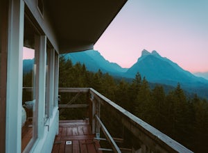
Heybrook Lookout
4.72.47 mi / 984 ft gainTo the trailhead, drive east on highway 2 from Everett. Just past milepost 37 you will see a gravel parking area on the left side of the highway. Wander through a mossy forest that reminds me of Olympic National Park and traverse up 1.3 miles of switch backs to ascend heybrook lookout! Dogs ar...Read more -
North Bend, Washington
Otter Falls
4.08.37 mi / 853 ft gainThe hike begins at Snoqualmie Lake Trailhead, but you'll actually have to start your hike about a half mile down the road from the trailhead as some cement barricades are up. There is plenty of room to park below the barricades, and the walk up to the trial head is easy and quick. Once at the tr...Read more -
North Bend, Washington
Rainy Lake Trail
4.09 mi / 3205 ft gainThis is an abandoned trail that heads south along Rainy Creek, off of the downstream section of the Middle Fork Snoqualmie Trail, and up to Rainy Lake. The lake is popular among fisherman, since it is home to lots of trout, but be warned -- route-finding skills are a must on this trip. I do my be...Read more -
North Bend, Washington
Middle Fork Snoqualmie River Trail
27.57 mi / 3609 ft gainThis beautiful tucked-away trail offers runners, hikers, and backpackers a new view of their favorite neighboring peaks - like Mailbox Peak and Mt. Si - from one of the most scenic river trails in the Seattle area. Often overlooked in favor of more rigorous hikes, the Middle Fork is a gently gra...Read more -
Seabeck, Washington
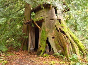
Hike to Guillemont Cove Stump House
4.52.5 miHave you ever been inside a stump house? This is your chance! Just outside of Seabeck, Washington lies a hobbit stump house tucked into a mossy forest on the shores of Guillemont Cove. Drive to Seabeck, turn right onto Miami Beach Road, bear left onto Stavis Bay road and continue for 4.5 miles...Read more -
Brinnon, Washington
Hike to Mt. Walker North & South Viewpoints
3.04 mi / 2000 ft gainDirections: From the Quilcene Ranger Station drive 4.6 miles south on US 101. Watch for the signs for Mount Walker View Point. Turn left onto Mount Walker Road. The trail head is about a quarter mile up the road with pull over parking on the left side of the road. In the winter and early spring, ...Read more -
Granite Falls, Washington
Old Robe Canyon Trail
3.69 mi / 771 ft gainNOTE: The trail is currently closed about 1 mile in due to landslides. This trail starts right off the Mountain Loop Highway outside of Granite Falls. Look out for a brick sign with the trail name, as it's easy to miss otherwise. There's parking next to the highway, but since there is a history...Read more -
North Bend, Washington
Summit Mt. Defiance
5.011 mi / 3300 ft gainThis hike offers some of the best views one can see in the area. On a clear day, you'll get amazing views of Mt. Rainier. The best part is that as you start heading uphill in the first half mile, you'll get great views of McClellan Butte. Once you reach the summit of Defiance at 5584 feet, you'll...Read more -
North Bend, Washington
Bandera Mountain
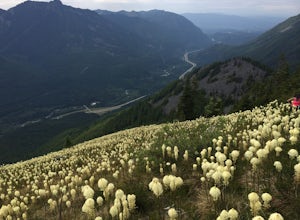
4.47.8 mi / 3176 ft gainThis hike has unreal views of Mount Rainier. On a great clear spring day, the mountain is out. It's right in your face. It's incredible. If you tackle this hike in the spring the bear grass and wildflowers are alive and blooming towards the top and it makes for some fantastic picture-taking. Once...Read more -
North Bend, Washington
Mason Lake via Ira Spring
4.26.88 mi / 2316 ft gainIra Spring trail offers up great views prior to reaching the ridge that you go over to reach Mason Lake. The lake itself is an amazing sight—beautiful water with rocks and trees along the shores, making this 6.5-mile roundtrip hike well worth it. The trail to Mason Lake, the Ira Spring trail, pr...Read more -
North Bend, Washington
Camp and Trail Run from Rainbow Lake
I backpacked to and setup basecamp at Rainbow Lake and then I ran over to Island Lake. After enjoying the peace and quite I ran up to the top of Bandera Mountain and enjoyed the views. Then, I ran back to basecamp and spent the night. The following morning I ran up to the top of Mount Defiance a...Read more -
Gold Bar, Washington
Greider Lakes Trail
8.5 mi / 2054 ft gainGreider Lakes Trail is an approximately 8+ mile hike out-and-back from the trailhead, which is labeled after a long drive up a gravel road. First 2 miles are flat, next 3 are switchbacks up. Once you reach the first larger lake, keep going! The second one is also gorgeous. This is a beautiful hik...Read more -
27662-27664 Olympic Highway, Washington
Hike Falls View Canyon
1.5 mi / 300 ft gainThis hike is located immediately off of Highway 101 in the Falls View Campground. If the campground is closed you can park right outside of the gate (but don't block it) and hike in. Inside the gate you will see 3 paths in front of you, take a left and after about a quarter mile you will reach th...Read more -
Granite Falls, Washington
Heather Lake Trail
4.34.33 mi / 1165 ft gainThe trail takes you on a gradual climb up to Heather Lake with beautiful second growth to admire along the way. The trail can be very wet and muddy with many tree roots to catch your toes, so make sure to wear a sturdy pair of tennis shoes or hiking shoes. Dogs are permitted on this trail on-leas...Read more -
Brinnon, Washington
Rocky Brook Falls
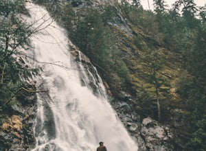
4.80.25 mi / 141 ft gainTo find the falls, head north up Hwy. 101 past Brinnon, Washington and hang a left at Dosewallips Rd. Keep an eye on the mile markers. Right after mile three and crossing a small bridge, there's a parking area on the left side enough for about 6 cars. The hike to Rocky Brook Falls is a short on...Read more -
North Bend, Washington
McClellan Butte
5.010.61 mi / 3629 ft gainStarting at the McClellan's Butte Trailhead, right off of I-90 exit 47, head out on the main (only) trail at the trailhad. The first half mile of the trail is quite easy as it meanders through the forest, but don't be fooled or worried, it will get harder. This first half mile has a crossing of a...Read more

