Kirkland, Washington
Top Spots in and near Kirkland
-
Sequim, Washington
Hike to Royal Basin
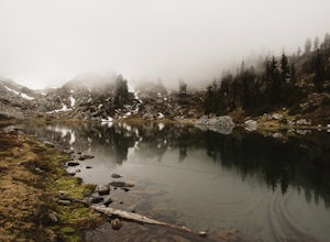
4.715.76 mi / 3409 ft gainIf you're looking for a long day hike or multi-night backpacking trip in the Olympics, add Royal Lake and Royal Basin to your adventure list! The first mile of trail along the Dungeness River gains a gentle 300 feet. When you reach the bridge, do not cross it (the trail across the bridge goes...Read more -
Snoqualmie Pass, Washington
Hike to Margaret Lake
6 mi / 1800 ft gainStarting at an elevation of 3,300 feet, begin the hike on a steep gravel road for 1/4 of a mile. Take a left onto a dirt road that will lead to an area of clear cuts and windy switchbacks.As daunting as this may seem, don't be discouraged. On a clear day, the surrounding peaks of Snoqualmie Pass ...Read more -
Snoqualmie Pass, Washington
Lillian Lake
5.08.36 mi / 2969 ft gainWe backpacked our way to Lillian Lake and set up camp. There is a trail that lead around the lake and a trail that leads up to Rampart Lakes and Rachael Lake as well. We found a few more camps spots on Lillian Lake, then we noticed that only ONE other camp spot was being used. If you want peace ...Read more -
Snohomish County, Washington
Hike Johnson Ridge to Scorpion Mountain
9 mi / 2650 ft gainFrom Skykomish, WA drive east on SR 2 roughly 1 mile and turn left on the Beckler River Road, FS RD 65. Drive north on this road approximately 7 miles taking a sharp right at the pavement's end just before crossing the Rapid River. You are now on FS RD 6520. Continue on this road bearing left a...Read more -
Snoqualmie Pass, Washington
Hike to Rachel Lake
4.88 mi / 1600 ft gainThis hike is 8 miles roundtrip, with 1600 feet of elevation gain. Once you're on the trail, it starts heading uphill to help get your heart rate up on the hike. As you enter the Alpine Lakes Wilderness, the trail starts to level out. You'll cross a few streams and hike through a fair amount of ve...Read more -
Snoqualmie Pass, Washington
Day Hike to Lila Lakes and Alta Pass
4.312 mi / 3000 ft gainGetting There From Seattle, drive Interstate 90 to Exit 62, Signed Kachess Lake/Stampede Pass. Turn left and head north over the interstate; you'll reach Kachess Lake Campground in five miles. Turn left where the pavements ends and drive four miles on Box Canyon Road (FS Road #4930) to the Rachel...Read more -
Snoqualmie Pass, Washington
Take a Hike Up To Rampart Lakes
5.011 mi / 2200 ft gainGetting There: From I-90 East, take exit 62. Take a left, heading over the highway. After 5.2 miles, the road veers left, passing Lake Kachess Campground. Go another 0.3 miles on the gravel road and take a right at a sign for Rachel Lake/Trail 1313. At this point, the road gets a little rough, bu...Read more -
Snoqualmie Pass, Washington
Hike Alta Mountain
4.012 mi / 3300 ft gainStart off at Trail #1313 to Rachel Lake. The first 2.5 miles is a flat, slow uphill hike till you get to a river crossing. From there, the next 1.3 miles will be a 1,000 foot elevation gain to Rachel Lake. Once you arrive, this is a good spot to rest, eat some snacks, and replenish your water sup...Read more -
Snoqualmie Pass, Washington
Snowshoe to Rachel Lake
8 mi / 2100 ft gainBegin at the Rachel Lake Trailhead and fill out the registry with your individual/group information.As you start the hike heading Northwest towards the lake itself, the trail begins to steadily climb from its initial elevation of 2500 feet. Once you cross the Alpine Lake Wilderness sign, the path...Read more -
Skykomish, Washington
Hike Mount Sawyer
8 mi / 1200 ft gainThis trail starts off going through the forest of fir and hemlock for the first mile. Once you reach the top of the first hill, you will get a glimpse of all the views you will have the opportunity to enjoy later on. As you descend, the trees will start to thin out. The trail follows the ridge l...Read more -
Carbonado, Washington
Hike the Upper Foothills Trail along the Carbon River
10 mi / 30 ft gainThe upper Foothills Trail from the Fairfax Bridge to Manley Moore can be hiked starting from either end as an "out and back" hike or a "point to point" by shuttling with two vehicles. Starting from the upper end of the trail you begin by walking under the Kolisch Rd. Bridge, which has the Manley...Read more -
Hoodsport, Washington
Climb Mt. Washington
3.5Follow the driving directions, pass the upper Mt Eleanor parking area and continue until the road dead-ends due to a landslide. Try to leave room for cars to turn around when you park.Follow the trail which starts just near the lake boulder near the parking area. The trail through the lower slope...Read more -
Mason County, Washington
Hike to Lake of the Angels
5.06.75 mi / 3599 ft gainThe trail up to Lake of the Angels, known as the Putvin Trail, starts out pretty mellow with a gradual uphill climb. Your first marker will be an old roadbed at around 1.4 miles, but you'll need to cross two ravines before making it there. It's thick forest with gorgeous views in the clearings, s...Read more -
Carbonado, Washington
Summit Lake
4.56.13 mi / 1499 ft gainSummit Lake, nestled in a small basin just north of Mt. Rainier National Park in the Clearwater Wilderness, has everything a hiker could want in a day-hike or easy overnight backpack. The views, the well-maintained trail, and a perfect distance make this hike a must-do for anybody in the Pacific ...Read more -
Carbonado, Washington
Hike Bearhead Mountain
5.06 mi / 1800 ft gainFormerly the site of an old fire lookout, Bearhead Mountain located in the Clearwater Wilderness, provides great unobstructed views of the north side of Mount Rainier, Little Tahoma, and many other surrounding Cascade mountain peaks. In the summer months you are likely to encounter great wildflow...Read more -
Hoodsport, Washington
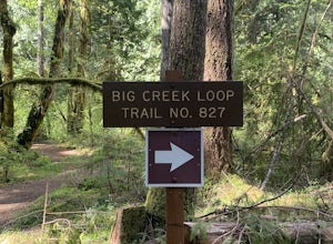
Upper Big Creek Loop Trail
4.76 mi / 1142 ft gainUpper Big Creek Loop Trail is a loop trail that takes you by a river located near Lilliwaup, Washington.Read more

