Hoodsport, Washington
Top Spots in and near Hoodsport
-
Brinnon, Washington
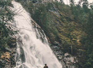
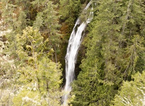
Rocky Brook Falls
4.80.25 mi / 141 ft gainTo find the falls, head north up Hwy. 101 past Brinnon, Washington and hang a left at Dosewallips Rd. Keep an eye on the mile markers. Right after mile three and crossing a small bridge, there's a parking area on the left side enough for about 6 cars. The hike to Rocky Brook Falls is a short on...Read more -
Quinault, Washington
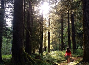
Backpack to Enchanted Valley Chateau
5.031.59 mi / 5052 ft gainThis backpacking trip can easily be done in 2 days, but some people prefer to stretch it out to 3. Luckily there are several different spots to stop and camp, so you can split up the distance however you are the most comfortable. The elevation over the course of the trail is minimal, which means ...Read more -
Brinnon, Washington
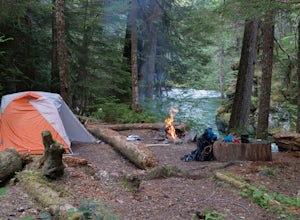
Camp at the Dose Forks
15 mi / 1200 ft gainThe Dose Forks Campground is an overlooked campsite deep within the Olympic National Park, making it a perfect weekend camping destination. A mild, 7.5 mile (one-way) trail delivers you to this enchanting area and is a must for those who love photographing forests. There are no reservation requir...Read more -
Gig Harbor, Washington
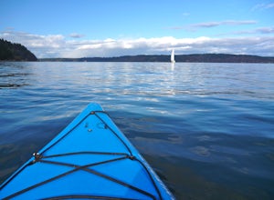
Kayak Gig Harbor
3.0Just over the Tacoma Narrows Bridge is a small, quiet, and tranquil town of Gig Harbor. The best way to experience the town is from the water.Tucked beneath Anthony's restaurant is Gig Harbor Rent-a-Boat, a small rental company that will outfit you for your afternoon on the water. Most days the ...Read more -
Brinnon, Washington
Hike Lower Big Quilcene River
13 mi / 1800 ft gainWhile this hike does not provide any sort of fantastic views, its does provide an easy ~13 mile roundtrip hike from the trailhead to a parking lot for the Upper Big Quilcene Trail which leads to Marmot Pass. Along the way you will cross several bridges, some large and wide, other simple log bridg...Read more -
Brinnon, Washington
Hike to Mt. Walker North & South Viewpoints
3.04 mi / 2000 ft gainDirections: From the Quilcene Ranger Station drive 4.6 miles south on US 101. Watch for the signs for Mount Walker View Point. Turn left onto Mount Walker Road. The trail head is about a quarter mile up the road with pull over parking on the left side of the road. In the winter and early spring, ...Read more -
27662-27664 Olympic Highway, Washington
Hike Falls View Canyon
1.5 mi / 300 ft gainThis hike is located immediately off of Highway 101 in the Falls View Campground. If the campground is closed you can park right outside of the gate (but don't block it) and hike in. Inside the gate you will see 3 paths in front of you, take a left and after about a quarter mile you will reach th...Read more -
Gig Harbor, Washington
Run through Point Defiance Park
5.04.3 miPoint Defiance Park is the largest urban park in Pierce County and it provides a variety of amenities. Located at the very northwest tip of Tacoma, the park provides residents with a much needed retreat from the bustle of everyday life. Point Defiance Park is the place to go if you need a quick d...Read more -
Tumwater, Washington
Tumwater Falls Trail
3.00.8 mi / 72 ft gainTumwater Falls Trail is a loop trail that takes you by a waterfall located near Olympia, Washington.Read more -
Quilcene, Washington
Marmot Pass via Big Quilcene Trail
5.010.5 mi / 3481 ft gainThis trail has a nice, steady climb that's perfect for beginner or intermediate backpackers. The first 2.5 miles follow a forest trail along the Big Quilcene River. For the next 3 miles, the trail flows in and out of shaded trees, over a small talus field, and through a meadow before the final ac...Read more -
Quilcene, Washington
Buckhorn Mountain
12.26 mi / 4429 ft gainThe climb to Buckhorn Mountain above Marmot Pass is a must see for every PNW adventurer with the endurance to tackle nearly 14 miles and 4,400 feet of gain. Listen to the rushing waters of the Big Quilcene River as the trail gently traverses up 5.5 miles to Marmot Pass. Be sure to filter water ...Read more -
Quilcene, Washington
Backpack to Marmot and Constance Passes
24 mi / 5200 ft gainThe secret to this trip: Marmot Pass and Boulder Shelter, where you can camp on National Forest Service land. Multiple excellent, large backpacking sites sit just on the edge of the National Park, giving you great access to Mt. Constance and Mt. Deception, two of the tallest peaks in the Olympics...Read more -
Port Orchard, Washington
Crabbing Puget Sound
Did you know that Dungeness Crabs are named after the port of Dungeness, Washington where they were first commercially fished? Big, meaty and delicious these crabs are plentiful in the Puget Sound region as their under appreciated cousins the Red Rock Crab. The Washington State Department of Fi...Read more -
Quilcene, Washington
Mount Townsend
8.59 mi / 2949 ft gainThere are four trailheads that guide you to the top of Mount Townsend, but the most popular choice is to begin at the Upper Trailhead Trail #839 (snow permitting). The trail gradually climbs while traversing through forested area. While walking through the fir and hemlock trees, you pass three ...Read more -
Amanda Park, Washington
Walk along the Maple Glade Rain Forest Trail
0.49 mi / 56 ft gainThe Quinault Valley receives an average of 12 feet of rain per year which maintains the temperate rain forest ecosystem. The Quinault Rain Forest is located within the Olympic National Park and is located on the N. Shore Road about 6 miles off of HWY 101. Once you arrive to the ranger station y...Read more -
Sequim, Washington
Hike to Royal Basin
4.715.76 mi / 3409 ft gainIf you're looking for a long day hike or multi-night backpacking trip in the Olympics, add Royal Lake and Royal Basin to your adventure list! The first mile of trail along the Dungeness River gains a gentle 300 feet. When you reach the bridge, do not cross it (the trail across the bridge goes...Read more

