Entiat, Washington
Top Spots in and near Entiat
-
Leavenworth, Washington
Hike Fourth of July Creek to Icicle Ridge
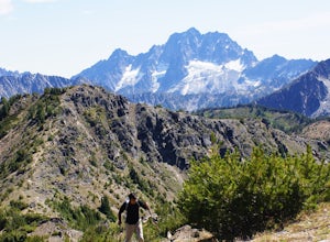
12 mi / 4800 ft gainMost adventurers travel down Icicle Creek Road to visit Colchuck Lake and the Enchantment Basin. But, if you're looking for an adventure for a cool summer morning without the crowds, continue past the Colchuck/Stuart forest road and explore this trail! Expansive views of the entire Stuart range...Read more -
Cle Elum, Washington
Wenatchee Crest Trail
6.53 mi / 712 ft gainWenatchee Crest Trail is an out-and-back trail that provides a good opportunity to view wildlife located near Cashmere, Washington.Read more -
Leavenworth, Washington
Backpack to Lake Caroline in the Enchantments
5.75 mi / 3100 ft gainFrom Leavenworth, WA head down Icicle Creek road and head to the Eightmile Lake Trailhead.The backpack starts at roughly 3270 feet of elevation and the highest point of the hike is 6300 feet. To start you will hike through a very beautiful and forested area for a while before getting into a burn ...Read more -
Leavenworth, Washington
Eightmile Lake
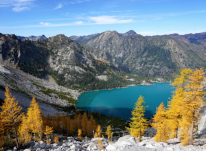
4.06.76 mi / 1496 ft gainBeginning at the trailhead, fill out a self-issued permit allowing you to stay overnight. Start your trek heading upwards at an elevation of 3300 feet. As you become adapted to the trail, you will start to realize it is maintained and well groomed. In addition, The 1300 feet of elevation gained t...Read more -
Leavenworth, Washington
Climb Cashmere Mountain
4.017 mi / 5700 ft gainTo get to Cashmere Mountain, drive east towards Leavenworth on Highway 2 and turn right on Icicle Creek Road. After 8.5 miles, turn left onto Eightmile Road for 3 miles, and park at the Eightmile Lake trailhead. The hike begins at Eightmile Lake Trail. After 2.8 miles, just past Little Eightmile ...Read more -
Leavenworth, Washington
Ski Tour the Enchantments
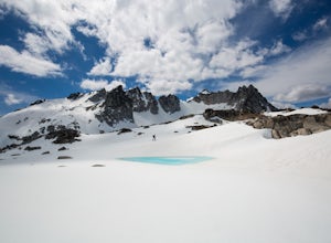
5.0The Enchantments is one of the most beautiful spots in Washington, but rarely visited outside the summer months, when access is merely difficult. But for those brave souls with the knowledge and determination to ski these hallowed slopes, the experience is surreal.The approach up Aasgard Pass is ...Read more -
Leavenworth, Washington
Colchuck Lake via Stuart Lake Trail
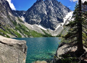
4.48.13 mi / 2156 ft gainTo reach the trailhead, turn onto Icicle Creek Road from US2. Drive 8.4 miles and turn left onto Forest Service Road 7601. Follow the potholed dirt road 3.7 miles to the Stuart Lake trailhead. Parking for about 20-30 cars and a toilet are available in the lot. Northwest Forest Pass required. The...Read more -
Leavenworth, Washington
Aasgard Pass via Stuart Lake Trail
3.511.15 mi / 4560 ft gain“These fleetingly rare sights offer a recipe for what I call ‘the Quest.’ The Quest is the force that motivates us to travel. It’s putting oneself in the perfect place at the perfect time. It’s the insatiable urge to find that quintessential moment.” - Washington AAA Journal The arrival of “gold...Read more -
Leavenworth, Washington
Climb to the Summit of Colchuck Peak
12.5 mi / 5300 ft gainGetting There: From US2 in Leavenworth, Washington, turn onto Icicle Creek Rd. Drive 8.2 miles and turn left on Forest Service Road 7601—you might be able to spot it more easily as the turnoff for the Bridge Creek Campground. In 3.7 miles, you'll arrive at the Stuart Lake Trailhead parking lot; w...Read more -
Leavenworth, Washington
Snowshoe to Colchuck Lake
3.316 mi / 3000 ft gainFrom Leavenworth, head south on Icicle Creek rd for 8.2 miles until you reach USFS rd 7601. This road isn't plowed and is blocked by a locked gate about one quarter mile from where it intersects with Icicle Creek Road (usually from November to May), so parking at the intersection is probably your...Read more -
Leavenworth, Washington
Hike to Lake Stuart
4.89 mi / 1665 ft gainBegin this hike at the Lake Stuart trailhead at the end of Eightmile road just outside of Leavenworth, Washington. The trail follows Mountaineer Creek and leads you across a log bridge over the falls. After the bridge, the trail narrows and steepens through several switchbacks. After 2.2 miles...Read more -
Leavenworth, Washington
Scramble to the Summit of Dragontail Peak
16 mi / 7000 ft gainGetting There From Leavenworth, WA, drive Icicle Creek Road for 8.5 miles until you reach Bridge Creek Campground. Turn left here onto Forest Service Road #7601 signed for the Stuart Lake Trailhead. The pavements ends and the road gains elevation quickly as your car transports you high above the ...Read more -
Leavenworth, Washington
Hike to the Enchantments' Horseshoe Lake
1.016 mi / 6000 ft gainGetting There From Leavenworth, WA, drive Icicle Creek Road for 8.5 miles until you reach Bridge Creek Campground. Turn left here onto Forest Service Road #7601 signed for the Stuart Lake Trailhead. The pavements ends and the road gains elevation quickly as your car transports you high above the ...Read more -
Leavenworth, Washington
Day Hike the Enchantments
5.018.05 mi / 4675 ft gainStart at the Stuart Lake trailhead, which at 3400' is a full 2000' higher than the Snow Lake trailhead you'll finish at. Put 2.5 easy miles under your feet along Mountaineer Creek before turning left on the trail up to Colchuck Lake. The trail steepens for the next 1.5 miles before popping you ou...Read more -
Leavenworth, Washington
The Enchantments: Stuart Lake Trailhead to Snow Lake Trailhead
5.018.02 mi / 4626 ft gainThere are a couple different ways to tackle this hike through the stunning Central Cascade region. I recommend checking out this handy resource for more detailed info. Bottom line: this is an absolutely amazing hike for people willing to take a little bit of an ass kicking. Aasgard Pass rises 1,...Read more -
Cle Elum, Washington
Backpack to Navaho Pass
12 mi / 4220 ft gainThis is a beautiful trail in the Teanaway area, located in Washington State. The trailhead starts along the Stafford Creek Trail and follows the creek for the first couple miles of the trail. There are a number of different types of wildflowers out here that make the first few miles a nice warmup...Read more

