Ellensburg, Washington
Looking for the best hiking in Ellensburg? We've got you covered with the top trails, trips, hiking, backpacking, camping and more around Ellensburg. The detailed guides, photos, and reviews are all submitted by the Outbound community.
Top Hiking Spots in and near Ellensburg
-
Leavenworth, Washington
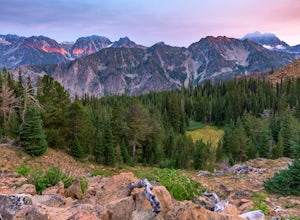
Backpack to Lake Caroline in the Enchantments
5.75 mi / 3100 ft gainFrom Leavenworth, WA head down Icicle Creek road and head to the Eightmile Lake Trailhead.The backpack starts at roughly 3270 feet of elevation and the highest point of the hike is 6300 feet. To start you will hike through a very beautiful and forested area for a while before getting into a burn ...Read more -
Leavenworth, Washington
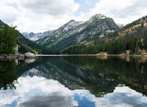
Eightmile Lake
4.06.76 mi / 1496 ft gainBeginning at the trailhead, fill out a self-issued permit allowing you to stay overnight. Start your trek heading upwards at an elevation of 3300 feet. As you become adapted to the trail, you will start to realize it is maintained and well groomed. In addition, The 1300 feet of elevation gained t...Read more -
Leavenworth, Washington
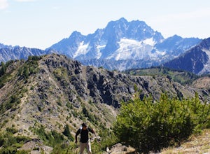
Climb Cashmere Mountain
4.017 mi / 5700 ft gainTo get to Cashmere Mountain, drive east towards Leavenworth on Highway 2 and turn right on Icicle Creek Road. After 8.5 miles, turn left onto Eightmile Road for 3 miles, and park at the Eightmile Lake trailhead. The hike begins at Eightmile Lake Trail. After 2.8 miles, just past Little Eightmile ...Read more -
Easton, Washington
Snowshoe to Amabilis Mountain
9.5 mi / 2100 ft gainTo reach Amabilis Mountain, park at the Cabin Creek Sno Park at Exit 63 off I-90. Take the overpass across the highway to the trailhead and strap on your snowshoes. There's a maze of cross-country ski trails, but you'll want to keep to the right and follow the Berg trail for a quarter mile until ...Read more -
Peshastin, Washington
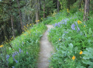
Hike Sauer’s Mountain
4.06 mi / 2000 ft gainSauer’s Mountain is one of those well defined, moderate, and rewarding hikes that give you just the right amount of views for the effort, but the real treat is catching the wildflower bloom in mid-May. The trailhead is located on private property. Start by parking along the private drive and walk...Read more -
Leavenworth, Washington
Hike Fourth of July Creek to Icicle Ridge
12 mi / 4800 ft gainMost adventurers travel down Icicle Creek Road to visit Colchuck Lake and the Enchantment Basin. But, if you're looking for an adventure for a cool summer morning without the crowds, continue past the Colchuck/Stuart forest road and explore this trail! Expansive views of the entire Stuart range...Read more -
Snoqualmie Pass, Washington
Chikamin Peak via Mineral Creek Trailhead
15.34 mi / 5771 ft gainThis is a S5 T4 scramble that involves some routefinding past the alpine lakes. We did this as a day trip and we were out and back in about 12 hours. There are multiple routes to get to Chikamin, one from the PCT, which is 24 miles RT and the other is from the Mineral Creek Trailhead (47.4176, -...Read more -
Enumclaw, Washington
Norse Peak via Silver Creek
7.77 mi / 2405 ft gainStart out in Crystal parking lot A. There is a small and steep trail that heads up the hill labeled as Silver Creek Trail. The trail follows a horse trail for the majority of the route and gets renamed Bullion Basin Trail shortly after you enter the woods, so when it doubt keep following the hoof...Read more -
Enumclaw, Washington
Hike to Greenwater Lakes
4.5 mi / 900 ft gainFollowing along the Greenwater River, family friendly Greenwater lakes Trail #1176 which has minimal elevation gain, winds through a lush green mossy old growth forest. Along the trail you will cross over several log bridges and pass a couple of beautiful waterfalls. At just under two miles int...Read more -
Enumclaw, Washington
Backpack Noble Knob via Greenwater Trail
16.9 mi / 3920 ft gainFrom Greenwater heading south: Pass the fire station to FR 70 on the left. Follow FR 70 for about nine miles to FR 7033. Take a right and follow the road to the trailhead. Northwest Forest Pass required. The trail is in good shape and mostly flat to Greenwater Lakes which is great for families a...Read more -
Snoqualmie Pass, Washington
Day Hike to Lila Lakes and Alta Pass
4.312 mi / 3000 ft gainGetting There From Seattle, drive Interstate 90 to Exit 62, Signed Kachess Lake/Stampede Pass. Turn left and head north over the interstate; you'll reach Kachess Lake Campground in five miles. Turn left where the pavements ends and drive four miles on Box Canyon Road (FS Road #4930) to the Rachel...Read more -
Snoqualmie Pass, Washington
Take a Hike Up To Rampart Lakes
5.011 mi / 2200 ft gainGetting There: From I-90 East, take exit 62. Take a left, heading over the highway. After 5.2 miles, the road veers left, passing Lake Kachess Campground. Go another 0.3 miles on the gravel road and take a right at a sign for Rachel Lake/Trail 1313. At this point, the road gets a little rough, bu...Read more -
Snoqualmie Pass, Washington
Hike Alta Mountain
4.012 mi / 3300 ft gainStart off at Trail #1313 to Rachel Lake. The first 2.5 miles is a flat, slow uphill hike till you get to a river crossing. From there, the next 1.3 miles will be a 1,000 foot elevation gain to Rachel Lake. Once you arrive, this is a good spot to rest, eat some snacks, and replenish your water sup...Read more -
Snoqualmie Pass, Washington
Snowshoe to Rachel Lake
8 mi / 2100 ft gainBegin at the Rachel Lake Trailhead and fill out the registry with your individual/group information.As you start the hike heading Northwest towards the lake itself, the trail begins to steadily climb from its initial elevation of 2500 feet. Once you cross the Alpine Lake Wilderness sign, the path...Read more -
Snoqualmie Pass, Washington
Hike to Rachel Lake
4.88 mi / 1600 ft gainThis hike is 8 miles roundtrip, with 1600 feet of elevation gain. Once you're on the trail, it starts heading uphill to help get your heart rate up on the hike. As you enter the Alpine Lakes Wilderness, the trail starts to level out. You'll cross a few streams and hike through a fair amount of ve...Read more -
Ronald, Washington
Sprite Lake via Paddy-Go-Easy Pass Trail
6.5 mi / 2923 ft gainThe Trail Begin backpacking the Paddy-Go-Easy Pass Trail (#1595) through dense spruce forests with riparian undergrowth. The trail will switchback and climb steadily across dry meadows filled with wildflowers, and you'll have increasing views westward of Mount Daniel, Mount Hinman, and Cathedral...Read more

