Edmonds, Washington
Looking for the best photography in Edmonds? We've got you covered with the top trails, trips, hiking, backpacking, camping and more around Edmonds. The detailed guides, photos, and reviews are all submitted by the Outbound community.
Top Photography Spots in and near Edmonds
-
Granite Falls, Washington
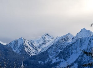
Snowshoe to Coal Lake
13 mi / 1600 ft gainhttps://www.theoutbound.com/wa...Starting out at the Deer Creek gate of Mountain Loop Highway the road is flat and uneventful for the first 2 miles or so, though it does offer some great views of the Big Four as well as a few other peaks and the babbling south fork of the Stillaguamish river. The...Read more -
Anacortes, Washington
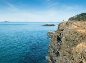
Pacific NW Trail in Deception Pass State Park
5.02.12 mi / 259 ft gainStarting from the Rosario Beach parking lot, the trail heads out past a large recreation area for families and into a wooded area leading up to Rosario Head. At this point in the trail there are beaches on either side that provide a great opportunity to explore some tidal pools. If you choose to...Read more -
Sequim, Washington
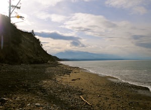
Hike Dungeness Spit
3.511 mi / 130 ft gainPark at a the north side of the Dungeness Spit Recreation Area, in the Refuge parking lot. There is a kiosk at the Refuge where you can pay an entrance fee ($3) and check the Tide Table. Only attempt the hike at low tide or the sand spit becomes narrow and you have to climb over logs.Follow the R...Read more -
Granite Falls, Washington
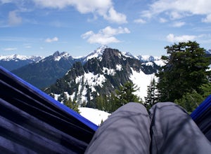
Hike to Perry Creek Falls & Mount Forgotten Meadows
11.5 mi / 3700 ft gainMost visitors park at this trailhead to hike Dickerman Mountain. Until this spring, so did I. However, don't overlook this stunning valley hike to Perry Creek, Mount Forgotten Meadows, and the scramble up Mount Forgotten!Begin this hike on the Perry Creek trail, which begins on the far left sid...Read more -
Granite Falls, Washington
Mt. Dickerman Summit
7.93 mi / 3675 ft gainIn general, this is a strenuous hike or snowshoe at approximately 8 miles round trip with nearly 4000 elevation gain. Be aware of current snow conditions and avalanche risk if heading up in the winter. Do not attempt a winter trip without proper knowledge, skill, and gear. Some previous winter tr...Read more -
Granite Falls, Washington
North Lake via Independence Lake
5.56 mi / 2431 ft gainNorth Lake is everything you could want in a subalpine lake: emerald green hues, cold, clear water, lots of brook trout and far from cell-phone reception. This backpack is perfect when the weather gets hot and sunny, though it does reside in what is known as “the wettest section of the Cascades,...Read more -
Hoodsport, Washington
Snowshoe Mt. Ellinor's Winter Route
5 mi / 4500 ft gainYou can stat this adventure at one of two trailheads. I suggest using the lower of the two. The start of the trail ascends through a forest of old growth pines with periodic views of Mt Washington. Eventually, at a fork in the trail, you will see a sign marking the start of the winter route. You ...Read more -
Hoodsport, Washington
Summit Mount Ellinor
4.83.08 mi / 2467 ft gainHikers who reach the summit of Mount Ellinor are treated to a rarer view of Olympic National Park, one that is notably more immersive, rugged and dynamic than the common vista from Hurricane Ridge. Ellinor’s profile is, no doubt, familiar to most Seattleites, as it’s the Olympics’ southernmost p...Read more -
North Bend, Washington
Summit Mt. Defiance
5.011 mi / 3300 ft gainThis hike offers some of the best views one can see in the area. On a clear day, you'll get amazing views of Mt. Rainier. The best part is that as you start heading uphill in the first half mile, you'll get great views of McClellan Butte. Once you reach the summit of Defiance at 5584 feet, you'll...Read more -
North Bend, Washington
Bandera Mountain
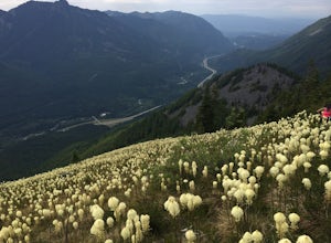
4.47.8 mi / 3176 ft gainThis hike has unreal views of Mount Rainier. On a great clear spring day, the mountain is out. It's right in your face. It's incredible. If you tackle this hike in the spring the bear grass and wildflowers are alive and blooming towards the top and it makes for some fantastic picture-taking. Once...Read more -
Granite Falls, Washington
Gothic Basin
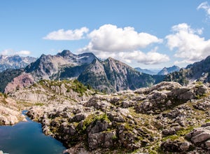
4.48.74 mi / 2785 ft gainLooking for a hike that will make you feel like you're in a foreign landscape, but don't have to deal with that far of a drive? Then consider hiking Gothic Basin. This hike is located only 30 miles down the Mountain Loop Highway, which is nearly a hour shorter for people that live in the greater ...Read more -
Granite Falls, Washington
Foggy Lake via Gothic Basin
4.59.78 mi / 3179 ft gainDrive the Mountain Loop Highway to Barlow Pass and park at the pass using your Northwest Forest Pass. (In early or late season, be aware of snow conditions at the pass and, more importantly, along the trail up to Gothic Basin.) From Barlow Pass, start hiking south past the trail gate and in the ...Read more -
Granite Falls, Washington
Climb Del Campo Peak, WA
5.0Begin by parking at Barlow Pass and following the Gothic Basin Trail to Foggy Lake. Most of the trip's mileage is consumed by just getting to Foggy Lake, from here, the summit sits about 3/4 of a mile distant and over a thousand above you.Face the mountain and identify the obvious leftward trendi...Read more -
North Bend, Washington
McClellan Butte
5.010.61 mi / 3629 ft gainStarting at the McClellan's Butte Trailhead, right off of I-90 exit 47, head out on the main (only) trail at the trailhad. The first half mile of the trail is quite easy as it meanders through the forest, but don't be fooled or worried, it will get harder. This first half mile has a crossing of a...Read more -
Snohomish County, Washington
Hike to Glacier Basin
13 mi / 2600 ft gainStart off by traveling down the Mountain Loop Highway, arriving at the Barlow Pass Trailhead. You will walk about 200ft to reach an old gated road. This road will lead you towards Monte Cristo. About 1.5 miles down the road, the road will start to turn into a trail that runs along the river. You ...Read more -
Anacortes, Washington
Hike to the Summit of Mt. Erie
4.05 mi / 900 ft gainTo start this hike, jump on trail 215 for a short distance of about a 1/4 mile. From here, continue until you cross trail 320 and head left onto it. Stay on 320 until you come across trail 230.Take 230 uphill (resembles an old fire road) toward the ravine just above a creek. From here, head onto ...Read more

