Deming, Washington
Top Spots in and near Deming
-
North Vancouver, British Columbia
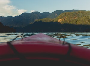
Kayak Deep Cove
4.8Only 30 minutes from downtown Vancouver, Deep Cove is a great place to paddle in tranquil ocean waters. You can rent ocean kayaks, canoes and stand-up paddle boards from Deep Cove Kayak.The bay in front of the community is one of the few in Indian Arm that has both a sheltering shape and the shal...Read more -
North Vancouver, British Columbia
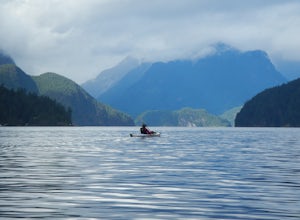
Kayak Camp Indian Arm
4.5Setting out from Deep Cove’s pebble shoreline, it only takes a few minutes before you are away from small village and paddling the calm waters of this gorgeous arm. Seals can be frequently spotted as you follow the path of off oceanfront homes, some living off the grid, deeper into the mountains....Read more -
Harrison Mills, British Columbia
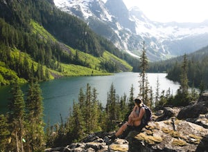
Hike to Statlu Lake
5.6 mi / 984.3 ft gainStatlu Lake is a hidden gem in the Harrison area. Start your journey at the Harrison West Forest Service Road. This road is pretty well maintained, and a piece of cake for any 4x4 vehicle but high clearance is always helpful, especially for the last bit of road up the hill to the trailhead. It wo...Read more -
North Vancouver, British Columbia
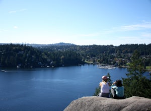
Hike Quarry Rock
3.82.4 mi / 328.1 ft gainDeep Cove is a cozy little town located at the base of Mt. Seymour, lying on the shores of the Indian Arm which is a branch of the Burrard Inlet in North Vancouver. In autumn, the tree-lined streets glow orange in the sunlight and the sailboats, kayakers and paddleboarders fill the harbour with ...Read more -
Arlington, Washington
Three Fingers Lookout
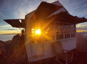
4.514.31 mi / 4357 ft gainApproximately 11 miles east of Granite Falls, WA, on the Mt. Loop Highway, turn onto Forest Service road 41 and follow this road for 18.0 miles to the trailhead. The road is quite rough and it is recommended you have a four-wheel drive vehicle. There is a washout about halfway along the road, an...Read more -
Hope, British Columbia
Hike to Flood Falls, British Columbia
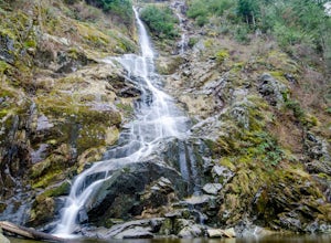
5.00.6 mi / 262.5 ft gainYou can see the waterfall up high cascading down to the ground from where you park. Once you get to the trailhead and park on the side of the road, follow the trail toward the waterfall. The trail is a bit rough in spots with lots of roots, so be careful where you step. On the way to the falls, t...Read more -
Coupeville, Washington
Hike Ebey's Landing
4.5Just walk straight past the restroom to find the start of the trail route. The Bluff trail heads up a set of stairs to the top of the hillside on the right. After climbing the stairs, you come right up on farmland (Ebey's Prairie), with a grassy two-track trail leading up toward the top of the bl...Read more -
Rockport, Washington
Sourdough Mountain Trail
5.09.34 mi / 5046 ft gainGoing east from Newhalem on highway 20, turn off towards the small town of Diablo. There are signs from there on where to park. This hike is very difficult. It is very steep and gains elevation very quickly and right from the start. Once you get above tree line though you are greeted with great ...Read more -
Rockport, Washington
Hike to Pyramid Lake
2.1 mi / 1500 ft gainDay hike with moderate elevation gain, 2.1 miles one way. You will be going up, up, up until you get to the top where you will find the lake. Take your time going up - take breaks and stop to check out the forest around you. There were a few times where we found it difficult to follow the trail (...Read more -
North Vancouver, British Columbia
Hike Mount Seymour to First Peak
4.0The elevation gain to first peak is approximately 451m and is about 9km.There are several ways to get to the top, each trail is marked well. One way is to follow the ski run up to brockton point and then take the turn off to Mount Seymour. Do not follow the Elsay Lake trail as it's signifciantly ...Read more -
North Vancouver, British Columbia
Hike and Camp on Mt. Seymour
From the end of the parking lot next to the BC Parks sign board, walk towards the ski run and follow it uphill to a green sign on the left. The first trail goes to Dog Mountain, another scenic and shorter hike then Mount Seymour. Instead, follow the trail that heads uphill and parallel to the ski...Read more -
North Vancouver, British Columbia
Snowshoe Mt. Seymour
4.55.5 mi / 1476 ft gainThis trip is best done in a 3-5 hour window. The trail meanders up past several peaks until you reach the summit and a panoramic view of Vancouver and the mountains.Start at the Mount Seymour Parking Lot, walk uphill and follow the trail to the left of the ski hill until you get to the the trail ...Read more -
North Vancouver, British Columbia
Snowshoe Dog Mountain
2.7 mi / 328.1 ft gainA perfect way to get outside before or after work. Dog mountain is an easily accessible snowshoe trail that takes you up to the short peak from the Mt. Seymour parking lot. This is a perfect spot for sunrise or sunset photography, and you can catch great 360 views from the top. Start at the BC Pa...Read more -
North Vancouver, British Columbia
Hike Dog Mountain, BC
4.23.1 mi / 150 ft gainThe trail begins in the furthest northwest corner of the parking lot, by a big trail map. The start of the trail is gradual and meanders through the forest. The trail then begins to become more technical and requires scrambling over rocks and up areas with roots. Although this hike has minimal ga...Read more -
North Vancouver, British Columbia
Hike to Mystery Lake
4.03.1 mi / 492.1 ft gainFrom the Mt. Seymour ski area parking lot, head towards the Mystery Peak Express. Once you have passed the base of the Mystery Peak Express, you will continue up the trail to your left (right goes to dog mountain, straight to the 3 peaks of Seymour). Follow the trail all the way up to the lake. T...Read more

