Carnation, Washington
Looking for the best backpacking in Carnation? We've got you covered with the top trails, trips, hiking, backpacking, camping and more around Carnation. The detailed guides, photos, and reviews are all submitted by the Outbound community.
Top Backpacking Spots in and near Carnation
-
Snoqualmie Pass, Washington
Hike Alta Mountain
4.012 mi / 3300 ft gainStart off at Trail #1313 to Rachel Lake. The first 2.5 miles is a flat, slow uphill hike till you get to a river crossing. From there, the next 1.3 miles will be a 1,000 foot elevation gain to Rachel Lake. Once you arrive, this is a good spot to rest, eat some snacks, and replenish your water sup...Read more -
Granite Falls, Washington
Gothic Basin
4.48.74 mi / 2785 ft gainLooking for a hike that will make you feel like you're in a foreign landscape, but don't have to deal with that far of a drive? Then consider hiking Gothic Basin. This hike is located only 30 miles down the Mountain Loop Highway, which is nearly a hour shorter for people that live in the greater ...Read more -
Granite Falls, Washington
Foggy Lake via Gothic Basin
4.59.78 mi / 3179 ft gainDrive the Mountain Loop Highway to Barlow Pass and park at the pass using your Northwest Forest Pass. (In early or late season, be aware of snow conditions at the pass and, more importantly, along the trail up to Gothic Basin.) From Barlow Pass, start hiking south past the trail gate and in the ...Read more -
Granite Falls, Washington
Mt. Dickerman Summit
7.93 mi / 3675 ft gainIn general, this is a strenuous hike or snowshoe at approximately 8 miles round trip with nearly 4000 elevation gain. Be aware of current snow conditions and avalanche risk if heading up in the winter. Do not attempt a winter trip without proper knowledge, skill, and gear. Some previous winter tr...Read more -
Darrington, Washington
Camp at Goat Lake
4.310.4 mi / 1400 ft gainIf you just loved your day hike to Goat Lake so much that you want to return and spend some more time, you're in luck - the lake offers a camping area that holds at least 15 campsites and even comes with a pit latrine. This is a great overnight option if you aren't looking for a difficult hike in...Read more -
Snoqualmie Pass, Washington
Spectacle Lake via Pete Lake Trail
5.018.91 mi / 3058 ft gainDepending on when you arrive at the Pete Lake Trailhead, expect to be traveling with company as it is one of the more popular locations on the eastside of Snoqualmie Pass. At an elevation of 2600 feet, the beginning route is a moderate 400 feet of elevation gain. Start on your way through the va...Read more -
Granite Falls, Washington
North Lake via Independence Lake
5.56 mi / 2431 ft gainNorth Lake is everything you could want in a subalpine lake: emerald green hues, cold, clear water, lots of brook trout and far from cell-phone reception. This backpack is perfect when the weather gets hot and sunny, though it does reside in what is known as “the wettest section of the Cascades,...Read more -
Skykomish, Washington
Pacific Crest Trail's Section J: Stevens Pass to Snoqualmie Pass
70.27 mi / 14911 ft gainThis is the Section J hike of the Pacific Crest Trail between Stevens and Snoqualmie Pass. It is about a 70 mile hike, and I started near Stevens Pass heading South. The PCT starts at the Stevens Pass Ski Resort off of Highway 2. The trail starts out under chairlifts and through ski runs – I chos...Read more -
Arlington, Washington
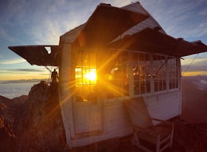
Three Fingers Lookout
4.514.31 mi / 4357 ft gainApproximately 11 miles east of Granite Falls, WA, on the Mt. Loop Highway, turn onto Forest Service road 41 and follow this road for 18.0 miles to the trailhead. The road is quite rough and it is recommended you have a four-wheel drive vehicle. There is a washout about halfway along the road, an...Read more -
Ronald, Washington
Winter Backpack to Jade Lake
4.022 mi / 4000 ft gainStarting at the Hyas Lake trailhead north of Cle Elum, it's a meandering easy hike through the woods for about 5.0 miles up to Deception Pass. You gain 1100 feet through this first five miles to the junction with the PCT. From here take a left to continue on the Lake Clarice Trail towards Marmot...Read more -
Ronald, Washington
Hike to Dip Top Gap
25 mi / 5000 ft gainThis is a great side trip from Backpacking to Marmot & Jade Lakes. Check out the Adventure linked above for directions on how to get as far as Jade Lake. I would recommend 2 nights at either Marmot or Jade to allow for a full day of exploration from your camp. From Jade what is described be...Read more -
Ronald, Washington
Backpack to Circle Lake, Alpine Lakes Wilderness
16 mi / 2800 ft gainStart at the Cathedral Rock Trailhead and start to head up the long switchbacks. After running into the Trail Creek trail, keep right heading towards Cathedral Rock and Squaw Lake. There are a couple nice spots around Squaw Lake, about 2.5 miles in, to stop and have a snack. Now head around the l...Read more -
Ronald, Washington
Climb Mt. Daniel via the Southeast Ridge
5.016 mi / 6000 ft gainFar from the iconic skyline of Seattle, on King County's Eastern boundary, is a lesser known natural skyscraper named Mt. Daniel. At 7960 feet plus, Mt. Daniel's true summit effortlessly juts into the sky as King County's tallest point.From Roslyn, head North for roughly 15 miles on Salmon La Sac...Read more -
Ronald, Washington
Marmot and Jade Lakes via Deception Pass Trail
5.020.29 mi / 4370 ft gainThe road in is passable with basically any vehicle, though there are some potholes to be avoided. Start at the Deception Pass Trailhead near the parking lot. There is a quick and easy 4.5 miles as you pass Hyas Lake, then you start climbing up to the trail junction for Tuck and Robin Lakes and th...Read more -
Ronald, Washington
Tuck and Robin Lakes
4.313.94 mi / 4199 ft gainRobin Lakes have been coined "The Little Enchantments", and once you visit, you'll realize the nickname is strikingly accurate. But while the hike up is no Aasgard Pass, it's far from a walk in the park. When you leave the car at the end of the pothole-ridden Salmon La Sac forest service road, y...Read more -
Skykomish, Washington
Hike to Josephine Lake
10.4 mi / 2100 ft gainStarting in the parking lot at Steven's Pass Ski Resort (roughly 4,062 feet in elevation; I recommend parking in E lot), start by walking between the two main lodges towards the ski lifts. You'll see a trail on the northwest-facing slope that switches back across the mountain - this is the PCT. O...Read more

