Brinnon, Washington
Top Spots in and near Brinnon
-
Port Angeles, Washington
Olympic National Park Foothills Trail
6.23 mi / 1772 ft gainOlympic National Park Foothills Trail is an out-and-back trail where you may see beautiful wildflowers located near Port Angeles, Washington.Read more -
Port Angeles, Washington
Humes Ranch and Goblin Gates
6.4 mi / 994 ft gainThe Elwha River Trail cuts south into the heart of Olympic National Park along a densely forested valley, following the same route taken by some of the earliest explorers of the Olympic Peninsula at the end of the 19th century. Past Port Angeles, at a hard curve in US-101, take Olympic Hot Sprin...Read more -
Port Angeles, Washington
Wolf Creek Trail
8.12 mi / 3970 ft gainTo tackle the Wolf Creek Trail, you start by winding up Whiskey Bend Road just outside of Port Angeles, falling the curves and hills of Elwha River. The peaks of the Olympic Mountains stand in the distance.Once you approach a clearing and small parking area, you grab the gear and hit the trail. T...Read more -
Bellevue, Washington
Coal Creek Trail
4.05.55 mi / 545 ft gainThis trail takes you through Coal Creek park and follows the creek along the trail with minimal elevation gain. This trail can also be accessed from the northern end of the park if that's a more convenient drive. For the lower parking lot, park at the Red Town lot (exit 13 off I-90) and cross the...Read more -
Bellevue, Washington
Coal Creek Falls via Red Town Trailhead
3.02.29 mi / 518 ft gainThe popular trailhead is located in the Cougar Mountain Regional Wildlife Park. There is a veritable maze of trails and trailheads here so it is helpful to bring along a map of the area. A trail map for Cougar Mountain can be found on kingcounty.gov. From the trailhead veer left following the Re...Read more -
Bellevue, Washington
Anti-Aircraft Peak Loop
4.53.53 mi / 436 ft gainHead up the road about .75 miles and take a left onto the Klondike Swamp Trail (well-singed). Stay on Klondike for a mile before taking a left onto Lost Beagle Trail. From here the trail climbs uphill and wraps around the edge of the park, offering views of the surrounding area. Hop on Shangri-La...Read more -
Port Angeles, Washington
Peabody Creek Trail
5.05.1 mi / 948 ft gainPeabody Creek Trail is an out-and-back trail that takes you by a river located near Port Angeles, Washington.Read more -
Port Angeles, Washington
Swim in the Elwha River
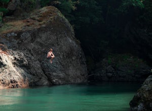
Tucked away in the trees along Olympic Hot Springs Road, the Elwha River slows to a crawl and forms a perfect natural swimming hole. It is a great place to cool off, picnic, and enjoy the beautiful forest surrounding the Elwha River. The river's water is crystal clear and a vivid blue-green co...Read more -
Renton, Washington
Far County Falls via Licorice Fern Trail
4.24.25 mi / 801 ft gainFrom Seattle, take the I-90 E to exit 15. Make a right on 17th Ave. This street will later become Renton/Issaquah Rd. Drive about four miles then turn right on to May Valley Rd. Make a sharp right onto SE 112th St. This street will soon turn into 169th Ave SE as it turns left. The trailhead is ri...Read more -
Port Angeles, Washington
West Elwha River Trail
5.06.11 mi / 1198 ft gainWest Elwha River Trail is an out-and-back trail that takes you by a river located near Port Angeles, Washington.Read more -
Coupeville, Washington
Hike Ebey's Landing
4.5Just walk straight past the restroom to find the start of the trail route. The Bluff trail heads up a set of stairs to the top of the hillside on the right. After climbing the stairs, you come right up on farmland (Ebey's Prairie), with a grassy two-track trail leading up toward the top of the bl...Read more -
Port Angeles, Washington
Olympic Hot Springs
3.721.52 mi / 3556 ft gainA local favorite, this moderate day hike winds its way uphill from the Appleton Pass trailhead through old growth stands of fir, hemlock and cedar for 2.2 miles to a cluster of hot springs interspersed among the trees. Note: This route is now closed due to a washed out road. The current route is ...Read more -
Port Angeles, Washington
Madison Falls
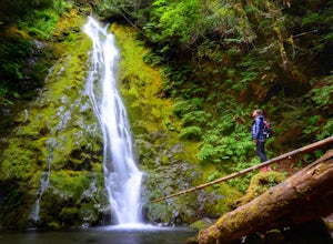
4.00.16 mi / 98 ft gainMadison Falls is at the end of a 200 foot paved pathway. It is approximately 60 feet tall and lingers in the midst of incredible lush forest. Enjoy it from a viewing point of up close and personal where you can see the greenest of moss growing up along the rocks.Read more -
Woodinville, Washington
Woodland Plateau and Lloyd Trail Loop
5.02.63 mi / 276 ft gainWoodland Plateau and Lloyd Trail Loop is a loop trail where you may see local wildlife located near Woodinville, Washington.Read more -
Amanda Park, Washington
Walk along the Maple Glade Rain Forest Trail
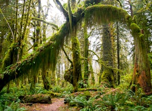
0.49 mi / 56 ft gainThe Quinault Valley receives an average of 12 feet of rain per year which maintains the temperate rain forest ecosystem. The Quinault Rain Forest is located within the Olympic National Park and is located on the N. Shore Road about 6 miles off of HWY 101. Once you arrive to the ranger station y...Read more -
Port Angeles, Washington
Run Ediz Hook "The Spit"
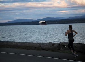
4.73 mi / 0 ft gainEdiz Hook or as locals call it, "the Spit" is a 3 mile long sand spit that extends out from Port Angeles along the Juan De Fuca. The views of the surrounding mountains and Vancouver Island, the marine life, beaches, and picnic areas make this a prime spot for a memorable run. We parked at the lo...Read more

