Arlington, Washington
Looking for the best backpacking in Arlington? We've got you covered with the top trails, trips, hiking, backpacking, camping and more around Arlington. The detailed guides, photos, and reviews are all submitted by the Outbound community.
Top Backpacking Spots in and near Arlington
-
Concrete, Washington
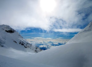
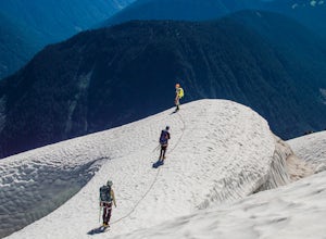
Climb Mt. Baker via Squak Glacier
10 mi / 7500 ft gainNOTE: THIS ROUTE REQUIRES GLACIER TRAVEL SKILLSMt Baker, or Kulshan, is a remarkable mountain in northwest Washington. Whether you're in Anacortes, Bellingham, Vancouver or on the San Juan Islands you can see Mt Baker standing as a citadel over the Northwest. Unlike the more popular routes like t...Read more -
Darrington, Washington
Climb Sloan Peak via the Corkscrew Route
5.014 mi / 6035 ft gainYou'll start the approach to this climb at the Sloan Peak trailhead at 1800ft elevation. Moving south along the trail, you'll begin with a traverse through some marshlands and several water crossings along the Sauk River and its tributaries for the first mile and before gaining any elevation. It ...Read more -
Darrington, Washington
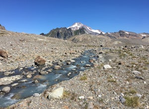
Backpack to Glacier Peak Meadows and White Chuck Glacier
34 mi / 9000 ft gainStarting at the North Fork Sauk Trailhead (NFD 49) off the Mountain Loop Highway, you will travel 5.3 miles and gain a leisurely 1,100 feet of elevation until you reach Mackinaw Shelter. This is where the real work begins. The trail gains a calf-burning 3,000 feet in the next 2.9 miles until you ...Read more -
Concrete, Washington
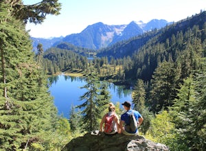
Anderson and Watson Lake
5.68 mi / 1165 ft gainThe drive up to the starting point of the trail to Anderson and Watson Lake was easy, but at the end it gets a little tricky - the service road is sharp gravel and runs for about 10 miles to the trailhead. Some spots are steep and there are large potholes, but slow and steady wins the race. There...Read more -
Gold Bar, Washington
Barclay Lake
4.44.4 mi / 607 ft gainWith less than 500 feet of total elevation and 4.4 miles of round trip hiking, the Barclay Lake trail is a perfect hike for beginners, families, or those looking for a quick morning or afternoon jaunt. Yet dont let the simplicity of the hike fool you. The end result of the hike is nothing short o...Read more -
Gold Bar, Washington
Winter Backpack to Blanca Lake
7.5 mi / 3300 ft gainSince Blanca Lake is a very popular place for folks to explore and with the nice and sunny weekend. I drove out Friday night and slept in my Jeep. Got up at 7:30am when folks first started arriving to the trail head.A couple of things to keep in mind before you start this hike. The 7.5 miles ro...Read more -
Marblemount, Washington
Lookout Mountain Trail
5.09.06 mi / 4610 ft gainBeginning about 7 miles down the Cascade River Road from Marblemount, the Lookout Mountain Lookout trailhead is on the north side of the road with parking for about 4-5 cars. With about 4500' elevation gain in 4.7 miles, this hike is definitely a thigh burner. The trail begins with a steep climb...Read more -
Marblemount, Washington
Hidden Lake Lookout
4.97.39 mi / 3415 ft gainBe careful when heading up this 4.5 mile trail since there can be snow coverage into the summer. When you start the trail, you'll get a little tree coverage as you start climbing up. Unfortunately, the shade starts to dissipate after about a mile, where you'll cross over Sibley Creek and enter th...Read more -
Leavenworth, Washington
Evergreen Mountain Lookout
4.52.88 mi / 1522 ft gainThis is a relatively short hike, at only 2.6 miles round trip, that takes you up to the nearly 5600 foot summit. The hike may be short but it is extremely steep, gaining 1300ft in the 1.3 miles to the summit, so be prepared for a good leg workout. On the way to the top you will walk through field...Read more -
Brinnon, Washington
Hike Lower Big Quilcene River
13 mi / 1800 ft gainWhile this hike does not provide any sort of fantastic views, its does provide an easy ~13 mile roundtrip hike from the trailhead to a parking lot for the Upper Big Quilcene Trail which leads to Marmot Pass. Along the way you will cross several bridges, some large and wide, other simple log bridg...Read more -
Marblemount, Washington
Winter ascent of Trappers Peak
9.78 mi / 3448 ft gainNorth Cascade National Park is home to some of the most rugged and remote mountains in the lower 48 states. Because of this, the area is rarely seen up close and personal in the winter, but there are a few spots where you can see these wild mountains that will defy all imagination. In terms of lo...Read more -
Marblemount, Washington
Thornton Lakes & Trappers Peak
3.710.57 mi / 3885 ft gainTo get to your campground or to Trappers Peak, hike roughly five miles along the trail to ridge, where the trail divides. If you head left you'll go down into lake basis where you can drop your gear. Come back to the divide and head right, which will lead you up to trappers peak. Something to ke...Read more -
Deming, Washington
Hike Skyline Divide
5.09 mi / 2500 ft gainIf driving 13 miles on a forest road, and hiking miles of switchbacks doesn't bother you, your in for one of the most exquisite views that you can get from hiking in Washington state.Just a mile outside of the town of Glacier, turn onto Forest Road 37 and follow it up switchbacks for the majority...Read more -
Deming, Washington
Hiking the Kulshan Ridge
This hike starts out at Artist Point, where already you can see jaw-dropping scenery of Mt. Shuksan, Baker, Coleman, and many other peaks of the North Cascades. No matter what time of year you visit, you are bound to get unbelievable views and photos.Artist Point is the furthest destination along...Read more -
Deming, Washington
Hike to Table Mountain via Artist Point
5.03 mi / 560 ft gainThe hike takes off from the Artist Point parking lot at an elevation of 5,220 feett.The trail slowly meanders up for a while until reaching the final steep switchbacks where you'll have a sheer cliff to your side—don't let it distract you, and keep focused on the trail in front of you!Once you've...Read more -
Deming, Washington
Lake Ann and Lower Curtiss Glacier
5.011.67 mi / 3241 ft gainThe trail begins just below Artist Point and is well marked from a paved parking lot. Make sure to have a Northwest Forest Pass for your vehicle. Start your hike by descending on switchbacks through sub-alpine forest. It's a nice start, but remember, that means an uphill hike out. After entering...Read more

