Quicksburg, Virginia
Looking for the best hiking in Quicksburg? We've got you covered with the top trails, trips, hiking, backpacking, camping and more around Quicksburg. The detailed guides, photos, and reviews are all submitted by the Outbound community.
Top Hiking Spots in and near Quicksburg
-
Rileyville, Virginia
Backpack Jeremy's Run Trail, Shenandoah NP
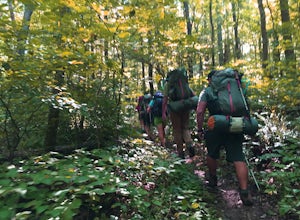
3.310 miThis hike is best done as a two-day, one-night backpacking trip, however it can be done as a day hike if you don't wish to backpack.Jeremy’s Run is a beautifully forested 10 mile roundtrip hike with numerous stream-crossing. The trailhead starts at the Elkwallow Picnic area, at about mile 24 of S...Read more -
Luray, Virginia
Mary's Rock via Meadow Spring Parking Area
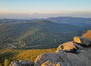
4.62.75 mi / 640 ft gainMary’s Rock is just south of the Thornton Gap Entrance in Shenandoah National Park’s Central District. This write-up details the hike from the Meadow Spring Parking area, but there are alternate routes starting from the Panorama parking area (3.7 miles round trip), Jewell Hollow Overlook (6 mile...Read more -
Luray, Virginia
Hike to Hazel Falls in Shenandoah National Park
5.05.2 mi / 100 ft gainThe trail to Hazel Falls may not be the most "wow" trail in Shenandoah but it is well worth it to reach the beautiful gorge where Hazel River falls over big boulders. You should park at the Meadow Spring parking lot at mile 33 on Skyline Drive. You will see the trail post to the right of the par...Read more -
Elkton, Virginia
Bearfence Mountain Loop
4.81.04 mi / 220 ft gainThis is one of my favorite hikes in Shenandoah National Park for its views, easy access to the trail, and the option to combine it with a much further hike on the AT. There is also a really fun little rock scramble at the top that scares a lot of people away, but makes for a more secluded summit,...Read more -
Syria, Virginia
Hike Cedar Run Falls Trail
4.72.6 mi / 1000 ft gainCedar Run Falls is located in the central district of Shenandoah National Park. This is a pretty waterfall that flows into a deep swimming hole. There are two ways to get to the Cedar Run Waterfall: from the top of the mountain off of Skyline Drive and from the bottom of the mountain off of Wea...Read more -
Syria, Virginia
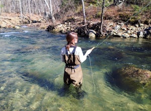
Fly Fish on the Robinson River
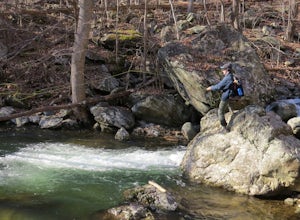
5.06 mi / 2000 ft gainThere are two sections that you can fish on the Robinson River. The first section is about 15 minutes away from the trailhead of White Oak Canyon. The river is on the right side of the road and you can see where it has bee stocked from the white diamonds on the trees on the side of the road. This...Read more -
Syria, Virginia
White Oak Canyon Cedar Run Loop
4.07.67 mi / 2257 ft gainThis route combines Cedar Run Falls and White Oak Canyon Trail (one of the more popular hikes in SNP, with separate adventures detailing those hikes). Parking is easy, but gets very crowded due to the popularity of White Oak Canyon (WOC). When starting from the parking area/Shenandoah ranger stat...Read more -
Rileyville, Virginia
Hike to Overall Run Falls
5.06.1 mi / 1700 ft gainStart at the Hogback parking lot at MP 21.1 on the Skyline Drive. Take the Appalachian Trail south for 0.8 miles, and turn right onto the Tuscarora-Overall Run Trail. After 0.5 miles you will come to another intersection-keep right to stay on the Tuscarora-Overall Run Trail. A final intersection...Read more -
Wardensville, West Virginia
White Rocks Loop, George Washington NF
4.59.26 mi / 1690 ft gainThe trail begins near the upper parking area next to a closed gate. If you park in the lower parking area, you'll have to walk about .3 miles up the road to get to this gate. Start out on the forest service (FS) orange-blazed trail, following it for about a quarter mile. From there head onto Old...Read more -
Etlan, Virginia
Old Rag Mountain Loop
4.78.95 mi / 2510 ft gainBe prepared to deal with crowds, especially on the rock scrambles, which tend to cause a bottle neck on this trail in Shenandoah National Park. I would recommend starting out early on this loop hike, around 6 or 7 am to avoid the crowds. Definitely arrive no later than 9:30am, as the parking lot ...Read more -
Etlan, Virginia
Hike to the Summit of Mt. Robertson in Shenandoah NP
9 mi / 2500 ft gainThis hike is one of the lesser known hikes in Shenandoah. While everyone else is headed to Old Rag, hikers will find themselves on a peaceful hike to the summit of Mt. Robertson. Hikers should park in the Old Rag Parking lot and make sure to pay the daily fee ($25). If you have a yearly pass, be ...Read more -
Washington, Virginia
Hike Little Devil Stairs
4.75.5 mi / 1480 ft gainThis hike starts with an immediate stream crossing -- how wet your feet get depends on the water level but bring an extra pair of socks! The first mile consists of a typical Shenandoah hike -- uphill on a dirt path and along a stream. But soon you reach the base of Little Devil Stairs. This po...Read more -
Bentonville, Virginia
Hike the Shenandoah River State Park Loop
5.08 mi / 650 ft gainShenandoah River State Park is located in the heart of the Shenandoah Valley. The park is full of well-maintained trails great for hiking and mountain biking. The trails both parallel the banks of the river as it snakes through the Shenandoah Valley and through the rolling hills, which provides...Read more -
Stanardsville, Virginia
Hike South River Falls
4.54.4 miThe trail head for the South River Falls Trail is located at mile marker 63 off of Skyline Drive via the South River Picnic Area. Loop around the picnic area until you reach the Eastern corner where you will find a sign and a map marking the beginning of the 4.2-mile trail. Over the first mile...Read more -
Madison, Virginia
Hike Bear Church Rock via the Graves Mill Trail
3.58.5 mi / 2250 ft gainStarting at the Graves Mill Parking area, head up the yellow blazed trail that is marked by a big cement marker. The trail will follow closely beside the gorgeous Rapidan River. Hike for half a mile until you come to the intersection of the Staunton River Trail. Turn left (do not cross the river)...Read more -
Madison, Virginia
Fly Fish on the Rapidan River
5.05 miPark at the Graves Mill Parking Area. From here you can easily follow the Rapidan River up the mountain. Fishing reports inform that the lowest concentration of brookies are at the lower boundaries of the park so take some time to enjoy the trail and hike up stream. At the lower boundaries you mi...Read more

