Orkney Springs, Virginia
Top Spots in and near Orkney Springs
-
Davis, West Virginia
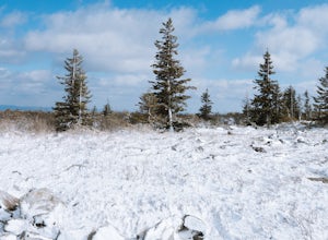
Snowshoe or Cross-Country Ski Dolly Sods
8 mi / 1400 ft gainFrom January to April, the forest roads that provide vehicle access to the Dolly Sods Wilderness in West Virginia are closed. If you're up for a cold weather adventure, park your car (in accordance with the signage and without blocking the road) and hike up the Forest Road 75 near Davis, WV, to B...Read more -
Davis, West Virginia
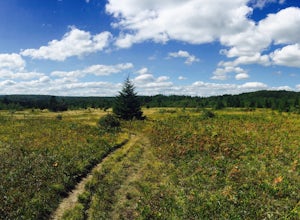
Bear Rocks and Beaver Dam Loop
6.36 mi / 699 ft gainStarting on Bear Rocks Trail, hike down to the Red Creek. Sometimes water levels can be high, but most of the time you can cross the creek without getting any deeper than your knees. Link up with the Raven Ridge Trail and head south. Enjoy the views through this section, as it's a great place to ...Read more -
Davis, West Virginia
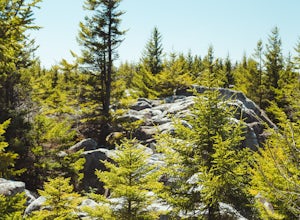
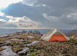
Bear Rocks Loop
4.710.54 mi / 1293 ft gainThis particular hike is great as there are multiple camping sites, both established and backcountry, and views for miles around almost every bend. Still not convinced? This high-altitude plateau has characteristics typically found in Canadian landscapes. so you can travel north without leaving y...Read more -
Maysville, West Virginia
Dolly Sods North Loop via Bear Rocks
5.011.69 mi / 1171 ft gainArguably one of the most beautiful hiking areas on the United States' east coast, the Dolly Sods Wilderness inarguably has the most unique trailhead warning sign: Watch out for unexploded ordinance in the area. (The U.S. Army used the area for artillery and mortar training during WWII.) Don't fre...Read more -
Maysville, West Virginia
Lions Head Loop
5.020.35 mi / 2195 ft gainWhat used to be an artillery testing site during WWII, Dolly Sods is a great place for backpackers of almost any expertise. Water is easily found throughout the wilderness area and while 21 miles might feel like a lot, it is very manageable over the course of 3 days. Attached (at the bottom) is...Read more -
Davis, West Virginia
Photograph Bear Rocks Preserve
5.0The Bear Rocks Preserve is a 477 acre land tract maintained and supported by The Nature Conservancy. Offering a diverse range of plant species more commonly seen in the Northeast, visitors will find blueberries, huckleberries, mountain laurel, azalea, and rhododendron among the sandstone outcrop...Read more -
Etlan, Virginia
Old Rag Mountain Loop
4.78.95 mi / 2510 ft gainBe prepared to deal with crowds, especially on the rock scrambles, which tend to cause a bottle neck on this trail in Shenandoah National Park. I would recommend starting out early on this loop hike, around 6 or 7 am to avoid the crowds. Definitely arrive no later than 9:30am, as the parking lot ...Read more -
Etlan, Virginia
Hike to the Summit of Mt. Robertson in Shenandoah NP
9 mi / 2500 ft gainThis hike is one of the lesser known hikes in Shenandoah. While everyone else is headed to Old Rag, hikers will find themselves on a peaceful hike to the summit of Mt. Robertson. Hikers should park in the Old Rag Parking lot and make sure to pay the daily fee ($25). If you have a yearly pass, be ...Read more -
Appalachian Trail, Virginia
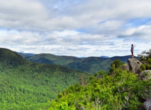
Hike North Mount Marshall in Shenandoah NP
1 mi / 350 ft gainPark at the Mount Marshall parking area at ~MP 15.6 on the Skyline Drive. From the back of the parking lot, take the white-blazed Appalachian Trail north for a short 0.4 miles to a large rock outcrop with views south. After finished exploring this outcrop, continue on the AT for another 0.1 mil...Read more -
Stanardsville, Virginia
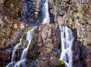
Hike South River Falls
4.54.4 miThe trail head for the South River Falls Trail is located at mile marker 63 off of Skyline Drive via the South River Picnic Area. Loop around the picnic area until you reach the Eastern corner where you will find a sign and a map marking the beginning of the 4.2-mile trail. Over the first mile...Read more -
Front Royal, Virginia
Explore Skyline Caverns
Skyline Caverns is located right off Stonewall Jackson Highway with plenty of parking. The cave tour is about 60 minutes with little walking and minimal elevation gain. If you time it right you and your friends can get the whole tour to yourselves. The backstory the tour guide gives you, is inte...Read more -
Front Royal, Virginia
Explore Skyline Drive In Winter
4.5Skyline Drive is a winding highway that cuts straight through Shenandoah National Park. Being that we are in the south, you will find that the road is closed for the majority of the winter, and usually at the very mention of snow. The first few years of living here it was incredibly frustrating...Read more -
Elkton, Virginia
Hike to Hightop Mountain, Shenandoah NP
4.53.2 mi / 900 ft gainThe parking area for the Hightop Mountain hike is one mile south of the Swift Run Gap entrance on Skyline Drive. If you’re looking to add extra mileage to your hike, you can also park at the entrance and pick up the Appalachian Trail just south of the overpass (doing so will add 1.2 miles each w...Read more -
Madison, Virginia
Hike Bear Church Rock via the Graves Mill Trail
3.58.5 mi / 2250 ft gainStarting at the Graves Mill Parking area, head up the yellow blazed trail that is marked by a big cement marker. The trail will follow closely beside the gorgeous Rapidan River. Hike for half a mile until you come to the intersection of the Staunton River Trail. Turn left (do not cross the river)...Read more -
Madison, Virginia
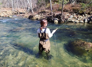
Fly Fish on the Rapidan River
5.05 miPark at the Graves Mill Parking Area. From here you can easily follow the Rapidan River up the mountain. Fishing reports inform that the lowest concentration of brookies are at the lower boundaries of the park so take some time to enjoy the trail and hike up stream. At the lower boundaries you mi...Read more -
South River, Virginia
Hike to Compton Peak
5.0This unique hike on the Appalachian Trail in Shenandoah National Park is 2.4 miles round trip with an 835' elevation gain, and leads you to two viewpoints as well as a cool rock outcrop.Access this hike from the Compton Gap parking area (elevation 2,145') on the Skyline Drive at Mile 10.4. Cross ...Read more

