Orkney Springs, Virginia
Looking for the best photography in Orkney Springs? We've got you covered with the top trails, trips, hiking, backpacking, camping and more around Orkney Springs. The detailed guides, photos, and reviews are all submitted by the Outbound community.
Top Photography Spots in and near Orkney Springs
-
Luray, Virginia
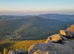
Photograph Pinnacles Overlook
5.0Pinnacles Overlook in Shenandoah National Park is a southern facing overlook in the Central District that provides one of the best views of Old Rag. Looking south over the Blue Ridge Mountains, this 3,320 foot overlook has a great view of the southern Blue Ridge Mountains as well as a valley th...Read more -
Luray, Virginia
Mary's Rock via Meadow Spring Parking Area
4.62.75 mi / 640 ft gainMary’s Rock is just south of the Thornton Gap Entrance in Shenandoah National Park’s Central District. This write-up details the hike from the Meadow Spring Parking area, but there are alternate routes starting from the Panorama parking area (3.7 miles round trip), Jewell Hollow Overlook (6 mile...Read more -
Luray, Virginia
Hike to Hazel Falls in Shenandoah National Park
5.05.2 mi / 100 ft gainThe trail to Hazel Falls may not be the most "wow" trail in Shenandoah but it is well worth it to reach the beautiful gorge where Hazel River falls over big boulders. You should park at the Meadow Spring parking lot at mile 33 on Skyline Drive. You will see the trail post to the right of the par...Read more -
Luray, Virginia
Photograph Hazel Mountain Overlook
4.0Skyline Dive runs through the heart of Shenandoah National Park. Consisting of 72 overlooks over 105 miles, Skyline Drive offers great views of the surrounding Blue Ride Mountains and valleys. Hazel Mountain Overlook is located at mile marker 33 along Skyline Drive and is one of a handful of ov...Read more -
Luray, Virginia
Photograph Buck Hollow Overlook
Buck Hollow Overlook is one of 72 beautiful overlooks that are on Skyline Drive. Skyline Dive is the road that winds through the heart of Shenandoah National Park. Over 105 miles long, Skyline Drive offers great views of the surrounding Blue Ride Mountains and valleys while simultaneously offeri...Read more -
Stanley, Virginia
Hike to Bear Church Rock via Bootens Gap
3.59.4 mi / 800 ft gainThe trail leads along the ridge of Jones Mountain to the gorgeous views at Bear Church Rock, and it's the perfect hike for those seeking solitude - didn't see another soul the entire time on a holiday weekend.From the parking lot, head out left on the AT northbound. In .4 miles you will come to a...Read more -
Elkton, Virginia
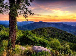
Photograph The Point Overlook
4.0The Point is the best overlook off of Skyline Drive to watch the sun set behind the Blue Ridge Mountains. The Point Overlook is one of 72 overlooks for people to enjoy the beauty of Shenandoah National Park as they drive along Skyline Drive. Skyline Drive is the road that winds through the hear...Read more -
Seneca Rocks, West Virginia
Seneca Rocks Trail
4.73.12 mi / 784 ft gainSeneca Rocks is probably one of the best known landmarks in West Virginia. This iconic formation sits 900 feet above the North Fork River. I highly recommend anyone interested in taking a trip to West Virginia take some time to visit Seneca Rocks. These rock formations are really an amazing site....Read more -
Elkton, Virginia
Bearfence Mountain Loop
4.81.04 mi / 220 ft gainThis is one of my favorite hikes in Shenandoah National Park for its views, easy access to the trail, and the option to combine it with a much further hike on the AT. There is also a really fun little rock scramble at the top that scares a lot of people away, but makes for a more secluded summit,...Read more -
Washington, Virginia
Hike Little Devil Stairs
4.75.5 mi / 1480 ft gainThis hike starts with an immediate stream crossing -- how wet your feet get depends on the water level but bring an extra pair of socks! The first mile consists of a typical Shenandoah hike -- uphill on a dirt path and along a stream. But soon you reach the base of Little Devil Stairs. This po...Read more -
Syria, Virginia
Hike Cedar Run Falls Trail
4.72.6 mi / 1000 ft gainCedar Run Falls is located in the central district of Shenandoah National Park. This is a pretty waterfall that flows into a deep swimming hole. There are two ways to get to the Cedar Run Waterfall: from the top of the mountain off of Skyline Drive and from the bottom of the mountain off of Wea...Read more -
Syria, Virginia
White Oak Canyon Cedar Run Loop
4.07.67 mi / 2257 ft gainThis route combines Cedar Run Falls and White Oak Canyon Trail (one of the more popular hikes in SNP, with separate adventures detailing those hikes). Parking is easy, but gets very crowded due to the popularity of White Oak Canyon (WOC). When starting from the parking area/Shenandoah ranger stat...Read more -
Davis, West Virginia
Camp at Red Creek Campground
5.0Beginning your hikes from the Red Creek Campground gives you plenty of good options. For day hikers there is parking at the signed trailheads and for those who want to call the Campground home for a few days the campsites are nice and spaced out so you don't feel like you're sharing your tent spa...Read more -
Bentonville, Virginia
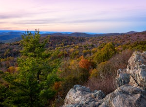
Photograph Range View Overlook
5.0Range View Overlook in Shenandoah National Park is an amazing spot to watch the sunrise and sunset where the Blue Ridge Mountains meet the rolling hills. Range View Overlook has views of Jenkins Mountain to the south, Pignet Mountain and Mary’s Rock to the southwest, and Hogback Mountain to the w...Read more -
Davis, West Virginia
Snowshoe or Cross-Country Ski Dolly Sods
8 mi / 1400 ft gainFrom January to April, the forest roads that provide vehicle access to the Dolly Sods Wilderness in West Virginia are closed. If you're up for a cold weather adventure, park your car (in accordance with the signage and without blocking the road) and hike up the Forest Road 75 near Davis, WV, to B...Read more -
Davis, West Virginia
Bear Rocks and Beaver Dam Loop
6.36 mi / 699 ft gainStarting on Bear Rocks Trail, hike down to the Red Creek. Sometimes water levels can be high, but most of the time you can cross the creek without getting any deeper than your knees. Link up with the Raven Ridge Trail and head south. Enjoy the views through this section, as it's a great place to ...Read more

