Narrows, Virginia
Top Spots in and near Narrows
-
Natural Bridge Station, Virginia
Hike Devil's Marbleyard
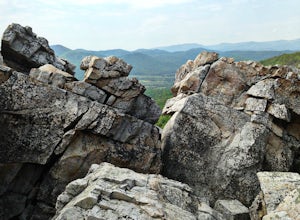
5.03.24 mi / 1421 ft gainWant to scale the side of a rock face? If you do, I highly suggest adding this adventure to your list. Hiking to the marbleyard and back to the parking lot will have you at a 3 mile journey. How many hours will it take to hike the trail and tackle Antietam Quartzite boulders larger than cars you ...Read more -
Natural Bridge Station, Virginia
Swim at Arnold Valley Pool
4.6Arnold Valley Pool might be a couple hundred feet from the road but most people don’t even notice when they pass by. This swimming hole is located on the same road as Devil’s Marbleyard and is the perfect place to cool off after the intense hike at the Marbleyard or on any hot summer day. The swi...Read more -
Ripplemead, Virginia
Hike Barney's Wall
4.68.4 mi / 1600 ft gainThis hike begins in the parking lot for Cascade Falls. Keep left at the first and second intersections to stay on the Upper Trail. At the third intersection, stay straight (don't turn right) to stay on the Conservancy Trail.Follow the Conservancy Trail for 0.4 miles, and continue on it when it br...Read more -
Ripplemead, Virginia
Cascade Falls
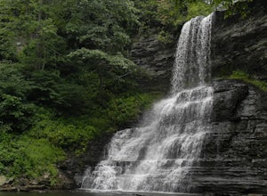
4.93.81 mi / 732 ft gainThe 66' Cascade Falls located in Giles Count is arguably one of the most beautiful waterfalls in Virginia. This classic hike is 4.0 miles and gains 800' in elevation. Located in Pembroke, Virginia, access the trail head by taking Cascade Drive (VA-623) off of US-460 and drive 3.3 miles to the p...Read more -
Dublin, Virginia
Camp at Claytor Lake State Park
4.0Claytor Lake is a very well maintained state park in Dublin, VA. There are four campgrounds available. Campgrounds A, B and C are mostly for tent camping with no electric or water hookups, while campground D accommodates RV units with water and electric hookups.Claytor Lake is idea for families l...Read more -
Willis, Virginia
Hike Buffalo Mountain
4.72 mi / 700 ft gainCOVID-19 CLOSURE: Due to Covid-19, this trail will be closed effective April 10, 2020 at 8 PM until June 24, 2020. A short 1.0 mile hike to the summit with 700’ elevation gain, the trail switchbacks steeply up to the exposed rocky summit. To the north you can see Sharp Top and Flat Top at the Pe...Read more -
Meadows of Dan, Virginia
Photograph Mabry Mill
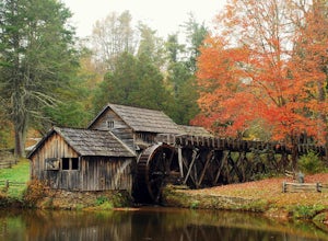
4.7Mabry Mill is one of the most photographed spots on the Blue Ridge Parkway, and rightfully so. Located at MP 176.1 the mill is beautiful in any season and easily accessed from the parking lot. Since this place is so popular, be prepared for crowds.This place is a nice " leg-stretcher" if driving ...Read more -
Big Island, Virginia
Hike to Little and Big Rocky Row
5.010.8 mi / 2700 ft gainStarting at the James River Footbridge, which is the longest foot traffic only bridge on the entire Appalachian Trail. Head north on the Appalachian Trail. You will quickly cross over Rt. 501. After a mile of hiking through the woods skirting the Rocky Row Run stream, you will cross over Forest ...Read more -
Pearisburg, Virginia
Hike Angels Rest and the Wilburn Valley Overlook
4.6For a tough hike with rewarding views, check out Angels Rest and the Wilburn Valley Overlook. Easily accessible from US-460 near Pearisburg, this hike along the Appalachian Trail gains a total of 1600’ elevation is a 4.6 mile round trip hike. Angels Rest is a large boulder that overlooks the New...Read more -
Narrows, Virginia
Rice Fields via Appalachian Trail
5.05.24 mi / 1302 ft gainThis hike begins on the Appalachian Trail just north of Pearisburg, Virginia. To get to the trail head, take Route 460 and turn on to Clendennin Road(Route 641). Take Clendennin road 1.5 miles and then turn left on to Pocahontas road. In about 300ft you will pass a cattle grate and an old barbed ...Read more -
Draper, Virginia
Bike the New River Trail
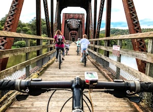
5.057 miThere are several locations to begin your trek on the New River Trail, but our favorite is the Draper Valley area. The pin on the map will take you right to the parking lot. There is a $5 state park fee and a self-pay envelope station. From here we head south, and after about a mile you catch you...Read more -
Rustburg, Virginia
Explore the Hydaway Outdoor Recreation Center
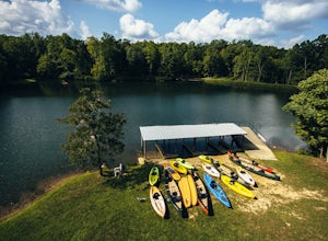
4.3If you love everything outdoors, the Hydaway Outdoor Recreation Center is the place for you! You can do almost any activity you can think of here. If you aren't affiliated with Liberty University, you can't rent their equipment, but you can bring you own to use. The main attraction is the lake wh...Read more -
Hot Springs, Virginia
Explore Falling Spring Falls in the Alleghany Highlands
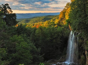
4.2Just nine miles north of I-64, this viewpoint is not one to be missed if you’re in the area. According to the information post at the overlook, “The site was once visited by [Thomas] Jefferson to survey the falls and he mentions it in his manuscripts ‘Notes on the State of Virginia’ written in 1...Read more -
Narrows, Virginia
Hike Sentinel Point and Mill Creek Falls
5.07.8 mi / 1800 ft gainThere are many trails in the area so here is a map to start out because it can get confusing:http://gilescounty.org/images2/Map-Town%20Farm-Hiking%20Trails%20%282010%29.pdf.From the parking area, keep to the left side of the stream and head up the gravel road. You'll soon come to the Mill Creek ...Read more -
James River Heritage Trail, Virginia
Run on the Seven Rails Trail
3 mi / 117 ft gainEasily accessible from the Percival's Island Natural Area parking lot, the James River Heritage Trail and adjoining Seven Rails Trail are an easy escape from downtown Lynchburg. From the parking lot, follow the trail signs toward Percival's Island, which will almost immediately take you across a...Read more -
Lexington, Virginia
House Mountain Trail
4.08.93 mi / 2733 ft gainHouse Mountain provides two amazing views via two out-and-back hikes, for a combined hike of 8.75 miles. If you’re short on energy and/or time, the 6 miles round trip to Big House Mountain is (in my opinion) the better of the two overlooks. Either way, keep in mind that this hike covers a great...Read more

