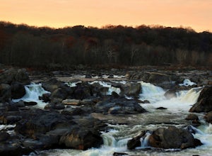
Boyce, Virginia
Looking for the best photography in Boyce? We've got you covered with the top trails, trips, hiking, backpacking, camping and more around Boyce. The detailed guides, photos, and reviews are all submitted by the Outbound community.
Top Photography Spots in and near Boyce
-
Stanley, Virginia
Lower Hawksbill to Salamander to Appalachian Trail Loop
2.68 mi / 666 ft gainThis is one of 2 trails that will take you to the summit of Hawksbill Mountain. The other is the Upper Hawksbill Trail (which I also wrote an adventure about!). This trail is a combination of the Lower Hawksbill Trail, the AT, and the Salamander Trail. The parking are area for this hike is at mi...Read more -
Syria, Virginia
White Oak Canyon Cedar Run Loop
4.07.67 mi / 2257 ft gainThis route combines Cedar Run Falls and White Oak Canyon Trail (one of the more popular hikes in SNP, with separate adventures detailing those hikes). Parking is easy, but gets very crowded due to the popularity of White Oak Canyon (WOC). When starting from the parking area/Shenandoah ranger stat...Read more -
Syria, Virginia
Hike Cedar Run Falls Trail
4.72.6 mi / 1000 ft gainCedar Run Falls is located in the central district of Shenandoah National Park. This is a pretty waterfall that flows into a deep swimming hole. There are two ways to get to the Cedar Run Waterfall: from the top of the mountain off of Skyline Drive and from the bottom of the mountain off of Wea...Read more -
Quicksburg, Virginia
Explore the Shenandoah Caverns
4.5Located west of Washington D.C. off Interstate 81 (exit 269) Shenandoah Caverns is a nice little place tucked away in the Virginia country side. Upon arrival you will be able to park your vehicle for free in the lot right across the street. The building you want to enter is called "The Yellow Bar...Read more -
Luray, Virginia
Upper Hawksbill Trail
2.09 mi / 482 ft gainThe trailhead has a small parking area at mile marker 46.7 on Skyline Drive, just past the Old Rag overlook (on the opposite side of the road) if you're driving south. The hike is a 2-mile out-and-back that takes you right to the summit. The first ~2/3 of it is relatively flat and very easy walk...Read more -
Stanley, Virginia
Photograph Spilter Knoll Overlook
5.0The Spitler Knoll is one of 72 overlooks for people to enjoy as they travel through Shenandoah National Park along Skyline Drive. Skyline Drive is the road that winds through the heart of Shenandoah National Park, starting at Front Royal in the north and ending at Rockfish Gap in the south. This...Read more -
Stanley, Virginia
Hike the Rose River Falls to Dark Hollow Falls Loop
5.04 mi / 950 ft gainParking at the trailhead is a few miles north of Big Meadows at the Fisher's Gap Overlook parking area. You will find much more solitude along this loop trail than if you were to park at the Dark Hollow Falls trailhead as the Dark Hollow Falls is much more popular. That makes being able to fin...Read more -
Stanley, Virginia
Backpack Rose River Loop
5.04 mi / 900 ft gainThe trail can be found on Skyline Drive. Though it is a little challenging to locate, you should park at Fisher’s Gap Overlook (mile marker 49.4), and then walk over across the road and find the trail. You'll spot it by looking over the side of the road and then hiking down. The Rose River Loo...Read more -
Stanley, Virginia
Hike to Rose River Falls
4.54 mi / 853 ft gainRose River Falls is often overshadowed by it's more popular cousin, Dark Hollow Falls, as both hikes begin at the same trail head. But because Dark Hollow Falls is such a short and well known hike, it can get extremely crowded. It is also one of the few trails in Shenandoah where dogs are not al...Read more -
Clifton, Virginia
Hike the Bull Run Occoquan Trail
13 miThe Bull Run Occoquan Trail is located in Fairfax County, Virginia and is 50 miles outside Washington, DC and runs along the Bull Run waterway for 6.5 miles from Bull Run Marina to Fountainhead Regional Park. The blue blazed trail undulates for a total ascent of 1,510 ft and descent of 1,526 ft, ...Read more -
McLean, Virginia
Photograph Great Falls of the Potomac
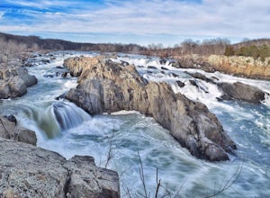
5.00.69 mi / 131 ft gainViewing Great Falls is easy which makes this adventure great for all levels of adventurers. There is a ~$10 entrance fee, there you will receive a map of the park. There are 3 platforms of viewing Great Falls, each platform has stunning panoramic views. Make sure you do not forget to bring your ...Read more -
Stanley, Virginia
Three Falls Hike
8.3 mi / 2200 ft gainThe Three Falls Hike in Shenandoah National Park will take you past three beautiful waterfalls all found within the central district of the park: Lewis Spring Falls, Dark Hollow Falls, and Rose River Falls. You are able to start the loop from any of the waterfalls’ trailheads, but I prefer to sta...Read more -
Great Falls, Virginia
Hike from Riverbend Regional Park to Great Falls National Park
5.02.5 mi / 75 ft gainThis hike utilizes the Potomac Heritage Trail from Riverbend Park to Great Falls National Park. This section is an easy, mostly flat trail that will take you along the Potomac until you reach Great Falls National Park. When you reach Riverbend Park turn right into the parking lot. At the end of t...Read more -
Stanley, Virginia
Camp at Big Meadows, Shenandoah National Park
4.4Visiting Shenandoah National Park for the first time can be quite overwhelming. The 109 mile long Skyline Drive, combined with over 500 miles of hiking trails, makes camping is a necessity if you truly want to experience Shenandoah.From the Appalachian thru-hiker to the RV'er, Big Meadows is perf...Read more -
Basye, Virginia
Orkney Springs Trail
4.94 mi / 1440 ft gainEasy to get to from Bryce resort, Orkney Springs Trail is a moderate to challenging trail. It starts with an easy trail through the woods but does get very steep in mile 2 in what seems like a very rocky dried-out river bed. There is a spectacular view around mile 2. If that's what you’re after y...Read more -
Potomac, Maryland
Great Falls and the Billy Goat Trail
4.54.61 mi / 272 ft gainJust outside of Washington DC is a great hike and rock scramble you don't want to miss. Great Falls lies in both Virginia and Maryland and has beautiful views of the Potomac River. Start out at the Great Falls Tavern parking lot (Maryland side), and keep in mind it is $10 to park here if you don...Read more

