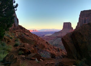
Westwater Canyon, Utah
Top Spots in and near Westwater Canyon
-
Moab, Utah
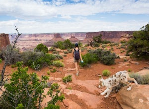
Hike the Big Horn Overlook Trail
4.03.5 mi / 0 ft gainAs a pet owner, you probably know that bringing your pooch along on your National Park adventures can be a frustrating experience. Most of our Parks do not allow pets on trails, and for several good reasons, but if you bring your dog(s) with you to Moab country, you’ll be happy to know that there...Read more -
Moab, Utah
Hike the West and East Rim Loop at Dead Horse Point
5.04.98 mi / 928 ft gainThis is a 5.5 mile loop, if you opt out of the several in/outs to various lookout points, which extend the hike to about 10 miles -- do not opt out! These lookout points get better and better. However, you can skip the only modest part of the trail, where the West and East rims of the trail meet...Read more -
Moab, Utah
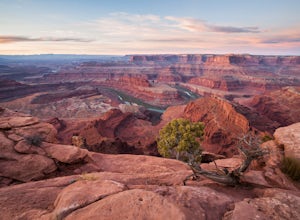
Capture Sunrise at Dead Horse Point SP
5.0Dead Horse Point State Park sits next to Canyonlands National Park with expansive views of the canyons carved by the Colorado River. The park can be accessed year-round and the best views are within feet of the parking lot. To capture the warm light of sunrise on the red rocks, head for the wes...Read more -
Palisade, Colorado
Hike Mt. Garfield in Palisade
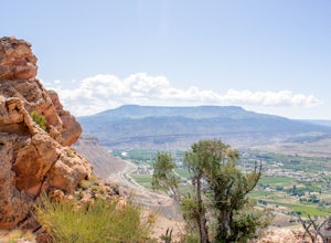
4 mi / 1940 ft gainThis hike is approx. 4 miles long and takes between 2.5-4 hours to complete depending on pace and stoppage time. This hike begins at the parking lot located at the base of the trail. Directions to Parking Lot: - Start at the Grand Junction Visitors Center, 740 Horizon Dr, Grand Junction, CO 8150...Read more -
Mesa County, Colorado
Backpack along the Gunnison River in the Dominguez-Escalante NCA
5.03.4 miIf you're looking to take your first backpacking adventure, but want something that is manageable yet thrilling, this is what you're looking for. Located along the Gunnison River in Western Colorado, the Dominguez-Escalante National Conservation area is easy to access yet full of adventure and be...Read more -
Moab, Utah
Mountain Bike Moab's White Rim Trail
5.0100 miThis trip can be done with an outfit or independently. The outfit Escape Adventures is highly recommended. They send two guides - one drives a pickup behind with all the camping gear. If you don't have the money or interest, however, it is possible to simply use panniers or a backpack to carry ev...Read more -
Moab, Utah
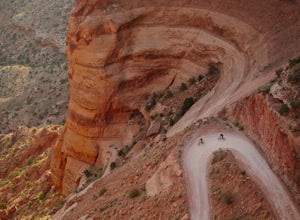
Mountain Bike the Shafer Trail in Moab
5.05 miThe best way to ride the Shafer Trail is to bring a support vehicle (one with 4WD and decently high clearance). If you're into a sufferfest, by all means climb your way out of there. You can also include it on a much, much longer ride like the White Rim Trail. But if you just want to experience t...Read more -
Moab, Utah
Hike the Neck Spring Trail
5.8 mi / 260 ft gainWith minor changes in elevation, a couple easy scrambles and the opportunity to find your route by cairns, the Neck Spring Trail is the perfect way to get acquainted with Island in the Sky area of Canyonlands National Park.Starting at the Shafer Canyon Overlook parking lot, the Neck Spring trail ...Read more -
Green River, Utah
Float the Green River through Labyrinth Canyon
5.0This trip goes 45 miles between Ruby Ranch and Mineral Bottom on the Green River in Utah north of Canyonlands National Park. Labyrinth Canyon is known for it's massive beautiful walls and oasis landscape surrounding the river. This entire section of water is flat water and can be done with no te...Read more -
Moab, Utah
Climb Wilson Arch
Wilson Arch is a common stop for people visiting the local national parks and Moab, but with some general climbing knowledge and gear you can make this into a longer outing. If coming from Moab, the arch is obvious on your left about 25 miles south. There is ample parking on both sides of the r...Read more -
Green River, Utah
Explore a Manmade Geyser in Utah
3.0Four and a half miles from the town of Green River, Utah, Crystal Geyser is one of the few manmade geysers as a result of the area's historical mining industry. This cold-water geyser usually erupts every eight to 20 hours. Getting There Getting to the geyser is easy and the site can be accessed ...Read more -
Monticello, Utah
Explore Looking Glass Arch
4.0Getting there:From Moab, follow Highway 191 south for about 23 miles until you get to Looking Glass Road/Co. Rd. 131. Take a right and follow the road for about 2 miles and then turn left into the parking lot.It is only about 0.10 miles from the parking lot to the arch itself, but there is a ~150...Read more -
Moab, Utah
Backpack the Lathrop Canyon Trail in Canyonlands
18 mi / 2130 ft gainAccess to this trailhead is a few miles south of the Islands in the Sky Visitor Center in Canyonlands National Park. An easy drive from Moab or Interstate 70. Remember to get permits and check in with the rangers if camping. If just doing a day hike then no permits are needed. REMINDER: There is ...Read more

