Tooele, Utah
Looking for the best hiking in Tooele? We've got you covered with the top trails, trips, hiking, backpacking, camping and more around Tooele. The detailed guides, photos, and reviews are all submitted by the Outbound community.
Top Hiking Spots in and near Tooele
-
Salt Lake City, Utah
Little Mountain in Emigration Canyon
4.34 mi / 440 ft gainJust off of Highway 80, head up Emigration Canyon Road to the trailhead. There is a large parking area on the opposite side of the road from the trailhead. The parking area comes equipped with a bathroom if you need one. To get started, cross the road and start heading uphill. Keep in mind that...Read more -
Salt Lake City, Utah
Hike Cardiff Fork
8 mi / 2880 ft gainCardiff Fork and Donut Falls share the same parking lot, so depending on what time of week you go exploring here, it may be the most packed parking in all of the Wasatch. Head up on a weekday for less crowds. The Cardiff Fork trailhead is follows the rocky jeep road around the parking lot to the...Read more -
Salt Lake City, Utah
Donut Falls
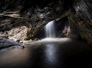
4.11.53 mi / 413 ft gainThe Trail Follow the trail for just a little bit and when it forks, stay to the left and you will arrive to Donut Falls. Once at the waterfall, climb up the rocks to get to the cave at the top, which is not visible from the bottom. To take pictures inside of the cave, you will most likely get yo...Read more -
Salt Lake City, Utah
Kessler Peak in Utah's Big Cottonwood Canyon
4.74.66 mi / 2733 ft gainKessler Peak is a 10,403-foot peak located in Big Cottonwood Canyon. From the top, you can see all the way to the Uintas to the East, The tram at Snowbird to the south, and the Salt Lake Valley to the west. To the north is Mount Raymond and Gobblers Knob. Kessler Peak is the terminus and highes...Read more -
Salt Lake City, Utah
Snowshoe to Cardiff Mine
7 mi / 1500 ft gainThe trail starts from the same trailhead as Donut Falls which is extremely popular. In the winter, the gates are closed and you need to park just off the highway. Follow the road and crowds along the trail but once you cross the bridge continue straight ahead instead of following the trail that c...Read more -
Salt Lake City, Utah
Backcountry Ski Cardiff Fork
4 miDrive up Big Cottonwood Canyon until you reach the Mill D South parking lot (aka Donut Falls parking). Head up the main road until you reach the bathrooms at the Donut Falls trailhead. Here you can either keep straight past the bathrooms, but the best way to go is to keep right along the road. Yo...Read more -
Provo, Utah
Hike the Pine Hollow Trail
4.04.4 mi / 1100 ft gainThe trailhead (Forest Trail 047 - Pine Hollow Trail) starts across the street from a turnout about .5 miles above Mutual Dell in American Fork Canyon. This highly trafficked trail is used for just about every activity you can think of, meaning that you can even snowshoe this in the winter. It's a...Read more -
Alta, Utah
Hike Mt. Superior and Monte Cristo
5.06.25 mi / 2500 ft gainMt. Superior, and its close neighbor, Monte Cristo, are two of the most iconic peaks in Little Cottonwood Canyon. Looming over Alta and Snowbird Ski resorts from the north side of the canyon, these two peaks dominate the Little Cottonwood skyline. Mt. Superior tops out at 11,132 feet, and Monte C...Read more -
Alta, Utah
Hike and Scramble Mount Superior
5.05 miThis is an intermediate to advanced hike. Scrambling up the ridge is more difficult but can be done by anyone with patience and a few maneuvering skills. It is best climbed in the summer months when the ridge is free of snow. However, it makes for a good winter climb for more technical experience...Read more -
Centerville, Utah
Hike to the Rope Swing on Deuel Creek Trail
5.02.6 mi / 646 ft gainNot only is this hike absolutely gorgeous, but it also has an epic rope swing at the end! To get to the trailhead you'll need a vehicle that can handle rough roads—you have to drive up a bit on the side of the mountain to get to the trailhead. The beginning of the hike is marked with a little bul...Read more -
Salt Lake City, Utah
Hike to Big Cottonwood Canyon's Desolation Lake
4.67.4 mi / 1900 ft gainDrive 9 miles into Big Cottonwood Canyon and park at the Mill D North Trailhead (on the left). On the right side of the road, there is a restroom. The trial head begins on the left, there is a visible sign you cannot miss before beginning.The trail is about 7.4 miles round trip, about half way t...Read more -
Salt Lake City, Utah
Hike from Mill D to Desolation Peak
10 mi / 2500 ft gainLargely runnable trail up through pines and aspens with a few steep climbs. Incredible wildflowers. You can stop at Desolation Lake then continue up towards the ridge and up to Desolation Peak. You have to listen and watch for descending bikers coming fast around corners.Read more -
Centerville, Utah
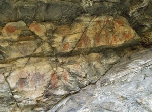
Hike to the Parrish Creek Pictographs
4.71 mi / 200 ft gainThe petroglyphs are pretty easy to find and it is such a short hike you can do it in about 45 minutes. To get to the trailhead, drive to Centerville, Utah and take 400 N all the way towards the mountain. The road with curve to the right with a small dirt road heading to the left. Take the dirt ro...Read more -
Provo, Utah
Mount Timpanogos via Timpanogos Trail #053
4.815.72 mi / 4970 ft gainThe Timpooneke trailhead is located in American Fork Canyon, next to the Timpooneke Campground. There is a $6 fee to enter the canyon, unless you have a National Park Pass with which you get in free. On the weekends, it may be difficult to find parking at the Timpooneke Campground, so arrive earl...Read more -
Provo, Utah
Timpanogos Basin via Timpooneke Trail
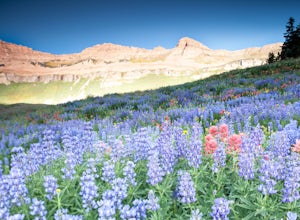
5.09.78 mi / 3015 ft gainThe wildflowers are normally at their peak from mid to end of July or the beginning of August. Depending on the amount of snow that year and how wet of a spring we had it could vary a little bit. But anytime during the mid summer you will encounter amazing Indian Paintbrush, Lupine, and other co...Read more -
Provo, Utah
Hike to Scout Falls
2.8 mi / 675 ft gainStarting at a little over 7,300 feet, the Timpooneke Trailhead offers a beautiful alpine setting for starting your hike. Several trails originate from the same parking lot so you will want to make sure you get on the correct trail. The parking lot can also get quite full on summer days as people ...Read more

