Sandy, Utah
"If you're in Utah for the mountains, Sandy is the place to be. You're only minutes from all the fun that Big and Little Cottonwood Canyons have to offer: Snowbird, Alta, Brighton, and Solitude resorts; dozens of trailheads for mountain biking and hiking; incredible limestone and granite for rock climbing. "
Top Spots in and near Sandy
-
Salt Lake City, Utah
Hike Porter Fork, Millcreek Canyon
5.06.8 mi / 3250 ft gainPorter Fork starts at the aptly named Porter Fork Trailhead about 4 miles up Millcreek Canyon. It’s actually Porter Fork Road for the first 1.5 miles of the trail. This section is a pleasant, paved path winding up through a dozen or so cabins. You’ll gain about 1,000 feet. If you make it past the...Read more -
Salt Lake City, Utah
Hike Cardiff Fork
8 mi / 2880 ft gainCardiff Fork and Donut Falls share the same parking lot, so depending on what time of week you go exploring here, it may be the most packed parking in all of the Wasatch. Head up on a weekday for less crowds. The Cardiff Fork trailhead is follows the rocky jeep road around the parking lot to the...Read more -
Salt Lake City, Utah
Trail Run Burch Hollow Trail
5.3 mi / 2412 ft gainThe Burch Hollow trailhead is about a quarter mile up the Pipeline trail in Millcreek Canyon. After hiking along the switchbacks of the Pipeline trail, you'll see a sharp turn in the trail that leads you up the side of the mountain. This turn can easily be missed so keep a good look out for it. C...Read more -
Alta, Utah
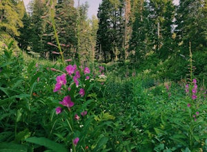
Albion Meadows Trail
4.92.86 mi / 696 ft gainAt Albion Basin, wildflowers you will see include lupine, Indian paintbrush, American bistort, sunflowers, fireweed, and many more! Drive to the very top of Little Cottonwood Canyon and park at the Albion Grill. There is a trail just behind the Grill that takes you through a variety of wildflowe...Read more -
Alta, Utah
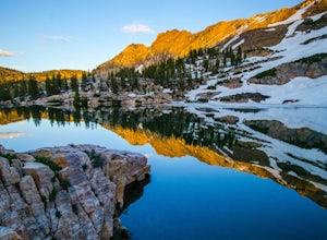
Cecret Lake from Albion Basin
4.94.48 mi / 1214 ft gainThe out-and-back trail from Albion Basin to Cecret Lake climbs a gentle slope and along the way there are interpretive signs with information about the basin, its plants, animals and geology. From the lake you can return the same way you came, or explore the area more. If you head there during t...Read more -
Salt Lake City, Utah
Hike Bowman Fork to Baker Pass
5.08.3 mi / 3375 ft gainTo get to the trailhead, drive up Millcreek Canyon about 4.5 miles until you reach the Terraces Picnic area. Turn here and drive up the small road until you reach the parking lot by the bathrooms. You'll see the Bowman Fork trailhead marker next to the parking lot. The trail climbs steadily and i...Read more -
Alta, Utah
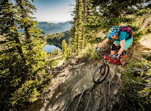
Mountain Bike Catherine's Pass
4.5 mi / 1200 ft gainThis ride isn't for the faint of heart. It's seriously tough. It's one of the most scenic and rewarding rides you'll ever do, though. The climbing is steep and the descents are rocky.Try to ride it early in the morning. Hikers frequent these trails. An early morning rip is the best way to keep fr...Read more -
Alta, Utah
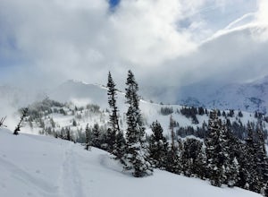
Backcountry Ski Grizzly Gulch
1.5 mi / 1400 ft gainTo get to the Grizzly Gulch trailhead, drive up Little Cottonwood until you reach Alta Ski Resort. Keep left along the road and park in the upper Alta parking lot. Head up the cat track with all the cats and snowmobiles parked to the side. About 100 yards up, you'll take a left and head up the st...Read more -
Alta, Utah
Spring Backcountry Ski Alta Ski Area
5 mi / 1800 ft gainStill have the skiing itch but it's late in the spring and the resorts have closed and the other backcountry skiing areas have melted? No problem, just head up to Alta Ski Area and get some amazing backcountry corn skiing laps in. Drive up Little Cottonwood Canyon all the way to the top and park...Read more -
Salt Lake City, Utah
Hike Jacks Mountain
4.02.4 mi / 1300 ft gainNamed for a toddler who died of Lukemia in 1995, Jacks Mountain is a beautiful place to sit above the valley and contemplate mortality. On the peak, you’ll find a couple mailboxes containing heartfelt notes from hundreds of hikers throughout the years. It’s the kind of place that restores your fa...Read more -
Salt Lake City, Utah
Hike to Big Cottonwood Canyon's Desolation Lake
4.67.4 mi / 1900 ft gainDrive 9 miles into Big Cottonwood Canyon and park at the Mill D North Trailhead (on the left). On the right side of the road, there is a restroom. The trial head begins on the left, there is a visible sign you cannot miss before beginning.The trail is about 7.4 miles round trip, about half way t...Read more -
Salt Lake City, Utah
Winter Backpack to Dog Lake and Backcountry Ski Reynolds Peak
4.55 mi / 1500 ft gainThe hike is considered moderate, but the 1500ft. elevation gain (2100ft. to Reynolds Peak) will definitely get your heart rate up. Snowshoes/skins are recommended but the trail is often packed enough to do without them.After crossing the street from the Spruces parking lot, follow the trail past...Read more -
Salt Lake City, Utah
Hike from Mill D to Desolation Peak
10 mi / 2500 ft gainLargely runnable trail up through pines and aspens with a few steep climbs. Incredible wildflowers. You can stop at Desolation Lake then continue up towards the ridge and up to Desolation Peak. You have to listen and watch for descending bikers coming fast around corners.Read more -
Salt Lake City, Utah
Hike Catherine Pass
4 mi / 1115 ft gainCatherine Pass is a must do if you are in the Salt Lake vicinity in July. The wildflowers are mind-blowing. But it’s a great hike to do in the Spring, after Alta Ski Resort has closed, and the Fall as well. It costs $6 per vehicle to drive to the trailhead, or $10 per person to ride the lift (if...Read more -
Salt Lake City, Utah
Backpack Lake Catherine and Bag Sunset Peak
3.53 mi / 1200 ft gainAny chance to get into the backcountry of the Wasatch Mountains is worth it. Many people day hike in the area, but not very many backpack in. The trail meets up with the Great Western Trail and overlooks Lake Catherine. The best place to camp is in the woods next to the lake. Hike down to the lak...Read more -
Salt Lake City, Utah
Hike Mount Wolverine
4 mi / 1425 ft gainThis mountain can be conquered two ways and is a great after-work adventure to watch the sunset, an early morning trail run, or a fun family challenge. The trail is 4 miles and 1,425 feet elevation gain (from the Alta side) or 6 miles and 2,050 feet (from the Brighton side). Both routes converge ...Read more

