Utah
Looking for the best running in Utah? We've got you covered with the top trails, trips, hiking, backpacking, camping and more around Utah. The detailed guides, photos, and reviews are all submitted by the Outbound community.
Top Running Spots in and near Utah
-
Ogden, Utah
Hike the Wheeler Creek and Icebox Canyon Loop
4 mi / 400 ft gainTo get to the trailhead from Ogden drive up Ogden Canyon toward Pine View Reservoir. Right when the canyon begins to open up and you can see the actual dam there is a turn off on the south side of the road that leads down a dirt road to a very small parking area and the trailhead. If the parking ...Read more -
Moab, Utah
Camp in Hunters Canyon
5.02 miMoab has become an increasingly popular adventure destination over the last few years. Its proximity to Arches and Canyonlands National Parks make it a popular spot for beginning day hikers as well as seasoned canyoneers, bikers, and climbers. It comes as no surprise that it can be a hassle to fi...Read more -
Salt Lake City, Utah
Kessler Peak in Utah's Big Cottonwood Canyon
4.74.66 mi / 2733 ft gainKessler Peak is a 10,403-foot peak located in Big Cottonwood Canyon. From the top, you can see all the way to the Uintas to the East, The tram at Snowbird to the south, and the Salt Lake Valley to the west. To the north is Mount Raymond and Gobblers Knob. Kessler Peak is the terminus and highes...Read more -
Salt Lake City, Utah
Hike or Trail Run Mount Van Cott
4.03 mi / 1400 ft gainThere are many different trailheads that will take you to the top of Mount Van Cott, but the main trailhead is up Red Butte Canyon. Drive up the canyon until you reach the parking lot where the canyon gate is blocking the road. After parking your car here, head up the dirt road on foot until you ...Read more -
Salt Lake City, Utah
Trail Run Upper Big Water Trail to Dog Lake
4.06.2 mi / 1267 ft gainDrive all the way to the top of Millcreek Canyon until you can't drive any further. (They close the road further down the canyon in the winter so this trail is not accessible to cars in the winter.) There is a small parking lot at the end of the road, park here. The trail head is going to be on t...Read more -
Holladay, Utah
Hike Heughs Canyon (Olympus Waterfall)
4.52 mi / 1000 ft gainHeughs Canyon starts right on the edge of Salt Lake City, but within minutes, you’re in a shady forest next to a gurgling stream. This is the prefect after-work hike that can be enjoyed year-round. Two miles round-trip and just over 1,000 feet, the path takes you to a beautiful waterfall that flo...Read more -
Dammeron Valley, Utah
Snow Canyon Overlook via Red Mountain Trail
4.74.65 mi / 525 ft gainWhile the trail to the top is mediocre, the views once you get there are absolutely stunning, making for an amazing hike. The hike begins at the Red Mountain Trailhead, north of Snow Canyon State Park. This trail is very rock and sandy, without much variety in landscape along the way. During the...Read more -
Moab, Utah
Hike the Big Horn Overlook Trail
4.03.5 mi / 0 ft gainAs a pet owner, you probably know that bringing your pooch along on your National Park adventures can be a frustrating experience. Most of our Parks do not allow pets on trails, and for several good reasons, but if you bring your dog(s) with you to Moab country, you’ll be happy to know that there...Read more -
San Juan County, Utah
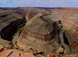
Camp at Goosenecks State Park
4.3Located near the southern border of the state, Goosenecks State Park is a small slice of Grand Canyon views in Utah. The park overlooks the meanders of the San Juan River, and canyons that have eroded over the millennia. This park is great for anyone hoping to learn about geology, get far away fr...Read more -
Salt Lake City, Utah
Hike or Run Mount Wire
3.74.5 mi / 2082 ft gainThis 4.5 out-and-back trail starts just south of the Natural History Museum at the University of Utah. Park in the museum parking lot and walk up the stairs to the Bonneville Shoreline Trail. Then head south along the BST for a few minutes until you reach a big yellow sign with 174 on it. Turn le...Read more -
Huntsville, Utah
Green Pond Loop
4.52.44 mi / 436 ft gainAbout a mile before Snowbasin, is a parking lot with a map and trail marker. The first incline is steep and follows a single track trail that leads to the ponds. This trail is great year-round, but in the winter, you may have some stray backcountry snowboarders in the area. It's pretty quiet over...Read more -
Salt Lake City, Utah
Hike Clayton Peak in Utah's Wasatch Mountains
4.03 mi / 1600 ft gainClayton Peak is approximately 1.5 miles from Guardsman Pass (3 miles round trip), and you'll gain about 1,600 feet of climbing. There is parking on top of the pass, but it fills up quickly with hikers and mountain bikers during peak season as this serves as the trailhead for Bloods Lake, Jupiter...Read more -
Moab, Utah
Camp at Sand Flats Recreation Area in Moab
3.0The rock domes and slickrock around the campsites provide fun for young and old to scramble on, or simply enjoy the sunrise or sunset. Located just outside of the town of Moab Utah is the Sand Flats Recreation Area. The area is managed jointly by the Bureau of Land Management and Grand County Uta...Read more -
Moab, Utah
Hike to Murphy Point
4.33.4 mi / 320 ft gainMurphy Point, found in the Island In The Sky district of Canyonlands NP, takes hikers on a mesa that ends at an overlook with sweeping vistas over Murphy Basin, the White Rim, and Green River. If you're looking to get away from the tourists, then head to this quiet and often overlooked trail.The ...Read more -
Salt Lake City, Utah
Hike Jacks Mountain
4.02.4 mi / 1300 ft gainNamed for a toddler who died of Lukemia in 1995, Jacks Mountain is a beautiful place to sit above the valley and contemplate mortality. On the peak, you’ll find a couple mailboxes containing heartfelt notes from hundreds of hikers throughout the years. It’s the kind of place that restores your fa...Read more -
Provo, Utah
Hike Mount Timpanogos via Aspen Grove
4.014 mi / 5140 ft gainThe Aspen Grove trail is shorter but a bit steeper than the Timpanooke Trail. This usually means that fewer people take this route, and on an extremely popular mountain like Timpanogos, that’s a good thing. The trail is 14 miles round trip with an elevation gain of 5,140 feet. The hike begins at...Read more

