Davis County, Utah
Top Spots in and near Davis County
-
Salt Lake County, Utah
Broads Fork Twin Peaks
5.08.57 mi / 4984 ft gainThe Broads Fork trailhead starts in Big Cottonwood Canyon in the same parking lot as the Lake Blanche trailhead. This trailhead is on the west side of the parking lot. The trail is marked and easy to follow for a good chunk of the way. You will come to a big basin and alpine meadow where you wil...Read more -
Salt Lake City, Utah
Hike Stairs Gulch
4.2Drive up Big Cottonwood Canyon for around 2.8 miles, parking will be along the road and there will be a large rock waterfall on the right hand side of the road. The trailhead is just a short distance from that rock fall (40.623824, -111.743208)Stairs Gulch is an easy, short hike, unless you're lo...Read more -
Salt Lake City, Utah
Hike the Mineral Fork Trail
4.09.3 mi / 3500 ft gainThe trailhead begins along Big Cottonwood Canyon Road, with a relatively small parking lot at the trailhead. Starting early in the day is advised, as on nice summer days it will fill up quickly. The trail has a steady ascent for the first 2 miles starting around 6700' through aspen forests and cr...Read more -
Salt Lake City, Utah
Backcountry Ski Mineral Fork
4.2 miMineral Fork is on the right side of the road about 5.8 miles up Big Cottonwood Canyon next to a cell tower and a giant brown Forest Service gate. There is room on the side of the road to park your car and throw your gear on. Once on the trail, you'll do a few switchbacks up the side of the mount...Read more -
Park City, Utah
Ride the RTS Trail
2.6 mi / 366 ft gainThe RTS trail at Utah's Olympic Park (ski jumping, bobsled, skeleton, and luge), is a fantastic beginner-to-intermediate trail. Since it's a short loop at only 2.6 miles and 366 feet of elevation gain, it's perfect for kids and beginners. Most of the sections are smooth dirt that winds through as...Read more -
Brighton, Utah
Hike or Trail Run Butler Fork
5.07.2 mi / 1964 ft gainTo get to the trailhead, drive up Big Cottonwood Canyon 8 miles. The parking lot is on the left side of the road. The first half mile is the steepest of the whole trail so don't get too intimidated by it, it mellows out a lot after. You will come to fork in the trail about a mile in, you can eith...Read more -
Brighton, Utah
Backcountry Ski Butler Fork
2 miThe trail head for Butler Fork is 8 miles up Big Cottonwood Canyon on the left side of the road. Throw your gear on and head up the trail. Continue along the skin track and after about 20 minutes you'll come upon a fork in the trail. The right trail will take you up the East Fork towards Butler B...Read more -
Park City, Utah
Hike, Run, Bike Rob's Trail in Park City
4.02.8 mi / 705 ft gainRob's Trail is a perennial favorite among Park City locals for year-round hiking, trail running, or mountain biking. The trail is primarily an out-and-back, but it if you go a bit further it can be combined with other trails to create a loop. The trail meanders through aspen and pine trees on the...Read more -
Salt Lake City, Utah
Hike to Big Cottonwood Canyon's Desolation Lake
4.67.4 mi / 1900 ft gainDrive 9 miles into Big Cottonwood Canyon and park at the Mill D North Trailhead (on the left). On the right side of the road, there is a restroom. The trial head begins on the left, there is a visible sign you cannot miss before beginning.The trail is about 7.4 miles round trip, about half way t...Read more -
Salt Lake City, Utah
Winter Backpack to Dog Lake and Backcountry Ski Reynolds Peak
4.55 mi / 1500 ft gainThe hike is considered moderate, but the 1500ft. elevation gain (2100ft. to Reynolds Peak) will definitely get your heart rate up. Snowshoes/skins are recommended but the trail is often packed enough to do without them.After crossing the street from the Spruces parking lot, follow the trail past...Read more -
Salt Lake City, Utah
Hike from Mill D to Desolation Peak
10 mi / 2500 ft gainLargely runnable trail up through pines and aspens with a few steep climbs. Incredible wildflowers. You can stop at Desolation Lake then continue up towards the ridge and up to Desolation Peak. You have to listen and watch for descending bikers coming fast around corners.Read more -
Salt Lake City, Utah
Hike Cardiff Fork
8 mi / 2880 ft gainCardiff Fork and Donut Falls share the same parking lot, so depending on what time of week you go exploring here, it may be the most packed parking in all of the Wasatch. Head up on a weekday for less crowds. The Cardiff Fork trailhead is follows the rocky jeep road around the parking lot to the...Read more -
Salt Lake City, Utah
Donut Falls
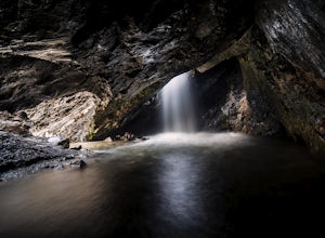
4.11.53 mi / 413 ft gainThe Trail Follow the trail for just a little bit and when it forks, stay to the left and you will arrive to Donut Falls. Once at the waterfall, climb up the rocks to get to the cave at the top, which is not visible from the bottom. To take pictures inside of the cave, you will most likely get yo...Read more -
Salt Lake City, Utah
Kessler Peak in Utah's Big Cottonwood Canyon
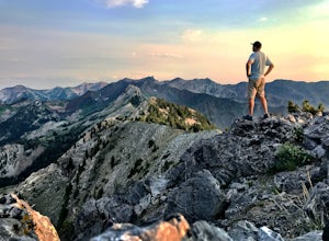
4.74.66 mi / 2733 ft gainKessler Peak is a 10,403-foot peak located in Big Cottonwood Canyon. From the top, you can see all the way to the Uintas to the East, The tram at Snowbird to the south, and the Salt Lake Valley to the west. To the north is Mount Raymond and Gobblers Knob. Kessler Peak is the terminus and highes...Read more -
Salt Lake City, Utah
Big Cottonwood Canyon Astrophotography
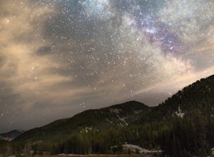
Located in the Wasatch Mountains, less 30 minutes from Salt Lake City, Big Cottonwood Canyon, provides some of the best rural dark-sky viewing of the Milky Way in the Wasatch.The Donut Falls trail head/Mill D trail head, close to the ski resorts of Brighton and Solitude, additionally provides one...Read more -
Salt Lake City, Utah
Snowshoe to Cardiff Mine
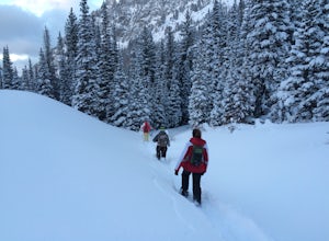
7 mi / 1500 ft gainThe trail starts from the same trailhead as Donut Falls which is extremely popular. In the winter, the gates are closed and you need to park just off the highway. Follow the road and crowds along the trail but once you cross the bridge continue straight ahead instead of following the trail that c...Read more

