Croydon, Utah
Looking for the best hiking in Croydon? We've got you covered with the top trails, trips, hiking, backpacking, camping and more around Croydon. The detailed guides, photos, and reviews are all submitted by the Outbound community.
Top Hiking Spots in and near Croydon
-
Salt Lake City, Utah
Trail Run or Hike Lambs Canyon
4.04 mi / 1531 ft gainTake I-80 East through Parley's Canyon and get off at the Lambs Canyon Exit. Stay right off the exit and start heading up the canyon. You will follow the road 1.5 miles. You will see the trail head on the right side of the road with a small area to park on the left next to the bathrooms.The trail...Read more -
Park City, Utah
Hike, Run, Bike Rob's Trail in Park City
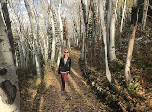
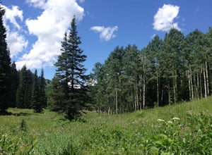
4.02.8 mi / 705 ft gainRob's Trail is a perennial favorite among Park City locals for year-round hiking, trail running, or mountain biking. The trail is primarily an out-and-back, but it if you go a bit further it can be combined with other trails to create a loop. The trail meanders through aspen and pine trees on the...Read more -
Salt Lake City, Utah
Hike or Trail Run Mount Van Cott
4.03 mi / 1400 ft gainThere are many different trailheads that will take you to the top of Mount Van Cott, but the main trailhead is up Red Butte Canyon. Drive up the canyon until you reach the parking lot where the canyon gate is blocking the road. After parking your car here, head up the dirt road on foot until you ...Read more -
Salt Lake City, Utah
Hike or Run Mount Wire
3.74.5 mi / 2082 ft gainThis 4.5 out-and-back trail starts just south of the Natural History Museum at the University of Utah. Park in the museum parking lot and walk up the stairs to the Bonneville Shoreline Trail. Then head south along the BST for a few minutes until you reach a big yellow sign with 174 on it. Turn le...Read more -
Ogden, Utah
Ben Lomond via North Skyline Trail
5.015.75 mi / 3671 ft gainThe trail starts in the Right Fork North Ogden Canyon near Liberty, Utah. Park in the main parking lot and then cross the road to the trailhead. You will see a sign at the beginning indicating that the Ben Lomond summit is 8.2 miles away. In the spring, it is quite difficult to make it all the ...Read more -
Park City, Utah
Hike Fantasy Ridge to Desolation Peak from Canyons Village
5.06.5 mi / 2000 ft gainThe easiest way to start this hiking only trail is to jump on the Red Pine Gondola at the Canyons Village of Park City Mountain Resort. If you have an Epic Pass, the lift is free. Otherwise, you'll need to buy a ticket to ride to the base of Red Pine Lodge. From the base of Red Pine Lodge (8,000...Read more -
Layton, Utah
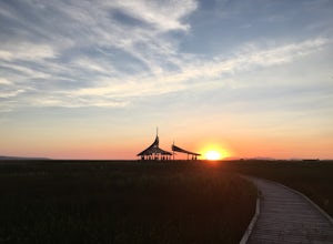
Stroll through the Great Salt Lake Shorelands Preserve
5.01 miThe wetlands of The Nature Conservancy's Great Salt Lake Shorelands Preserve are a unique system of salt and fresh water marshes, ponds, pools, sloughs and mudflats. It is a rich feeding ground for tens of thousands of migrating birds, making this destination a birder's paradise.Great for all ski...Read more -
Salt Lake City, Utah
Hike the Living Room
4.42.5 mi / 1000 ft gainBecause if its proximity to downtown Salt Lake, this is a great quick hike to do after work. Although it's short, it is fairly steep, climbing nearly 1000 feet in 1.25 miles. However, most people can do it without too much difficulty. This is a good family hike and allows dogs on leashes. Due to ...Read more -
Park City, Utah
Hike Quarry Mountain in Park City
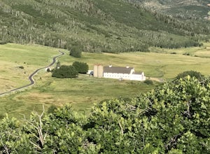
2.2 mi / 740 ft gainThe Quarry Mountain trail is a less-traveled option than the Iron Mountain trail in Park City offering unique views of McPolin Farm to the west, Kimball Junction and Old Ranch Road to the north, Park City to the south, and Promontory Ranch to the East. The trail starts at the McPolin Farm parking...Read more -
Salt Lake City, Utah
Ensign Peak
4.20.97 mi / 354 ft gainThis hike is a piece of cake with a sizable reward. It starts just up the hill behind the Capitol Building and ascends 350 feet over about 0.5 miles to the top on a very well marked trail. It's great for a family with young ones or maybe a quick post-dinner evening date. Parking is all along a re...Read more -
Salt Lake City, Utah
Hike Old Red Pine Road Trail
5.04.2 mi / 1000 ft gainThe trail begins at the parking lot at the very top of Millcreek, called Upper Big Water. The trail begins on the east side of the lot, where bathrooms are available. Walk to trail sign and head left to Old Pine Road Trail.From there, the trail remains relatively flat with some steep gains. The t...Read more -
Salt Lake City, Utah
Trail Run Upper Big Water Trail to Dog Lake
4.06.2 mi / 1267 ft gainDrive all the way to the top of Millcreek Canyon until you can't drive any further. (They close the road further down the canyon in the winter so this trail is not accessible to cars in the winter.) There is a small parking lot at the end of the road, park here. The trail head is going to be on t...Read more -
Salt Lake City, Utah
Mountain Bike Dog Lake, Millcreek Canyon
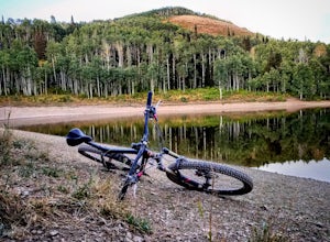
4.4 mi / 1260 ft gainIf it’s an even day and you’re in Salt Lake and you’re in possession of a mountain bike, put down your phone and spend the next 2 hours in pure bliss. Mountain bikers are only allowed to use the trails of upper Millcreek Canyon on even days, which makes for a busy route, but well worth it. This i...Read more -
Salt Lake City, Utah
Trail Run Burch Hollow Trail
5.3 mi / 2412 ft gainThe Burch Hollow trailhead is about a quarter mile up the Pipeline trail in Millcreek Canyon. After hiking along the switchbacks of the Pipeline trail, you'll see a sharp turn in the trail that leads you up the side of the mountain. This turn can easily be missed so keep a good look out for it. C...Read more -
Salt Lake City, Utah
Hike Bowman Fork to Baker Pass
5.08.3 mi / 3375 ft gainTo get to the trailhead, drive up Millcreek Canyon about 4.5 miles until you reach the Terraces Picnic area. Turn here and drive up the small road until you reach the parking lot by the bathrooms. You'll see the Bowman Fork trailhead marker next to the parking lot. The trail climbs steadily and i...Read more -
Salt Lake City, Utah
Hike Porter Fork, Millcreek Canyon
5.06.8 mi / 3250 ft gainPorter Fork starts at the aptly named Porter Fork Trailhead about 4 miles up Millcreek Canyon. It’s actually Porter Fork Road for the first 1.5 miles of the trail. This section is a pleasant, paved path winding up through a dozen or so cabins. You’ll gain about 1,000 feet. If you make it past the...Read more

