Utah
Looking for the best backpacking in Utah? We've got you covered with the top trails, trips, hiking, backpacking, camping and more around Utah. The detailed guides, photos, and reviews are all submitted by the Outbound community.
Top Backpacking Spots in and near Utah
-
Richmond, Utah
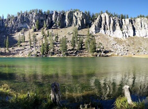
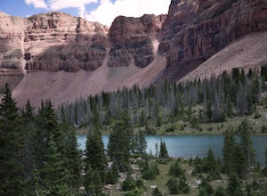
Backpack to White Pine Lake, Logan
4.57.6 mi / 1344 ft gainYou will start from the Tony Grove Lake parking lot and start hiking northeast on the White Pine Lake trailhead. The trail is roughly 3.8 miles to the lake through beautiful Quaking Aspens and Pines. The first 2.5 miles are fairly easy with a slight incline. You will then reach the top of a ridge...Read more -
Kane County, Utah
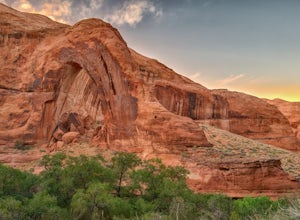
Hike to Broken Bow Arch
4.76.28 mi / 732 ft gainThe trailhead starts at the Willow Gulch Trailhead, located just off of Hole in the Rock Road in the Grand Staircase -Escalante National Monument. The coordinates for the trailhead are 37.324812,-111.023019. To get there head east on highway 12 out of Escalante, Utah until you get to Hole in the ...Read more -
Kane County, Utah
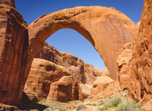
Backpack to Rainbow Bridge
5.017 mi / 2800 ft gainThis incredible trip isn't only about Rainbow Bridge. Honestly, the Bridge is just icing on the cake.The scenery is breathtaking along the way, changing and evolving as you pass through epic canyons and climb over rocky ledges to be rewarded with spanning vistas. It really is amazing. There's eve...Read more -
Duck Creek Village, Utah
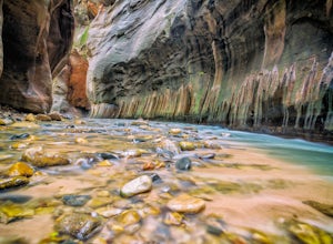
Hike The Narrows: Top Down
5.015.38 miTHE NARROWS This by far one of the most scenic and awesome hikes available in any National Park. There is no place in Zion National Park more sublime in its beauty and awe inspiring in its creation as you hike through the crystal clear Virgin River and marvel at the myriad of red, orange, yellow...Read more -
Evanston, Utah
Backpack to Dead Horse Lake
5.021 mi / 1400 ft gainDead Horse Lake is a lightly trafficked and highly scenic route in the High Uintas Wilderness. The trail is easy enough to do overnight but I recommend taking an extra day to explore the area around Dead Horse Lake. From the trailhead you will hike south on the West Fork Blacks Fork trail. The...Read more -
Pleasant Grove, Utah
Rock Climbing American Fork Canyon
4.7American Fork Canyon, UT has a rich history in outdoor activity. Little do most people know that American Fork was the birth place of steep, overhanging, sport climbing. Developed by locals, now legends, in the climbing world like Boone Speed and Jeff Pedersen amongst others. This canyon came ...Read more -
Hanna, Utah
Explore Grandaddy Basin
5.0Grandaddy Lake is the largest lake in the High Unitas. While Grandaddy Lake can have plenty of hikers, there are over twenty lakes within a two-hour hike within the Grandaddy Basin. Most hikers don’t go beyond Grandaddy lake, making the area a fantastic area to explore and camp. Elevation in the ...Read more -
Washington, Utah
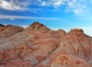
Camping at Yant Flat
5.02.6 mi / 500 ft gainThough only a few miles from civilization as a bird flies, this trailhead is only accessible via a dirt road (that can be quite bumpy - high clearance vehicles recommended though I did it in a car). Given the condition of the road, drive time can be 45 minutes from St George, Utah. The road is ...Read more -
Evanston, Utah
Backpack to Ryder Lake
4.718 mi / 2000 ft gainRyder Lake is accessed via the Stillwater Trail, beginning at the Christmas Meadows Trailhead off of Mirror Lake Highway. The trail heads due south from Christmas Meadows along the Stillwater River. It winds through lodgepole pine forests and skirts alpine meadows, gradually gaining elevation. A...Read more -
Oakley, Utah
Backpack to Cutthroat Lake
4 mi / 280 ft gainThere isn't a trail to Cutthroat Lake so for a portion of the hike will be cross-country. I highly recommend bringing a GPS but with intermediate route-finding skills you should be able to find your way. We used the Gaia GPS app and this made the hike much easier. The distance depends on the r...Read more -
New Harmony, Utah
Backpack the La Verkin Creek Trail
5.014 mi / 1200 ft gainI've visited Zion National Park twice this year and the experience between the two visitations were like night and day. Zion National Park is by no means a secret, and for good reason. Hikes such as Angels Landing, and the Narrows are locations which are sought after by every outdoorsman and novi...Read more -
Wellsville, Utah
Box Elder Peak
4.37.57 mi / 3986 ft gainFrom the Rattlesnake Trailhead (about a mile northeast of the Sherwood Hills Resort on U.S. 89) to the peak is just under 4.5 miles. The hike is great exercise, as it's relatively steep. The steep angle provides for stunning views along the entire trail, making this one of the most picturesque hi...Read more -
San Juan County, Utah
Backpack Great Gulch: Kane Gulch to Bullet Canyon
5.025 miOne of the many wonderful hidden gems in Utah (so just tell you close friends about it).Kane Gulch is located four miles south of the Highway 95/Highway 261 junction. At the Kane Gulch ranger station you will be able to use restrooms, overnight park your vehicle, pick up permits, and purchase are...Read more -
Monticello, Utah
Joint Trail in the Canyonlands Needles District
5.019.06 mi / 3028 ft gainA large part of the grandeur of Canyonlands National Park is the vast barren vista at Island in the Sky, but no visit to Canyonlands would be complete without the intimate and immersive desert experience that the Needles District offers. Drive two hours southwest of Moab away from cell phone rece...Read more -
Provo, Utah
Hike the Pine Hollow Trail
4.04.4 mi / 1100 ft gainThe trailhead (Forest Trail 047 - Pine Hollow Trail) starts across the street from a turnout about .5 miles above Mutual Dell in American Fork Canyon. This highly trafficked trail is used for just about every activity you can think of, meaning that you can even snowshoe this in the winter. It's a...Read more -
Boulder, Utah
Backpack Death Hollow in Grand Staircase-Escalante
22 mi / 1600 ft gainThe most popular route into Death Hollow is from the Boulder airstrip near the town of Boulder, Utah. The trailhead for the Boulder Mail Trail begins, or ends here depending on which way you are hiking. Leave a car at the Highway 12 bridge over the Escalante River for the thru hike, or get luck...Read more

