Alpine, Utah
Top Spots in and near Alpine
-
18899-19003 U.S. Highway 89, Utah
Visit the Flooded Thistle Ghost Town
3.0Thistle, Utah was a small community located in Spanish Fork Canyon, founded in 1883. It flourished for a time as a ranching community and eventually became a major stop on the rail line that ran through it. This all changed in 1983 when a massive landslide dammed the Spanish Fork River and floode...Read more -
Salt Lake City, Utah
Birding at Farmington Bay
5.0Every winter as the ice thaws, eagles gather at Farmington Bay to feed on huge populations of carp. This can produce a pretty amazing set of circumstances where it's not uncommon to see birds feeding just 50 yards from shore.The prime viewing opportunity happens around "Bald Eagle Day," an event ...Read more -
Kamas, Utah
Backcountry Ski Mt. Watson in the Uinta Mountains
Mt. Watson is a beauty. It is one of the tallest peaks directly outside of the High Uintas Wilderness area and has a stunning East face that is very steep and littered with cliff bands. Many people hike around Mt. Watson in the summer, when the Mirror Lake Highway is open and the trailhead is eas...Read more -
Coalville, Utah
Camp at Echo Reservoir
5.0This scenic reservoir provides you with the opportunity to spend the day on the water. To get here, drive around 45 minutes from Park City toward Coalville. Get off for the exit and take a left once in town; drive along this road until you see the campground entrance on your left.Overnight passes...Read more -
Payson, Utah
Mount Nebo via North Rim Trail
4.58.6 mi / 2897 ft gainMount Nebo is the tallest of all the mountains in the Wasatch, and also one of the easiest to hike, due to the fact that the trail begins at an elevation of ~9300 ft. The parking area for the trailhead is along a short dirt road, which is precisely marked on the location map. The trail itself is...Read more -
Croydon, Utah
Whitewater Kayaking the Weber River
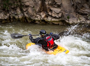
4.0This is a great beginner river for whitewater kayaking, with rapids from class II-III. It has plenty of features to keep you entertained, such as the Rock Garden, old bridges, and Taggart Falls, with several class II rapids in between. Be aware, there is a low bridge at one point in the river tha...Read more -
Layton, Utah
Adams Canyon
4.83.55 mi / 1434 ft gainThe trailhead is at a dirt parking lot with a lot of parking, but on Saturday mornings it can get full and people are forced to park on the street. As you start off, there are a few steep and sandy switchbacks. They don't last too long but on a hot day it can seem like forever. After that, the t...Read more -
Davis County, Utah
Hike Frary Peak Trail on Antelope Island
5.06.4 mi / 2030 ft gainThe Frary peak trail is the highest point of Antelope Island and can be found a short drive off of I-15 north on Antelope Drive near Layton. There is a fee to access the island, but well worth it. When you get to the island, head left along the east side of the island toward Fielding Garr Ranch. ...Read more -
Davis County, Utah
Hike the Frary Peak Trail
4.57 mi / 2050 ft gainThis is a fairly easy hike starting at the parking lot near the trailhead. You will encounter little or no obstacles on your hike, just a nice incline leading you to the highest point of the island.You will be able to see lots of buffalo roaming around most of the island on your way up. Be sure t...Read more -
Layton, Utah
Stroll through the Great Salt Lake Shorelands Preserve
5.01 miThe wetlands of The Nature Conservancy's Great Salt Lake Shorelands Preserve are a unique system of salt and fresh water marshes, ponds, pools, sloughs and mudflats. It is a rich feeding ground for tens of thousands of migrating birds, making this destination a birder's paradise.Great for all ski...Read more -
Kamas, Utah
Camp at Shallow Lake Meadow
Located 1.5 hours from Salt Lake Cityand just 1 hour from Park City this mountain meadow is a great placeto take your next adventure! Getting there was a piece of cake, theroad is mainly paved then turns to lava...I mean gravel for the lastmile. Along the road are several already established camp...Read more -
Kamas, Utah
Camp up Murdock Basin Road
4.0Murdock Basin Road is located about 22 miles up Mirror Lake Highway (UT-150) from Kamas, UT. After turning right onto Murdock Basin Rd, you'll cross a bridge over the Provo River and then it's onto the dirt road. Sites are scattered on the left and right (I suggest the left side spots) with plent...Read more -
Kamas, Utah
Hike to Island Lake
5.09 mi / 1000 ft gainThere are many lakes in this area, but Island Lake is the only one with epic cliff jumping. You can camp anywhere around the lake and campfires are permitted.The cliff is best to jump off mid summer when the water is the warmest, but it's always pretty cold. The cliffs are about 30-50 feet tall. ...Read more -
Kamas, Utah
Backpack to Island Lake
5.06 mi / 1000 ft gainYou begin at the Crystal Lake trailhead off of the Mirror Lake Highway. On the way to Island Lake you pass several other lakes including, Crystal Lake and Long Lake. The hike is not too hard but there are several switchbacks at the end to get you up above the ridge where the lake is located. It ...Read more -
Kamas, Utah
Duck Lake to Marjorie Lake Loop in the Uintas
8.4 mi / 850 ft gainThe trail to Duck Lake in the Uinta Mountains starts at the Crystal Lake Trailhead and is a popular starting off point for many trails like Cliff Lake, so the parking lot fills up quickly. Starting off, follow the signs for Long Lake. At about 1.3 miles you'll come to a junction. Follow the si...Read more -
Kamas, Utah
Ibantik Lake via Crystal Lake Trailhead
5.03.96 mi / 646 ft gainFrom the Crystal Lake trailhead, follow the trail 1.1 miles north to Wall Lake. Here, you'll come to a junction with the trail from Trail Lake; take the left trail heading north to Notch Mountain, and Ibantik Lake is a mere .6 miles northeast, nestled next to Notch Peak. At Ibantik Lake, you'll ...Read more

