Leander, Texas
Top Spots in and near Leander
-
Garfield, Texas
Hike the Southeast Metropolitan Park Primitive Trail
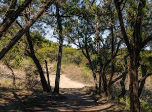
4.02.17 mi / 223 ft gainThe Southeast Metropolitan Park Primitive Trail is a quick 2.3 mile hike, perfect for families, hikers, and trail runners. This trail is dog friendly, and is open for use year round. This hike is lightly trafficked, so this is a great place to go if you are looking for some solitude.Read more -
Johnson City, Texas
Hike the Wolf Mountain Trail
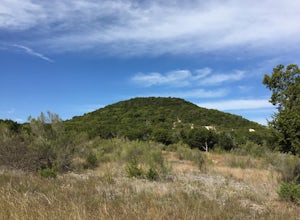
7.4 mi / 416 ft gainThe Wolf Mountain Trail is a 7.2 mile loop hike within Pedernales Falls State Park, right outside of Johnson City, Texas. The trail is pretty wide and great for all sorts of exercising and social distancing. The trail is relatively moderate and well maintained. There is little shade but it is st...Read more -
Johnson City, Texas
Hike Juniper Spring Via Wolf Mountain And Juniper Ridge
8.4 mi / 462 ft gainJuniper Spring via Wolf Mountain and Juniper Ridge is a 8.4 mile loop hike within Pedernales Falls State Park, right outside of Johnson City, Texas. This trail is moderately trafficked. The trail is pretty wide and great for all sorts of exercising and social distancing. The trail is relatively ...Read more -
Johnson City, Texas
Hike Wolf Mountain And Juniper Ridge Trail Loop
11.2 mi / 472 ft gainWolf Mountain and Juniper Ridge Trail Loop is a 11.2 mile loop hike within Pedernales Falls State Park, right outside of Johnson City, Texas. The trail is pretty wide and great for all sorts of exercising and social distancing. The trail is relatively moderate and well maintained. There is littl...Read more -
Johnson City, Texas
Hike Wolf Mountain, Juniper Ridge And South Loop Equestrian Trail
6.6 mi / 374 ft gainThe Wolf Mountain, Juniper Ridge and South Loop Equestrian Trail is a 6.6 mile loop hike within Pedernales Falls State Park, right outside of Johnson City, Texas. The trail is pretty wide and great for all sorts of exercising and social distancing. The trail is relatively moderate, with few incl...Read more -
Burnet, Texas
Tour the Longhorn Caverns
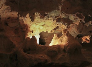
5.01.1 miThe Longhorn Cavern State Park is a hidden gem in the Hill Country. The caverns are breathtaking and some of the walls are completely covered in Quartz. During prohibition, bootleggers used the caverns as a speakeasy and there are remnants left from that era. In order to view the Caverns you must...Read more -
Burnet, Texas
Camp at Inks Lake's Pecan Flats
5.02 miInks Lake is located northwest of Austin and is home to about 200 campsites. For a more unique experience and to be set away from the parks many visitors, choose the Pecan Flats Trail Primitive Camp which is about a mile hike from the Pecan Flats trailhead.Once you enter the park, the Pecan Flats...Read more -
Burnet, Texas
Hike the Inks Lake State Park Trail
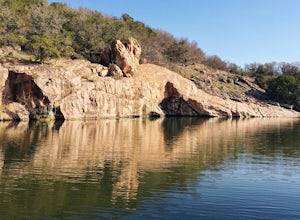
4.04.7 mi / 347 ft gainThe Inks Lake State Park Trail is a 4.7 mile loop trail located within Inks Lake State Park, just outside of Burnet, Texas. Only a small portion of the trail follows the lake, then it veers off through the rocky and hilly terrain of the Texas Hill Country. The trail is only partially shaded at ti...Read more -
Harker Heights, Texas
Dana Peak Park Loop
3.08 mi / 705 ft gainThis trail is shared by hikers, mountain bikers, horseback riders, and trail runners. The trail is open year-round, but is best travelled from October through April. Dogs are allowed on this trail but should be kept on leash. The peak offers scenic views of central Texas. You can park inside or o...Read more -
Salado, Texas
Hike the Chalk Ridge Falls Trail
3.02.5 mi / 131 ft gainThe Chalk Ridge Falls Trail can be found within Chalk Ridge Falls Park just outside of Belton, Texas. The trail features one main waterfall as well as a neat suspension bridge. The hike to the waterfall and the bridge are not but about half a mile from the parking lot. Overall the trail is about ...Read more -
Cedar Creek, Texas
Pine Ridge Overlook
4.52.95 miPine Ridge Overlook is one of the longest hikes at McKinney Roughs Nature Area offering 2.7 miles through piney woods that overlook valleys and offer glimpses of the Colorado River. McKinney Roughs is considered a nature and learning park and requires a $5 entrance fee per-person at the Visitor ...Read more -
Wimberley, Texas
Cliff Jump at Jacob's Well
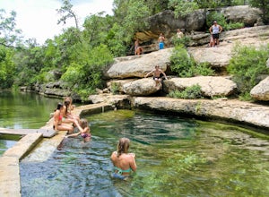
5.0Jacob's well is a 12 foot opening that goes 23 feet deep in a riverbed in central Texas and makes for an awesome spot to escape the summer heat. Once you reach the parking lot there are signs that direct you on the very shot walk to the riverbed. The underwater cave is situated below a rock face ...Read more -
Wimberley, Texas
Old Baldy Trail
0.17 mi / 92 ft gainOld Baldy Trail is a 0.2 mile out-and-back trail located between FM 2325 and FM 12 in Wimberley, Texas. The trail leads to the summit of a large hill with an overlook of the town and its surrounding area. It's a great location for a picnic or to just hang out and definitely worth the effort. Fa...Read more -
Niederwald, Texas
Explore the Five Mile Dam Park
Located about 6 miles from downtown San Marcos, the Five Mile Dam Park is a popular destination for swimming, boating, and other outdoor activities. It has a large flat field for playing soccer as well as many bathrooms. The Blanco River flows through the park and as the name implies, there is a ...Read more -
Bend, Texas
Hike to Spicewood Springs via Spicewood Canyon Trail
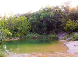
5.03.81 mi / 367 ft gainSpicewood Spring is a spring-fed swimming hole in Colorado Bend State Park and can be reached in one of two ways. There is an out and back trail that will take about 3.6 miles round trip if you just want to swim, but I prefer turning it into a scenic hike that takes you through Spicewood Canyon a...Read more -
Bastrop, Texas
Bike the Lost Pines of Bastrop
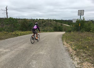
13 mi / 823 ft gainIn the fall of 2011, the most destructive fire in Texas history burned through Bastrop, just 45 minutes east of Austin, TX. This makes for an interesting, and eerie, bike ride. As you ride through the park, you can see the extent of damage the fire caused. It's also amazing to see the vegetation ...Read more

