Bastrop, Texas
Top Spots in and near Bastrop
-
San Marcos, Texas
Swim at Rio Vista Waterfall
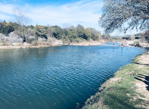
4.7Located about an hour north of San Antonio. The San Marcos River at Rio Vista Park in San Marcos, a short drive off from I-35. There are pretty trees for setting up your hammock or to have have a picnic in the shade. Rio Vista offers a small waterfall that you can slide down, flotation recommende...Read more -
Burton, Texas
Camp at Lake Somerville: Nail's Creek
Lake Somerville State Park has two portions you can visit, Nails Creek on the South side of the lake, and Birch Creek located on the North side of the lake. Both offer a variety of activities including camping, swimming, fishing, hiking, and horseback riding.Within the Nails Creek Unit you can se...Read more -
San Marcos, Texas
Hike the Ringtail Ridge Trail
4.01.93 mi / 91 ft gainThis trail is shared by hikers, trail runners, mountain bikers, and dog walkers. The trail is open for use year round, featuring beautiful wildflowers in the spring. The trail can be slightly hard to spot - a good place to park is next to a church off Old Hwy 80, and a spur trail will take you t...Read more -
San Marcos, Texas
Hike Limbo, Dante, Old West, Beatrice, And Ovid East Loop
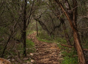
5.03 mi / 131 ft gainThe Limbo, Dante, Old West, Beatrice, and Ovid East Loop is a 2.98 mile loop trail that begins in Prospect Park and makes a loop around through the Purgatory Greenspace in San Marcos, Texas. The trail is mostly shaded and a little rocky at certain sections. However, this is a great hiking trail ...Read more -
San Marcos, Texas
Hike Limbo, Dante, and Ripheus Loop
2 mi / 98 ft gainThe Limbo, Dante, and Ripheus Loop is a 2-mile loop hike in San Marcos, Texas found within the Purgatory Creek Green space. The trail is a filled with nature and is perfect for escaping the business of town. The trail is beautiful during the spring, with an abundance of wildflowers. It is mostly ...Read more -
San Marcos, Texas
Hike Limbo Loop
1 mi / 55 ft gainThe Limbo Loop is a 1-mile loop hike in San Marcos, Texas found within the Purgatory Creek Green space. The trail is a filled with nature and wildlife. The trail is beautiful during the spring, with an abundance of wildflowers. It is mostly shaded, with few inclines. The trail is family and dog-...Read more -
San Marcos, Texas
Dante's, Lower Purgatory Creek and Blue Trail Loop
2.74 mi / 249 ft gainDante's, Lower Purgatory Creek and Blue Trail Loop is a 2.7 mile loop hike located in San Marcos, Texas. Located outside of downtown, it serves as a great nature trail for hiking, biking, and general exercise. It's primarily shaded and is a very moderate trail. It is not heavily trafficked, espec...Read more -
San Marcos, Texas
Purgatory Creek Natural Area Loop
4.07.77 mi / 568 ft gainPark in the dirt lot off of Hunter Road (see map) to access the trail. Trail is open year round and is dog-friendly.Read more -
San Marcos, Texas
Hike Lower Purgatory Creek Greenspace To Dante's Trail Loop
3.5 mi / 173 ft gainThe Lower Purgatory Creek Greenspace to Dante's Trail Loop is a 3.5 mile loop hike located in San Marcos, Texas. The trail is great for hiking, biking and general exercise. It's shaded for the most part. The trail is very rocky and uneven at certain points, but flat and smooth at others. It's a f...Read more -
San Marcos, Texas
Hike Dante's Trail And Backend Loop
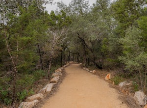
2.5 mi / 213 ft gainThe Dante's Trail and Backend Loop is a 2.5 mile loop hike located within the Purgatory Creek Greenspace area just south of San Marcos, Texas. This particular section of the Greenspace is made of flattened crushed gravel and is mostly shaded. The trail is very well maintained and several benches ...Read more -
San Marcos, Texas
Hike Purgatory Creek Overlook Via Dante's Trail
2.8 mi / 209 ft gainThe Purgatory Creek Overlook via Dante's Trail is a 2.8 mile out-and-back hike located within the Purgatory Creek Greenspace area just south of San Marcos, Texas. This particular section of the Greenspace is made of flattened crushed gravel and is mostly shaded. The trail is very well maintained ...Read more -
Georgetown, Texas
Hike San Gabriel River From Blue Hole
10.4 mi / 380 ft gainSan Gabriel River from Blue Hole is a 10.4 mile out and back hike that follows along the North San Gabriel River in Georgetown, Texas. The trail is moderately trafficked. A large majority of the trail is paved, shaded, and well-maintained. It provides beautiful views of the river with an abundan...Read more -
Georgetown, Texas
Blue Hole in Georgetown
5.0Head to the location pin and you will find free parking. Get out and head north on S Rock Street and you will come across a wide sidewalk that runs parallel with the South Fork San Gabriel River. Look East and you will see the Blue Hole about 600ft away. The waterfall has 3 levels. The first leve...Read more -
Georgetown, Texas
Hike the Pickett Trail
3.51.7 mi / 66 ft gainThe trail features a gorgeous river, and is enjoyable for all skill levels. Dogs are allowed to use this trail, but must be kept on leash. Parking at Blue Hole Park is relatively easy. Once parked, head west down the river for about a quarter mile and you'll find some picnic tables and a pavili...Read more -
Lakeway, Texas
Hike Hamilton Greenbelt
5.1 mi / 374 ft gainThe Hamilton Greenbelt is a 5.1 mile out-and-back neighborhood hike located in Lakeway, just 15 miles outside of downtown Austin. The trail is located in a neighborhood and is extremely well-maintained. At the entrance of the trail you will find a little garden area with a small waterfall and a s...Read more -
Georgetown, Texas
Hike the San Gabriel River Trail
7.6 mi / 498 ft gainThe San Gabriel River trailhead is found within Cedar Breaks Park, just northeast of Georgetown, Texas. The trail is a 7.6 mile moderate out-and-back trail. The trail is heavily trafficked and even more so on weekends. There are several inclines and declines, but nothing too significant. The trai...Read more

