Vonore, Tennessee
Looking for the best photography in Vonore? We've got you covered with the top trails, trips, hiking, backpacking, camping and more around Vonore. The detailed guides, photos, and reviews are all submitted by the Outbound community.
Top Photography Spots in and near Vonore
-
Sevier County, Tennessee
Little River Trail to Backcountry Campsite #30
5.012.34 mi / 412 ft gainThe trailhead parking area is large but if no spaces are available additional parking can be had at the Jake's Creek trailhead at the top of the hill and to the right of the Little River trail parking lot. After parking, the trailhead itself will be to the left of the parking area. Parking Lot Co...Read more -
Gatlinburg, Tennessee
Hike the Cucumber Gap and Little River Loop
4.05.5 mi / 800 ft gainThis loop offers a scenic 2.5 mile hike next to the river before looping back around via the Cucumber Gap Trail. At the tail end, you'll connect with the Jakes Creek Trail for about 0.7 miles to return you back to the parking lot. Many people hike this trial clockwise, but if it's a hot day, it...Read more -
Rockwood, Tennessee
Ozone Falls
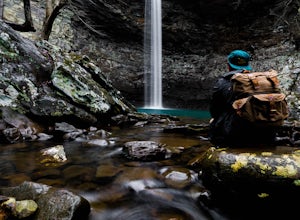
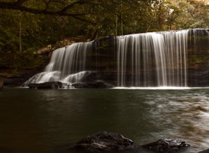
4.20.35 mi / 43 ft gainThis beautiful, 110-foot waterfall is an easy 15-minute walk from the parking area. Note that the walk down to the falls, although short, is steep and there isn’t a well-marked trail down. It’s more about choosing the path of least resistance. Also, it can get quite busy in the summer time espec...Read more -
Reliance, Tennessee
Hike the Scenic Spur Trail
5.03.9 mi / 426 ft gainVery little elevation gain leads to an easy hike along a river right outside of the Ocoee river region. First .7 miles is very flat, then leads to some slight elevation gain but nothing too serious. This trail traverses through the lush forest for a short distance when you come across a small cre...Read more -
Copperhill, Tennessee
Explore Ocoee Whitewater Center
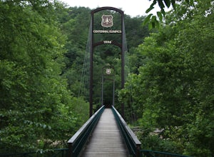
This location showcases the Ocoee river and the area used in the 1996 Olympics. This area is beautiful and has some amazing views. The drive to the whitewater center is called the Ocoee Scenic Byway and is the first national forest byway. The drive is gorgeous and features some amazing mountain v...Read more -
Knoxville, Tennessee
Bike or Run the Halls Greenway
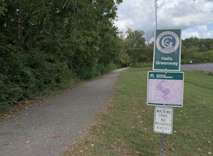
2 miThis place is located right in the middle of Halls Crossroads. There are multiple access points along the Greenway. There is the Halls Community Center which is where the GPS of this adventure will lead you or there is a small parking area next to the Halls Food City. There are other entrances fr...Read more -
Bryson City, North Carolina
Hike Ledbetter Creek
5.0Leaving the Nantahala Outdoor Center, drive upriver for 6.5 miles until you see a pull off on the right. Walk past the picnic tables, cross the railroad tracks, then follow the trail to arrive at the creek. Once you're there, it's up to you on what to do next.One of the most popular activities he...Read more -
Wartburg, Tennessee
Potter's Falls
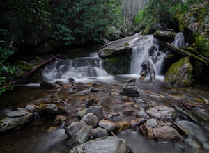
0.1 mi / 50 ft gainPotter's Falls is a semi locally known area that is used for lots of different activities. To get there the roads are pretty simple and easy to follow the directions. The parking can be a bit tricky especially if its during the summer or extreme cold in the winter. There are only about 15 spots o...Read more -
Benton, Tennessee
Take in the View at Chilhowee Overlook
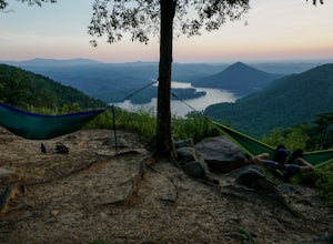
5.0Catch the sunset, bring friends and a picnic, or gaze at the stars from this classic Tennessee overlook! To reach Chilhowee Overlook, follow U.S. Highway from Ocoee, Tennessee for 8 miles then turn left onto Oswald Road. Follow Oswald Road for 3.75 miles until you encounter the overlook on your r...Read more -
Benton, Tennessee
Watch the Sunset from Sugarloaf Overlook
The overlook is easily accessible from a parking circle located off Oswald Road. Follow U.S. Highway from Ocoee, Tennessee for 8 miles then turn left onto Oswald Road. Follow Oswald Road for 2.5 miles until you encounter the overlook on your left. The overlook will be clearly marked with signage....Read more -
Spring City, Tennessee
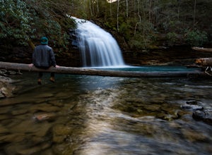
Hike to Stinging Fork Falls
3.53 mi / 400 ft gainThe trail begins on the right side of the parking lot. The first part is flat with no elevation change and easy walking. About half a mile in you will reach a trail split. The right trail will take you to the falls and the left trail will take you to an overlook of the gorge below. I was not able...Read more -
Kodak, Tennessee
Bobwhite Trail
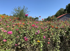
2 mi / 100 ft gainThis is a great and easy hike through the Seven Islands Birding State Park. This park is located in east Knoxville and is one only 20 minutes from downtown Knoxville. The trail starts at the Seven Islands Birding Park parking lot that has a beautiful garden with lots of wildflowers. The trail is ...Read more -
Kodak, Tennessee
Kelly Lane Greenway
2.5 mi / 50 ft gainThis trail is located in the Seven Islands Birding State Park. This park is east of Knoxville only about 20 minutes from downtown Knoxville. The park is small but there is plenty of beauty and lots of hiking trails in the area. At the beginning of the trail there is a gorgeous flower garden and a...Read more -
Bryson City, North Carolina
Clingmans Dome
4.41.23 miThe drive to Clingmans Dome is miles of scenic overlooks that provide endless views of ridges and valleys. Clingmans Dome Road comes to a parking lot from which you follow a .5 mile paved trail to the summit. There are also several trails that start on Clingmans Dome Road. Most notably The Appal...Read more -
Bryson City, North Carolina
Andrews Bald
5.03.55 mi / 1200 ft gainThe trail begins at the Clingmans Dome parking lot, just to the left of the paved walkway up to Clingmans Dome. You will start the hike at an elevation of 6130 feet which is only 334 feet less than Clingmans Dome which is the highest point in The Great Smoky Mountain National Park, and the second...Read more -
35.556724,-83.495827
Forney Creek Loop
4.519.04 mi / 3500 ft gainThis is an overnight loop hike that is built around one night in the back country. It can be done as an ambitious day hike. Be advised that permits are required by the NPS for all overnight stays in Great Smoky Mountain National Park. The hike begins at the Clingman's Dome parking lot at the For...Read more

