Vonore, Tennessee
Looking for the best hiking in Vonore? We've got you covered with the top trails, trips, hiking, backpacking, camping and more around Vonore. The detailed guides, photos, and reviews are all submitted by the Outbound community.
Top Hiking Spots in and near Vonore
-
Dayton, Tennessee
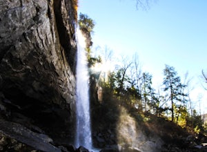
Hike through the Laurel Snow Pocket Wilderness
5.06 mi / 900 ft gainThe Laurel-Snow Trail was the first National Recreation Trail designated in Tennessee and at just under 35 miles from downtown Chattanooga, it is perfect for a day hike, for a day of climbing, or for setting up basecamp for the weekend. The 2,000 acre area sits along the Walden Ridge of the Cumbe...Read more -
Gatlinburg, Tennessee
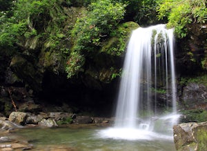
Grotto Falls Trail
5.01.83 mi / 585 ft gainThis is an intermediate hike along Trillium Gap Trail. There are four stream crossings on your way to the falls as you hike through an idyll, often wildflower-sprinkled landscape. Late spring is best for catching blooms. Once at the waterfall, you can walk behind the cascade of water. This is a ...Read more -
Lancing, Tennessee
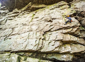
Climb The Lilly Bluff Wall
The Obed Wild and Scenic River is typically not found in the same conversations as Zion or Yosemite, but be assured this hidden gem of Tennessee is one of the East Coast's must climb destinations.There are a number of climbing areas within the Obed worth exploring, ranging from bouldering to mul...Read more -
Lancing, Tennessee
Camp at OBED Wild and Scenic River Area via the Point Trail
4 miYou will want to park at the Lilly Bluff parking lot. Your GPS won't know where this is, so here are the GPS coordinates N36° 06.162', W84° 43.280'.The trailhead is located on the North side of the parking lot. All you need to do is follow the sign for Point Trail. The trail culminates at an e...Read more -
Lancing, Tennessee
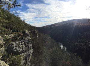
Take in the View at Lilly Bluff Overlook
5.00.6 mi / 0 ft gainHonestly this is hard to even call a trail, but that doesn't mean it lacks beauty. Once you take the right or left of off ridge Ridge Road make sure to go past the first parking lot and into the second larger parking lot. The trail starts near the front of the parking lot on the right side of the...Read more -
Gatlinburg, Tennessee
Mt. LeConte via Alum Cave Bluff
5.010.68 mi / 3982 ft gainThe Alum Cave trailhead is on Newfound Gap Road, 8 miles from the Sugarlands Visitor Center. Mt. LeConte is the third highest peak in the Smokies, and this is an extremely popular hike, so arrive early to get a parking spot and beat the crowds. Starting from the parking lot the trail gently wind...Read more -
35.629385,-83.450994
Camp out at Mt. LeConte Lodge via Alum Cave
5.09.96 miAt the summit of Mt. LeConte in the Great Smoky Mountains National Park, the lodge sits at a elevation of 6400 feet. It is the only "accommodations" inside the park boundaries. It is the highest lodge in the eastern United States. Accessible only by hiking one of the five trails to the summit,...Read more -
Corryton, Tennessee
Hike House Mountain, TN
5.03 miHouse Mountain is a short, at times strenuous hike that is doable in all weather conditions. Going at different times of year can be a treat due to the unique beauty of each season adding some spice to this quick trip. There are 5-7 switchbacks to push through, but the view atop House Mountain am...Read more -
Blairsville, Georgia
Nottely Reservoir Trail
2.53 mi / 335 ft gainNottely Reservoir Trail is a loop trail that takes you by a river located near Blairsville, Georgia.Read more -
Gatlinburg, Tennessee
Appalachian Trail: Charlie's Bunion and Kephart Loop
5.016.84 mi / 4429 ft gainAppalachian Trail: Charlie's Bunion and Kephart Loop is a loop trail that takes you by a waterfall located near Cherokee, North Carolina.Read more -
Andersonville, Tennessee
Norris Dam State Park Campground Trail
14.6 mi / 2310 ft gainNorris Dam State Park Campground Trail is a loop trail that takes you by a lake located near Rocky Top, Tennessee.Read more -
Copperhill, Tennessee
Hike the Beech Bottom Trail to Jacks River Falls
5.09 mi / 315 ft gainJacks River Falls is one of Georgia's most impressive waterfalls. Containing several cascades that combine to an 80 foot waterfall, this destination provides spectacular views and refreshing pools to take a dip in. You can approach the falls from either Jacks River Falls trail or the Beech Bott...Read more -
35.610235,-83.426410
Myrtle Point via Alum Cave
5.015.43 mi / 3100 ft gainThis hike can be started at the Alum Cave trailhead or the Boulevard Trailhead. For this particular adventure, the starting point is Alum Cave. If you're lucky enough to stay the night at the backcountry shelter on top of Mt. LeConte, (add 0.2 miles if coming from the Lodge), head east on the Bou...Read more -
Gatlinburg, Tennessee
Charlies Bunion via Appalachian Trail
5.04.32 mi / 1640 ft gainFrom the Sugarlands Visitor Center near Gatlinburg, drive approximately 13 miles south on Newfound Gap Road to reach the Newfound Gap Parking Area (it'll be on your left). The parking area is free and there are bathrooms. Follow the Appalachian Trail towards Katahdin, Maine (1972 miles away, woah...Read more -
Gatlinburg, Tennessee
Hike to the Jump-Off
4.36.2 mi / 1079 ft gainThis trail starts at the Newfound Gap parking lot. Newfound Gap is situated on the border of Tennessee and North Carolina. The views from Newfound Gap overlook North Carolina and are worth the trip in their own right. The restroom facilities are clean and have flushing toilets. Follow the crowds ...Read more -
Gatlinburg, Tennessee
Hike to Clingman’s Dome via Newfound Gap
4.516.6 mi / 1600 ft gainThis route to Clingmans Dome is available throughout the year. But during the winter months from December 1 through March 31, the 7-mile Clingman’s Dome Road that branches off Highway 441 at Newfound Gap, stays closed. This means the usual drive to the parking area located just a half mile below ...Read more

