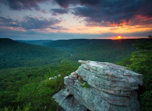
Sweetwater, Tennessee
Looking for the best hiking in Sweetwater? We've got you covered with the top trails, trips, hiking, backpacking, camping and more around Sweetwater. The detailed guides, photos, and reviews are all submitted by the Outbound community.
Top Hiking Spots in and near Sweetwater
-
Gatlinburg, Tennessee
Hike to Upper Meigs Falls
5.03.55 mi / 1000 ft gainParking available off of Little River Gorge Road (State Hwy. 73) at The Sinks/Meigs Creek Trailhead. The trail starts with winding elevation gain until it crests around 1 mile into the hike (notice pine trees at higher elevation). After the crest it starts descending towards Meigs Creek. While f...Read more -
Andersonville, Tennessee
Norris Dam State Park Campground Trail
14.6 mi / 2310 ft gainNorris Dam State Park Campground Trail is a loop trail that takes you by a lake located near Rocky Top, Tennessee.Read more -
Pikeville, Tennessee
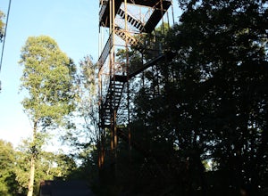
Hike to Fall Creek Falls Fire Tower
4.51 mi / 100 ft gainThe tower is located in the far northeast corner of Fall Creek Falls state park. The road to get there can be rough especially if it has rained recently but any 2 wheel drive vehicle should be able to make it. When you get to the trailhead it is a small gravel pull off with a gate. From the gate ...Read more -
Blairsville, Georgia
Nottely Reservoir Trail
2.53 mi / 335 ft gainNottely Reservoir Trail is a loop trail that takes you by a river located near Blairsville, Georgia.Read more -
Soddy-Daisy, Tennessee
Bouldering Stone Fort, TN
4.50.25 miStone Fort sits atop the Cumberland Plateau just half an hour from downtown Chattanooga, and is one of the premiere bouldering locations in the Southeast. One of the three sites of the annual Triple Crown Bouldering competition, Stone Fort offers a wealth of climbing problems for any climber's a...Read more -
Sparta, Tennessee
Virgin Falls State Natural Area Loop
5.04.46 mi / 400 ft gainBeginning at the Virgin Falls SNA parking area, the Virgin Falls trail is approximately a 9 mile round trip (excluding any side trails) which will allow you to experience three waterfalls: Big Branch Falls, Big Laurel Falls, and the namesake Virgin Falls. There is a fourth, Sheep Cave Falls, that...Read more -
Bryson City, North Carolina
Hike Ledbetter Creek
5.0Leaving the Nantahala Outdoor Center, drive upriver for 6.5 miles until you see a pull off on the right. Walk past the picnic tables, cross the railroad tracks, then follow the trail to arrive at the creek. Once you're there, it's up to you on what to do next.One of the most popular activities he...Read more -
Sevier County, Tennessee
Little River Trail to Backcountry Campsite #30
5.012.34 mi / 412 ft gainThe trailhead parking area is large but if no spaces are available additional parking can be had at the Jake's Creek trailhead at the top of the hill and to the right of the Little River trail parking lot. After parking, the trailhead itself will be to the left of the parking area. Parking Lot Co...Read more -
Gatlinburg, Tennessee
Hike the Cucumber Gap and Little River Loop
4.05.5 mi / 800 ft gainThis loop offers a scenic 2.5 mile hike next to the river before looping back around via the Cucumber Gap Trail. At the tail end, you'll connect with the Jakes Creek Trail for about 0.7 miles to return you back to the parking lot. Many people hike this trial clockwise, but if it's a hot day, it...Read more -
Soddy-Daisy, Tennessee
Hike the Hogskin Upper and Lower Loop
5.01.4 miAfter an easy 25 minute drive from Chattanooga you will reach North Chickamauga Gorge on Montlake Road in Soddy Daisy. Park any where in the gravel loop just make sure other cars can get through. From the Montlake Road Trailhead Kiosk the trail begins on an old mining road. Hogskin Upper Loop Tr...Read more -
Sevierville, Tennessee
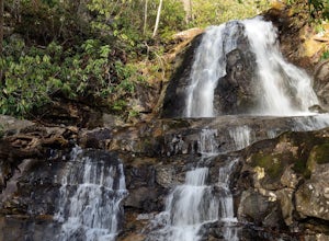
Laurel Falls Trail
4.32.45 mi / 314 ft gainThis straightforward, yet scenic hike follows a paved trail to the falls, which is among the most popular in the park. This trail can be especially crowded during the summer, so be sure to arrive early. Keep an eye out for a few steep drop-offs on either side of the trail along the way. There ha...Read more -
Kodak, Tennessee
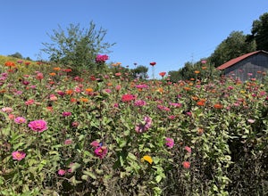
Bobwhite Trail
2 mi / 100 ft gainThis is a great and easy hike through the Seven Islands Birding State Park. This park is located in east Knoxville and is one only 20 minutes from downtown Knoxville. The trail starts at the Seven Islands Birding Park parking lot that has a beautiful garden with lots of wildflowers. The trail is ...Read more -
Kodak, Tennessee
Kelly Lane Greenway
2.5 mi / 50 ft gainThis trail is located in the Seven Islands Birding State Park. This park is east of Knoxville only about 20 minutes from downtown Knoxville. The park is small but there is plenty of beauty and lots of hiking trails in the area. At the beginning of the trail there is a gorgeous flower garden and a...Read more -
Mooneyham, Tennessee
Welch's Point
5.00.3 mi / 79 ft gainThis location was recently opened back to the public by Tennessee Wildlife Resources Agency and the Tennessee Department of Conservation and Environment in the fall of 2014 after being closed for over a decade! It is one of the most spectacular spots to watch the sunset in east Tennessee. This o...Read more

