Shady Valley, Tennessee
Looking for the best hiking in Shady Valley? We've got you covered with the top trails, trips, hiking, backpacking, camping and more around Shady Valley. The detailed guides, photos, and reviews are all submitted by the Outbound community.
Top Hiking Spots in and near Shady Valley
-
Linville, North Carolina
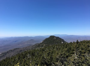
Profile Trail to Calloway Peak
5.06.2 mi / 2300 ft gainIf you're looking for a challenge and hoping to escape the crowds at Grandfather Mountain, this is the hike for you. Climbing up the back side of the mountain (opposite the famed mile-high swinging bridge) this trail is fee-free and easy-to-access with its own parking lot. The trail, marked w...Read more -
Seven Devils, North Carolina
Calloway Peak via Profile Trail
7.11 mi / 2493 ft gainCalloway Peak via Profile Trail is an out-and-back trail with waterfall views located near Banner Elk, North Carolina in Grandfather Mountain State Park.Read more -
Blowing Rock, North Carolina
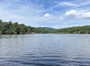
Price Lake Loop Trail
5.02.23 mi / 387 ft gainPrice Lake Loop Trail is a loop trail that takes you by a lake located near Blowing Rock, North Carolina.Read more -
Blowing Rock, North Carolina
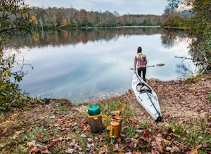
Camp and Paddle at Price Lake
This campground is all kinds of amazing, and if you get one of the sites in the A loop, you will have lakefront property (just be warned, if I see you there, I'll have to crash with you ;-). Price Lake is a gorgeous lake right off the Blue Ridge Parkway in North Carolina and perfect for canoeing...Read more -
Blowing Rock, North Carolina
Boone Fork Trail
4.05.06 mi / 1030 ft gainBoone Fork Trail is a loop trail that takes you by a waterfall located near Boone, North Carolina.Read more -
Johnson City, Tennessee
White Rock Overlook
5.02.85 mi / 876 ft gainThe White Rock trailhead is less than a 10 minute drive from downtown Johnson City. When pulling up Highbridge Road, take a left at the fork. You will shortly encounter a vehicle gate where you will park to the side of the road (do not block the yellow vehicle gate). You have the option to walk ...Read more -
Johnson City, Tennessee
White Rock Loop
5.04.94 mi / 1457 ft gainWhite Rock Loop is a loop trail where you may see beautiful wildflowers located near Johnson City, Tennessee.Read more -
Johnson City, Tennessee
Hike to Tip Top on Buffalo Mountain
4.05.4 mi / 1388 ft gainTip Top rests on one of the highest points of Buffalo Mountain. The overlook features tree coverage perfect for hammocking and benches while providing views of Downtown Johnson City as well as the other side of the mountain range. The hike from the trailhead to Tip Top is moderately steep. The tr...Read more -
Johnson City, Tennessee
Fork Knob, White Rock and The Noggin Loop
5.03.12 mi / 1220 ft gainThe Fork Knob and White Rock Loop in Johnson City, Tennessee, is a moderately challenging hiking trail that spans approximately 3.12 miles. The trail is marked by a variety of natural features, including a prominent rock formation known as White Rock, which offers panoramic views of the surroundi...Read more -
Newland, North Carolina
Big Hump Mountain via the Appalachian Trail
4.57.83 mi / 2021 ft gainTowering over Little Hump Mountain, Big Hump Mountain offers one of the clearest views on the Appalachian Trail. Big Hump Mountain is located in the Roan Highlands North of Bradley Gap. This peak is not as traveled as other popular hikes in the area despite its massive size because of the intense...Read more -
Newland, North Carolina
Hike to Bradley Gap along the Appalachian Trail
4.6 mi / 1339 ft gainBradley Gap rests along the Appalachian Trail overlooking North Carolina and Tennessee mountains. Part of the Roan Highlands, Bradley Gap can be accessed via Yellow Mountain Gap Trailhead. Follow the Roaring Fork Trail from the trailhead until you intersect the Appalachian Trail (White Blaze) app...Read more -
Johnson City, Tennessee
Sunset Point
5.00.65 mi / 223 ft gainSunset Point is an overlook located in Buffalo Mountain State Park. The trail is a short hike up along the White Rock loop trail then a short walk off the trail to get to the overlook. There is a clearing with a few benches that has wide open views to the west. The short hike up to the point shou...Read more -
Banner Elk, North Carolina
Calloway Peak via Daniel Boone Scout Trail
5.06.31 mi / 1991 ft gainAt 5,946 feet, Calloway Peak provides hikers with perhaps the best view of North Carolina's Blue Ridge Mountains. You'll have to earn this view - it is a tough climb up, although not terribly long. Begin at the trailhead for Tanawha Trail in the Boone Fork Parking Area on the Blue Ridge Parkway....Read more -
Banner Elk, North Carolina
Explore Boone Fork Creek
0.25 mi / 75 ft gainBoone Fork Bridge and creek is situated at the base of Grandfather Mountain, on the Blue Ridge Parkway, milepost 299.9. Elevation 3905'.The trailhead is at the left side of Boone Fork Creek parking area and the trail is a gentle meander through Rhododendrons and a hardwood forest.As you head tow...Read more -
Roan Mountain, Tennessee
Hughes Gap to Roan High Bluff
10.92 mi / 2986 ft gainHughes Gap to Roan High Bluff is an out-and-back trail that provides a good opportunity to view wildlife located near Bakersville, North Carolina.Read more -
Linville, North Carolina
Rough Ridge Lookout
4.30.5 mi / 92 ft gainThe trailhead for Rough Ridge will be on your righthand side when driving the Blue Ridge Parkway from Boone, NC. This trail gets busy in the warmer months, but parking usually is not too much of an issue. This trail is not open in the winter. Rough Ridge will take you around 30-45 minutes to rea...Read more

