Rutledge, Tennessee
Looking for the best hiking in Rutledge? We've got you covered with the top trails, trips, hiking, backpacking, camping and more around Rutledge. The detailed guides, photos, and reviews are all submitted by the Outbound community.
Top Hiking Spots in and near Rutledge
-
Sevierville, Tennessee
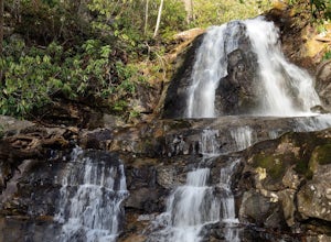
Laurel Falls Trail
4.32.45 mi / 314 ft gainThis straightforward, yet scenic hike follows a paved trail to the falls, which is among the most popular in the park. This trail can be especially crowded during the summer, so be sure to arrive early. Keep an eye out for a few steep drop-offs on either side of the trail along the way. There ha...Read more -
Walland, Tennessee
Drive the Foothills Parkway National Scenic Byway
5.0The foothills parkway runs parallel to the Great Smoky Mountains. It is 38.6 miles in total with the longest section at 33.0 miles. There are a few different places to get on to the parkway. There is one entrance near Fontana, Walland, Wears Valley, and Cosby. However Cosby is a smaller section a...Read more -
Newport, North Carolina
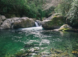
Hike to Mouse Creek Falls
5.04.2 mi / 605 ft gainFollow Big Creek Trail on a moderate climb to this 45-foot waterfall. Around 1.3 miles in, you will begin to hike alongside Big Creek, and shortly afterwards you will pass Midnight Hole, a particularly deep pool. There are a number of other small falls en route. In spring you should see a number ...Read more -
Newport, North Carolina
Hike to Mt. Sterling's Fire Tower
4.012 mi / 4200 ft gainOn your way in, stop at the ranger station parking lot to use the outhouses and grab a map for $1. Once at the Baxter Creek trailhead you have two options: 1. The Out and Back (12.2 miles) 2. The Loop (17 miles)Out and Back: Start on the Baxter Creek Trail and continue up for 6.1 miles until you...Read more -
Gatlinburg, Tennessee
Hike to Upper Meigs Falls
5.03.55 mi / 1000 ft gainParking available off of Little River Gorge Road (State Hwy. 73) at The Sinks/Meigs Creek Trailhead. The trail starts with winding elevation gain until it crests around 1 mile into the hike (notice pine trees at higher elevation). After the crest it starts descending towards Meigs Creek. While f...Read more -
Gatlinburg, Tennessee
Quilliam Cave via Courthouse Rock Trail
2.85 mi / 1404 ft gainQuilliam Cave via Courthouse Rock Trail is an out-and-back trail that takes you by a river located near Gatlinburg, Tennessee.Read more -
Sevier County, Tennessee
Little River Trail to Backcountry Campsite #30
5.012.34 mi / 412 ft gainThe trailhead parking area is large but if no spaces are available additional parking can be had at the Jake's Creek trailhead at the top of the hill and to the right of the Little River trail parking lot. After parking, the trailhead itself will be to the left of the parking area. Parking Lot Co...Read more -
Gatlinburg, Tennessee
Hike the Cucumber Gap and Little River Loop
4.05.5 mi / 800 ft gainThis loop offers a scenic 2.5 mile hike next to the river before looping back around via the Cucumber Gap Trail. At the tail end, you'll connect with the Jakes Creek Trail for about 0.7 miles to return you back to the parking lot. Many people hike this trial clockwise, but if it's a hot day, it...Read more -
Gatlinburg, Tennessee
Hike the Chimney Tops
4.94.03 mi / 1487 ft gainThe Chimney Tops Trail is one of the most visited trails in the Smokies, which is why I recommend going up just before sunset to beat the crowd! During the summer and fall months, it's common to see a hundred people taking in the views on the same trail, but if you scramble on out after hours, y...Read more -
Del Rio, Tennessee
Max Patch to Hot Springs, N.C. via Appalachian Trail
3.014.06 mi / 2966 ft gainMake a weekend trip from Max Patch to Hot Springs N.C., and be sure to soak in the natural hot springs at the old inn after your hike! This is an incredible, relatively easy hike with the reward at the end being hot springs on the French Broad River. You can break this up however you like, this i...Read more -
Gatlinburg, Tennessee
Hike to Mt. LeConte via Alum Cave Bluff
5.010.68 mi / 3982 ft gainThe Alum Cave trailhead is on Newfound Gap Road, 8 miles from the Sugarlands Visitor Center. Mt. LeConte is the third highest peak in the Smokies, and this is an extremely popular hike, so arrive early to get a parking spot and beat the crowds. Starting from the parking lot the trail gently wind...Read more -
35.629385,-83.450994
Camp out at Mt. LeConte Lodge via Alum Cave
5.09.96 miAt the summit of Mt. LeConte in the Great Smoky Mountains National Park, the lodge sits at a elevation of 6400 feet. It is the only "accommodations" inside the park boundaries. It is the highest lodge in the eastern United States. Accessible only by hiking one of the five trails to the summit,...Read more -
Townsend, Tennessee
Spruce Flats Falls
4.81.64 mi / 495 ft gainTo get to Spruce Flats Falls, you will want to drive down 2.2 miles down the scenic Tremont Road to the Great Smoky Mountains Institute and park in the visitor center parking area. You will then want to ascend up the gravel road past the sign that says restricted to unrestricted traffic (meaning ...Read more -
Del Rio, Tennessee
Max Patch Mountain
5.01.51 mi / 315 ft gainMax Patch Mountain was once cleared for pasture land, leaving an expansive flat summit that now serves as the ideal location for a picnic hike, flying a kite, or laying in the sun surrounded by the Great Smoky Mountains. With little elevation gain and a short distance it is also very family (and ...Read more -
Gatlinburg, Tennessee
Hike to the Jump-Off
4.36.2 mi / 1079 ft gainThis trail starts at the Newfound Gap parking lot. Newfound Gap is situated on the border of Tennessee and North Carolina. The views from Newfound Gap overlook North Carolina and are worth the trip in their own right. The restroom facilities are clean and have flushing toilets. Follow the crowds ...Read more -
Gatlinburg, Tennessee
Hike to Clingman’s Dome via Newfound Gap
4.516.6 mi / 1600 ft gainThis route to Clingmans Dome is available throughout the year. But during the winter months from December 1 through March 31, the 7-mile Clingman’s Dome Road that branches off Highway 441 at Newfound Gap, stays closed. This means the usual drive to the parking area located just a half mile below ...Read more

