Roan Mountain, Tennessee
Top Spots in and near Roan Mountain
-
Linville, North Carolina
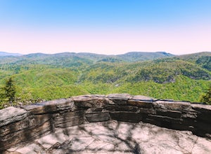
Take in the View at the Chestoa View Overlook
5.00.1 miChestoa View Overlook is an extremely short hike located down a pull-off at milepost 320 of the Blue Ridge Parkway. Park your vehicle in a designated spot then intercept the trail to the left of the lot. The trail will slowly descend down into a stone overlook. The panoramic view showcases the be...Read more -
Collettsville, North Carolina
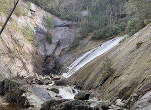
South Harper Creek Falls
5.03.46 mi / 564 ft gainSouth Harper Creek Falls is an out-and-back trail that takes you by a waterfall located near Collettsville, North Carolina.Read more -
Elizabethton, Tennessee
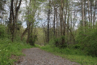
Flint Mill Trail
5.02.44 mi / 1302 ft gainFlint Mill Trail is an approximately 2.4 mile out-and-back trail in the Cherokee National Forrest. The trailhead is located on Flatwoods Road in Elizabethton, TN. The trail has a rather steep incline and is considered challenging. There is a 1,264 foot altitude change from the base to the top . T...Read more -
Bluff City, Tennessee
Spelunk Worley's Cave
5.03.5 mi / 100 ft gainWorley’s Cave, also known as Morrill Cave, lies just outside of Boone across the Tennessee border. It is the second longest cave in the state of Tennessee at a whopping 4.4 miles in total length. It is a non-lit cavern that’s path is lit only by those who venture in its depths (i.e. headlamps, la...Read more -
Burnsville, North Carolina
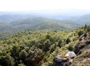
Camp at Snaggy Mountain
Snaggy Mountain is privately owned land that offers a beautiful camping spot located just outside of the Pigsah National Forest. It's completely secluded by an Apple Orchard and is a great home base for several hiking adventures in the area. The location on the map will get you to the parking spo...Read more -
Newland, North Carolina
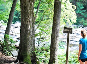
Hike the Conley Cove Trail into Linville Gorge
5.02.6 mi / 1200 ft gainFollow the gravel old 105 to the parking lot at the Rock Jock Trailhead. Follow this trail a short distance until it splits to the left for Conley Cove. The Conley Cove trail descends over 1,200 ft. into the Linville Gorge, providing a glimpse into the dense and wild Pisgah National Forest. Shor...Read more -
Bristol, Tennessee
Bouton Loop Trail
5.01.45 mi / 157 ft gainThe Bouton Trail Loop is an approximately 1.5 mile round trip on TVA land. There is a gravel parking lot with an information sign and trail map. Sections of the trail are gravel and sections are dirt. There are multiple places along the trail that cut off and lead down to the river for prime fish...Read more -
Bristol, Tennessee
Little Oak Campground
4.0Little Oak is a campground in Sullivan County, TN in the Cherokee National Forrest. There are 69 campsites located in three separate sections of the campground. Each section has a vault toilet and there is a shower house for the whole campground. There is a host in each section to help ensure you...Read more -
Bluff City, Tennessee
Kayak or SUP the South Fork
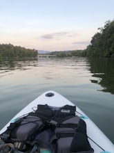
5.0There is a mud parking area on Lakeview Drive underneath the 11E bridges with a cleared mud parking area with access to the the South Fork of the Holston River. There is a gradual drop to the water where kayaks, canoes, or SUPs can be placed in the water. To the east, the river is more narrow at ...Read more -
Morganton, North Carolina
Hawksbill Mountain Trail
4.91.87 mi / 633 ft gainHidden far above the beautiful Linville Gorge stands Hawksbill Mountain, among many other fantastic hikes. The roughly 1.7 mile hike from the dusty gravel parking lot is steep but worth every step. It took me about an hour to conquer with a few water bottle-guzzling stops. At the top, you are al...Read more -
Morganton, North Carolina
Photograph Hawksbill Mountain at Sunrise or Sunset
5.01.5 mi / 860 ft gainThe trail to the summit of Hawksbill begins on an unpaved road for the Pigsah National Forest. In about a half a mile the trail turns left just before reaching the Jonas Ridge Trail. This turn is an clearly marked turn with a sign for "Hawksbill Summit". The trail then becomes steeper and rocki...Read more -
Bristol, Tennessee
Spillway Trail
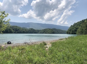
5.03.54 mi / 869 ft gainSpillway Trail is an out-and-back trail that takes you by a lake located near Bristol, Tennessee.Read more -
Bristol, Tennessee
Emmett Trail
5.02.16 mi / 194 ft gainThe Emmett Trail is one of the TVA South Holston Tailwater Trails. This trail began as a footpath created by anglers. The trail now has gravel, which makes for easier access for families and pets. The trailhead begins on Piney Hill Road where it the traverses down to the waters edge and leads to ...Read more -
Bristol, Tennessee
Osceola Island Loop
5.01.52 mi / 95 ft gainThe Osceola Island Loop is a 1.50 mile gravel loop on an island in the South Holston River. There are multiple benches along the loop to stop and observe the wildlife. Fishing is a common activity along the edge of the trail. There is a large parking area and bathrooms at the start of the trail.Read more -
Bristol, Tennessee
Explore the South Holston Dam
5.0Coming from US-421 turn off on Emmett Rd and keep left to get on Holston View Dam Rd and continue straight on this road by the river. There are parking spaces by the river below the dam and short easy trails to walk on next to the river. You’ll see fly fishers in the river below the dam on early ...Read more -
Bristol, Tennessee
Tailwater Trail
5.00.95 mi / 30 ft gainThe TVA Tailwater Trail is a 0.5 mile trail along the east side of South Fork Holston River. The trail is dirt and ends in an incline. Along the edge of the river, there are views of the distant Holston Mountain. This trail provides access to the river for fishing. It is located near the Emmett T...Read more

