Burrillville, Rhode Island
Looking for the best hiking in Burrillville? We've got you covered with the top trails, trips, hiking, backpacking, camping and more around Burrillville. The detailed guides, photos, and reviews are all submitted by the Outbound community.
Top Hiking Spots in and near Burrillville
-
Stonington, Connecticut
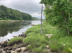
Hike River Road
4.03.9 mi / 55 ft gainRiver Road is a 3.9 mile point-to-point hike that takes you by a river located near Mystic, Connecticut.Read more -
Boston, Massachusetts
Freedom Trail
4.72.9 mi / 121 ft gainPark along the trail and then hop on. The Freedom Trail allows you to not only see the most beautiful parts of Boston (which is an absolutely gorgeous city) but you can learn some history too! Head off the trail a bit to explore the Charles River, the waterfront near the aquarium and picturesque ...Read more -
Stonington, Connecticut
Hike Denison Pequotsepos Nature Center Trail
5.01.7 mi / 72 ft gainDenison Pequotsepos Nature Center Trail is a 1.7 mile loop hike that takes you by a river located near Mystic, Connecticut.Read more -
Medford, Massachusetts
Hike Southern Middlesex Fells Loop
4.73.5 mi / 756 ft gainPark in the parking area near Bellevue Pond. There are multiple entrances to the reservation (some closer to the reservoir itself than others). I have spent days in there hiking around and never seeing the water and there are days when I just hiked right in to the water and sat and enjoyed it. Th...Read more -
Dartmouth, Massachusetts
Hike Frank Knowles–Little River Reserve Trail
4.64 mi / 295 ft gainFrank Knowles-Little River Reserve contains nearly 9 miles of hiking trails to explore. Start off by parking in the white sea shell parking lot. From there you will find the trail marked by a DNRT sign . My group and I walked along the red/boardwalk trail which features a number of boardwalks lea...Read more -
Westport, Massachusetts
Hike Gooseberry Island
1.5 mi / 36 ft gainBegin an hour before sunset at the intersection between West Beach and East Beach Road. The intersecting roads will lead you to a paved causeway over the ocean. Waves typically clash on either side of you as you drive over the ocean. There is a free parking lot once you reach the opening. To reac...Read more -
Glastonbury, Connecticut
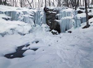
Blackledge Falls
4.01.46 mi / 207 ft gainAlthough the park contains hiking trails, a pond and a streambelt, the primary draw of this parcel of land is the 25 foot waterfall. The falls flow varies depending on the volume of precipitation, from a trickle in the dry months to a three-pronged vertical drop after some consistent snow melt or...Read more -
Groton, Connecticut
Hike Sheep Farm
3.01 mi / 91 ft gainSheep Farm is a 1 mile loop hike that takes you by a waterfall located near Groton, Connecticut.Read more -
Westerly, Rhode Island
Napatree Point Conservation Area Trail
4.03.19 mi / 82 ft gainNapatree Point Conservation Area Trail is a loop trail that takes you past scenic surroundings located near Westerly, Rhode Island.Read more -
Groton, Connecticut
Hike Haley Farm Loop
5.02.7 mi / 193 ft gainHaley Farm Loop is a 2.7 mile loop hike that takes you past wildlife located near Groton, Connecticut.Read more -
Groton, Massachusetts
Catch a Sunset at Gilbert Hill
5.01 miFrom Rt. I-495 Exit 31, Gibbert Hill has one of the greatest sunsets around Groton, MA area. You will see a lot of cows and even a castle. This is a very easy hike and a not so easy place to park, you have to leave you car on the side of the road, which is totally fine, I guess, it is easy.The wa...Read more -
Groton, Connecticut
Hike Bluff Point State Park Eastern Loop
4.54.3 mi / 344 ft gainBluff Point State Park Eastern Loop is a 4.3 mile loop hike where you may see beautiful wild flowers located near Groton, Connecticut.Read more -
Norwell, Massachusetts
Hike the Norris Reservation Loop
2.4 mi / 60 ft gainChoose from multiple trails in Norris that offer beautiful views of the the North river and marshland. Great spot to do some trail running through the woods and see the river too. There is also a pond a short distance from the parking lot that offers a great fishing spot with a picnic table nearb...Read more -
East Haddam, Connecticut
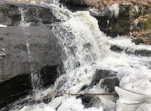
Explore Chapman Falls in Devil's Hopyard SP
4.0If you map to Chapman Falls in East Haddam, CT, you will be brought to a parking lot opposite from the waterfall in Devil's Hopyard, a beautiful Connecticut state park. Once there, it's only a few minute walk down a very clear trail to the base of the 60 foot falls. There's plenty of room to set ...Read more -
New Shoreham, Rhode Island
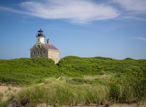
Walk to North Lighthouse
1 mi / 0 ft gainIn order to reach the Lighthouse you must walk along the trail that begins at the end of Corn Neck Rd. This walk is along the beach and then veers off to the left once you get closer to the light house (the seventh picture shows the start of the walk). It's only a half mile to the light house, bu...Read more

